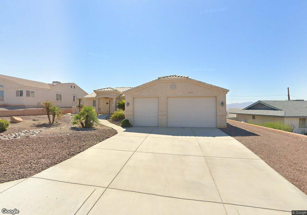
3894 Sloop Dr Lake Havasu City, AZ 86406
Estimated Value: $620,000 - $707,000
3
Beds
2
Baths
1,567
Sq Ft
$415/Sq Ft
Est. Value
About This Home
This home is located at 3894 Sloop Dr, Lake Havasu City, AZ 86406 and is currently estimated at $650,137, approximately $414 per square foot. 3894 Sloop Dr is a home located in Mohave County with nearby schools including Jamaica Elementary School, Thunderbolt Middle School, and Lake Havasu High School.
Ownership History
Date
Name
Owned For
Owner Type
Purchase Details
Closed on
Sep 24, 2004
Sold by
Nash Pauline L
Bought by
Shelton H Scott and Shelton Cheryl L
Current Estimated Value
Home Financials for this Owner
Home Financials are based on the most recent Mortgage that was taken out on this home.
Original Mortgage
$256,000
Outstanding Balance
$126,529
Interest Rate
5.74%
Mortgage Type
New Conventional
Estimated Equity
$523,608
Purchase Details
Closed on
Aug 1, 2002
Sold by
Kearns Michael J and Kearns Roberta J
Bought by
Nash Pauline L
Create a Home Valuation Report for This Property
The Home Valuation Report is an in-depth analysis detailing your home's value as well as a comparison with similar homes in the area
Home Values in the Area
Average Home Value in this Area
Purchase History
| Date | Buyer | Sale Price | Title Company |
|---|---|---|---|
| Shelton H Scott | $320,000 | State Title Agency Inc | |
| Nash Pauline L | $47,500 | State Title Agency Inc |
Source: Public Records
Mortgage History
| Date | Status | Borrower | Loan Amount |
|---|---|---|---|
| Open | Shelton H Scott | $256,000 |
Source: Public Records
Tax History Compared to Growth
Tax History
| Year | Tax Paid | Tax Assessment Tax Assessment Total Assessment is a certain percentage of the fair market value that is determined by local assessors to be the total taxable value of land and additions on the property. | Land | Improvement |
|---|---|---|---|---|
| 2026 | -- | -- | -- | -- |
| 2025 | $2,649 | $54,129 | $0 | $0 |
| 2024 | $2,649 | $53,419 | $0 | $0 |
| 2023 | $2,649 | $47,282 | $0 | $0 |
| 2022 | $2,535 | $35,163 | $0 | $0 |
| 2021 | $2,727 | $34,732 | $0 | $0 |
| 2019 | $2,587 | $29,905 | $0 | $0 |
| 2018 | $2,497 | $28,176 | $0 | $0 |
| 2017 | $2,472 | $27,424 | $0 | $0 |
| 2016 | $2,233 | $25,678 | $0 | $0 |
| 2015 | $2,137 | $22,509 | $0 | $0 |
Source: Public Records
Map
Nearby Homes
- 3883 Sloop Dr
- 3873 Packard Place
- 3956 Cherry Tree Blvd
- 3828 Cherry Tree Blvd
- 3856 Mission Dr N
- 3812 Yonder Dr
- 4019 Black Hill Dr
- 3937 Comet Dr
- 3852 Solar Dr
- 4051 Northstar Dr
- 4014 Cherry Tree Blvd
- 4050 Cherry Tree Blvd
- 3751 Mission Dr S
- 361 Mcculloch Blvd S
- 4019 Bluegrass Dr
- 4094 Cherry Tree Place
- 3808 Whaler Dr
- 4021 Tierra Vista Dr
- 386 Mcculloch Blvd S
- 3665 Pelican Place