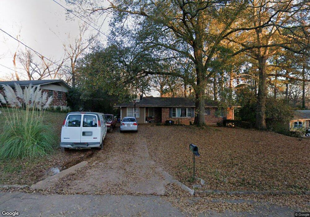
3895 E Kirksford Drive E 0 Decatur, GA 30035
Southwest DeKalb NeighborhoodEstimated Value: $208,000 - $230,000
3
Beds
2
Baths
1,377
Sq Ft
$161/Sq Ft
Est. Value
About This Home
This home is located at 3895 E Kirksford Drive E 0, Decatur, GA 30035 and is currently estimated at $221,612, approximately $160 per square foot. 3895 E Kirksford Drive E 0 is a home located in DeKalb County with nearby schools including Snapfinger Elementary School, Columbia Middle School, and Columbia High School.
Ownership History
Date
Name
Owned For
Owner Type
Purchase Details
Closed on
Aug 14, 2021
Sold by
Sfr Xii Atl Owner 1 Lp
Bought by
Sfr Xii Atl Owner 2 Lp
Current Estimated Value
Purchase Details
Closed on
Jun 7, 2021
Sold by
Chapple Reginald
Bought by
Sfr Xii Atl Owner 1 Lp
Purchase Details
Closed on
Apr 8, 2004
Sold by
Dixon Gale
Bought by
Chapple Reginald
Home Financials for this Owner
Home Financials are based on the most recent Mortgage that was taken out on this home.
Original Mortgage
$114,995
Interest Rate
5.54%
Mortgage Type
VA
Create a Home Valuation Report for This Property
The Home Valuation Report is an in-depth analysis detailing your home's value as well as a comparison with similar homes in the area
Home Values in the Area
Average Home Value in this Area
Purchase History
| Date | Buyer | Sale Price | Title Company |
|---|---|---|---|
| Sfr Xii Atl Owner 2 Lp | -- | -- | |
| Sfr Xii Atl Owner 1 Lp | $179,000 | -- | |
| Chapple Reginald | $116,000 | -- |
Source: Public Records
Mortgage History
| Date | Status | Borrower | Loan Amount |
|---|---|---|---|
| Previous Owner | Chapple Reginald | $114,995 |
Source: Public Records
Tax History Compared to Growth
Tax History
| Year | Tax Paid | Tax Assessment Tax Assessment Total Assessment is a certain percentage of the fair market value that is determined by local assessors to be the total taxable value of land and additions on the property. | Land | Improvement |
|---|---|---|---|---|
| 2025 | $4,157 | $84,480 | $14,362 | $70,118 |
| 2024 | $4,154 | $84,480 | $14,362 | $70,118 |
| 2023 | $4,154 | $84,480 | $14,000 | $70,480 |
| 2022 | $3,359 | $68,480 | $8,000 | $60,480 |
| 2021 | $2,232 | $42,800 | $4,240 | $38,560 |
| 2020 | $1,249 | $37,440 | $4,240 | $33,200 |
| 2019 | $1,045 | $31,760 | $4,240 | $27,520 |
| 2018 | $745 | $28,280 | $4,240 | $24,040 |
| 2017 | $841 | $25,200 | $4,240 | $20,960 |
| 2016 | $759 | $23,320 | $4,120 | $19,200 |
| 2014 | $370 | $9,840 | $4,120 | $5,720 |
Source: Public Records
Map
Nearby Homes
- 3905 Kirksford Dr
- 156 Glen Acres Ct
- 1751 Woodsloe Dr
- 1749 Meadowglades Dr
- 3992 Kirksford Dr
- 1788 Danrich Dr
- 4009 Kirksford Dr
- 1714 Camperdown Cir
- 1701 Corey Blvd
- 4029 Moffat Ct
- 1774 Austin Dr
- 1681 Atherton Cir
- 3964 Gretna Green Dr
- 1667 Atherton Cir
- 1688 Danrich Dr
- 1705 Atherton Dr
- 1752 Atherton Dr
- 1581 Hollyhock Terrace
- 1777 W Austin Rd
- 3895 Kirksford Dr
- 0 Kirksford Dr Unit 7077254
- 0 Kirksford Dr Unit 8264750
- 0 Kirksford Dr Unit 8207865
- 0 Kirksford Dr Unit 8153306
- 0 Kirksford Dr Unit 8141861
- 0 Kirksford Dr Unit 8054127
- 0 Kirksford Dr Unit 8022066
- 0 Kirksford Dr Unit 8007613
- 0 Kirksford Dr Unit 8677633
- 0 Kirksford Dr Unit 8736662
- 0 Kirksford Dr Unit 8220982
- 0 Kirksford Dr Unit 7532327
- 0 Kirksford Dr Unit 7378109
- 0 Kirksford Dr Unit 7359319
- 0 Kirksford Dr Unit 7313420
- 0 Kirksford Dr Unit 7028833
- 0 Kirksford Dr Unit 3163347
- 0 Kirksford Dr Unit 3090267
- 0 Kirksford Dr Unit 8102661