Estimated Value: $262,000 - $290,617
3
Beds
3
Baths
1,353
Sq Ft
$207/Sq Ft
Est. Value
About This Home
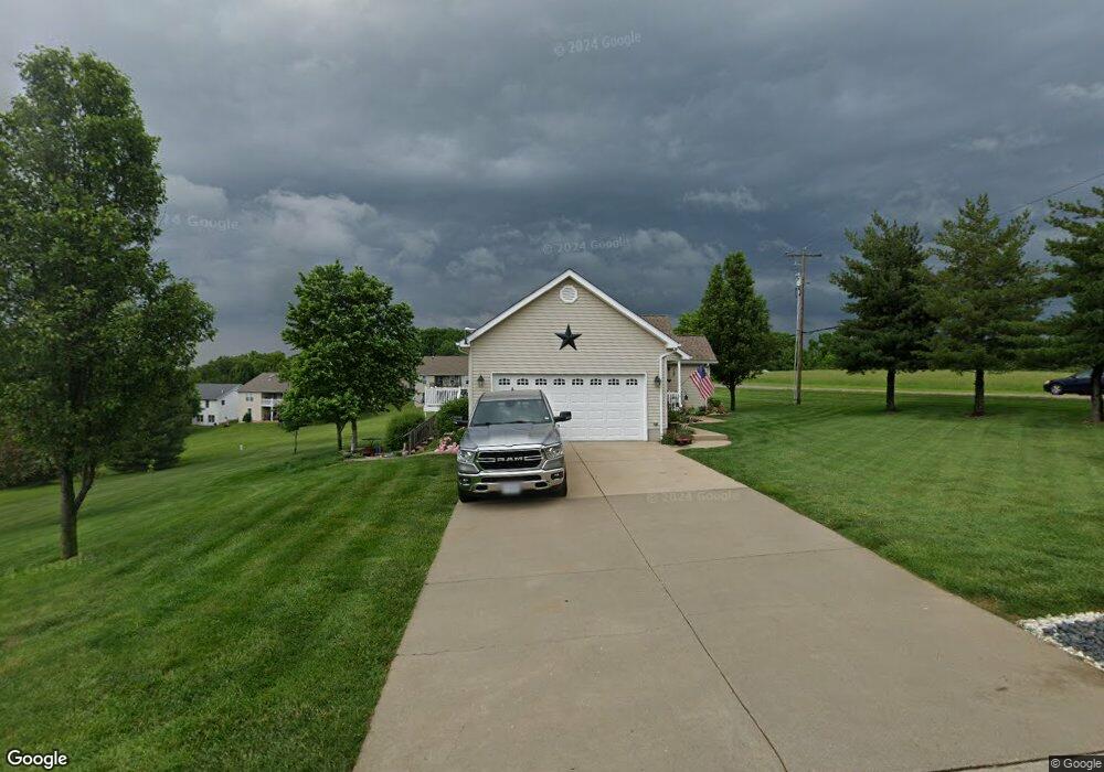
This home is located at 3895 Highway A, Union, MO 63084 and is currently estimated at $280,654, approximately $207 per square foot. 3895 Highway A is a home located in Franklin County with nearby schools including Union High School, Immaculate Conception School, and St. Gertrude Catholic School.
Ownership History
Date
Name
Owned For
Owner Type
Purchase Details
Closed on
May 10, 2023
Sold by
Messex Timothy and Messex Christine
Bought by
Messex Alexander T and Messex Gabrielle P
Current Estimated Value
Purchase Details
Closed on
Apr 9, 2010
Sold by
Danuser Darrin F and Danuser Chad E
Bought by
Messex Timothy A and Messex Christine M
Home Financials for this Owner
Home Financials are based on the most recent Mortgage that was taken out on this home.
Original Mortgage
$142,755
Interest Rate
4.96%
Mortgage Type
New Conventional
Create a Home Valuation Report for This Property
The Home Valuation Report is an in-depth analysis detailing your home's value as well as a comparison with similar homes in the area
Home Values in the Area
Average Home Value in this Area
Purchase History
| Date | Buyer | Sale Price | Title Company |
|---|---|---|---|
| Messex Alexander T | -- | None Listed On Document | |
| Messex Timothy A | -- | None Available |
Source: Public Records
Mortgage History
| Date | Status | Borrower | Loan Amount |
|---|---|---|---|
| Previous Owner | Messex Timothy A | $142,755 |
Source: Public Records
Tax History Compared to Growth
Tax History
| Year | Tax Paid | Tax Assessment Tax Assessment Total Assessment is a certain percentage of the fair market value that is determined by local assessors to be the total taxable value of land and additions on the property. | Land | Improvement |
|---|---|---|---|---|
| 2024 | $1,973 | $32,743 | $0 | $0 |
| 2023 | $1,973 | $32,743 | $0 | $0 |
| 2022 | $2,056 | $34,040 | $0 | $0 |
| 2021 | $2,059 | $34,040 | $0 | $0 |
| 2020 | $1,907 | $31,014 | $0 | $0 |
| 2019 | $1,902 | $31,014 | $0 | $0 |
| 2018 | $1,754 | $30,009 | $0 | $0 |
| 2017 | $1,758 | $30,009 | $0 | $0 |
| 2016 | $1,673 | $27,907 | $0 | $0 |
| 2015 | $1,646 | $27,907 | $0 | $0 |
| 2014 | $1,661 | $28,137 | $0 | $0 |
Source: Public Records
Map
Nearby Homes
- 873 W Park Rd
- 1017 Delmar Ave
- 3 Mount Vernon Ct
- 21 Forest Ln
- 7 Georgetown Ct
- 33 Hickory Cir
- 101 Hickory Cir
- 89 Hickory Cir
- 54 Hickory Cir
- 620 Union Ave
- 510 N Oak St
- 613 W State St
- 204 Wally Ave
- 7 Bertha Ln
- 1103 W Main St
- 506 W Main St
- 186 Little Rock Creek Ct
- 613 Rock Creek Dr
- 614 E State St
- 541 Rock Creek Dr
- 602 Eagle Ridge Dr
- 503 Eagle Ridge Dr
- 500 Eagle Ridge Dr
- 628 Eagle Ridge Dr Unit 630
- 504 Eagle Ridge Dr
- 202 Quail Ridge Ct
- 3908 Highway A
- 505 Eagle Ridge Dr
- 206 Quail Ridge Ct
- 507 Eagle Ridge Dr
- 508 Eagle Ridge Dr
- 201 Quail Ridge Ct
- 208 Quail Ridge Ct
- 3878 Highway A
- 203 Quail Ridge Ct
- 509 Eagle Ridge Dr
- 510 Eagle Ridge Dr
- 205 Quail Ridge Ct
- 511 Eagle Ridge Dr
- 210 Quail Ridge Ct