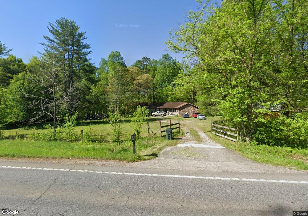
3895 Matt Hwy Cumming, GA 30028
Estimated Value: $757,000 - $1,214,000
3
Beds
1
Bath
2,238
Sq Ft
$445/Sq Ft
Est. Value
About This Home
This home is located at 3895 Matt Hwy, Cumming, GA 30028 and is currently estimated at $996,458, approximately $445 per square foot. 3895 Matt Hwy is a home located in Forsyth County with nearby schools including Coal Mountain Elementary School, North Forsyth Middle School, and North Forsyth High School.
Ownership History
Date
Name
Owned For
Owner Type
Purchase Details
Closed on
Nov 8, 2019
Sold by
Coal Mountain Natural Industries Llc
Bought by
Ihc Grp Llc
Current Estimated Value
Purchase Details
Closed on
Aug 15, 2012
Sold by
Pnc Bank National Associat
Bought by
Coal Mountain National Industr
Purchase Details
Closed on
Mar 26, 2012
Sold by
Pendley Dan
Bought by
Mcconnell Martha T
Purchase Details
Closed on
Dec 20, 2011
Sold by
Mginnis Woods Properties L
Bought by
Rbc Bank
Create a Home Valuation Report for This Property
The Home Valuation Report is an in-depth analysis detailing your home's value as well as a comparison with similar homes in the area
Home Values in the Area
Average Home Value in this Area
Purchase History
| Date | Buyer | Sale Price | Title Company |
|---|---|---|---|
| Ihc Grp Llc | $745,000 | -- | |
| Coal Mountain National Industr | $200,000 | -- | |
| Mcconnell Martha T | -- | -- | |
| Rbc Bank | -- | -- |
Source: Public Records
Tax History Compared to Growth
Tax History
| Year | Tax Paid | Tax Assessment Tax Assessment Total Assessment is a certain percentage of the fair market value that is determined by local assessors to be the total taxable value of land and additions on the property. | Land | Improvement |
|---|---|---|---|---|
| 2025 | $9,318 | $370,364 | $195,204 | $175,160 |
| 2024 | $9,318 | $379,996 | $210,220 | $169,776 |
| 2023 | $8,055 | $327,244 | $165,176 | $162,068 |
| 2022 | $7,037 | $219,156 | $106,008 | $113,148 |
| 2021 | $6,052 | $219,156 | $106,008 | $113,148 |
| 2020 | $5,936 | $214,980 | $106,008 | $108,972 |
| 2019 | $5,088 | $183,996 | $74,944 | $109,052 |
| 2018 | $4,745 | $171,568 | $74,944 | $96,624 |
| 2017 | $3,994 | $143,912 | $59,168 | $84,744 |
| 2016 | $3,666 | $132,076 | $47,332 | $84,744 |
| 2015 | $3,672 | $132,076 | $47,332 | $84,744 |
| 2014 | $1,944 | $73,428 | $47,332 | $26,096 |
Source: Public Records
Map
Nearby Homes
- 4420 Belcrest Way
- 4115 Sierra Vista Cir
- 4095 Sierra Vista Cir
- 3995 Sierra Lake Dr
- 3725 Sierra Lake Dr
- 3810 Sierra Lake Dr
- 3735 Sierra Lake Dr
- 6230 Dana Way
- The Colton Plan at Sierra Lake
- The Beckett Plan at Sierra Lake
- The Charleston Plan at Sierra Lake
- The Claire Plan at Sierra Lake
- The Margaret Plan at Sierra Lake
- The Sophia Plan at Sierra Lake
- 4015 Sierra Vista Cir
- 4555 Dennington Trace
- 4010 Sierra Knolls Ct
- 4020 Sierra Knolls Ct
- 6445 Crystal Ln
- 3940 Twin Lakes Rd
- 3865 Matt Hwy
- 3985 Matt Hwy
- 3985 Matt Hwy
- 4400 Watson Dr
- 4440 Watson Dr
- 4450 Watson Dr
- 4307 Gravitt Rd
- 4105 Matt Hwy
- 0 Belcrest Way Unit 83 7271669
- 0 Belcrest Way Unit 8712631
- 0 Belcrest Way Unit 8179596
- 0 Belcrest Way Unit 8151307
- 0 Belcrest Way Unit 8896658
- 0 Belcrest Way Unit 8560321
- 0 Belcrest Way Unit 8375597
- 0 Belcrest Way Unit 8328867
- 0 Belcrest Way Unit 8111579
- 0 Belcrest Way Unit 7565586
- 0 Belcrest Way Unit 7266376
- 0 Belcrest Way Unit 7227351