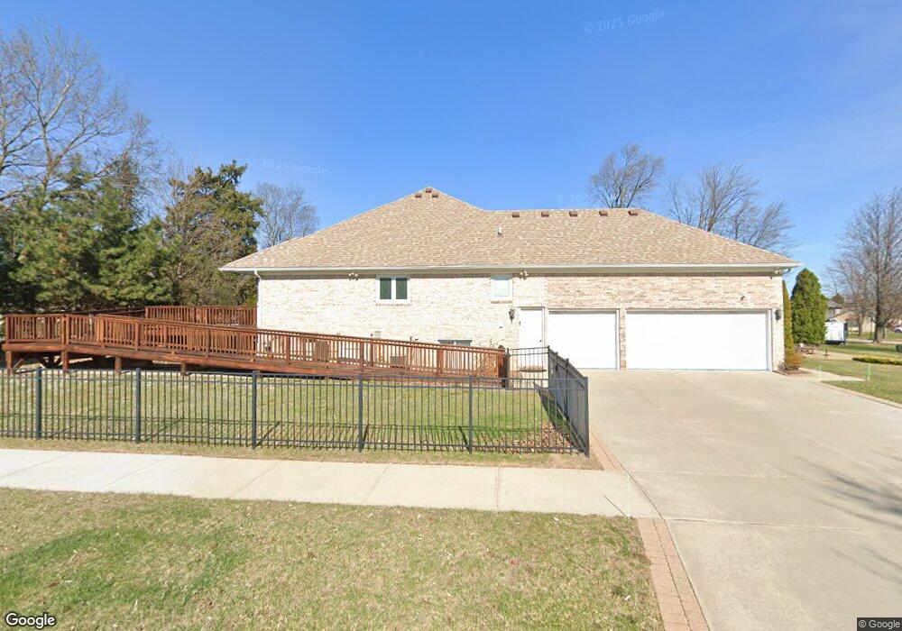
38977 Mallorn Dr Sterling Heights, MI 48313
Estimated Value: $432,679 - $507,000
--
Bed
--
Bath
2,088
Sq Ft
$224/Sq Ft
Est. Value
About This Home
This home is located at 38977 Mallorn Dr, Sterling Heights, MI 48313 and is currently estimated at $468,170, approximately $224 per square foot. 38977 Mallorn Dr is a home with nearby schools including Dekeyser Elementary School, Bemis Junior High School, and Adlai Stevenson High School.
Ownership History
Date
Name
Owned For
Owner Type
Purchase Details
Closed on
Apr 16, 2019
Sold by
Mckenna Maire and Mckenna James
Bought by
James Mckenna T and James Maim T
Current Estimated Value
Purchase Details
Closed on
Oct 17, 2005
Sold by
Mersinaj Fatri and Mersinaj Afrodhiti
Bought by
Mckenna James and Mckenna Maire
Purchase Details
Closed on
Sep 10, 2002
Sold by
Nu Way Homes
Bought by
Mersinaj Fatri
Home Financials for this Owner
Home Financials are based on the most recent Mortgage that was taken out on this home.
Original Mortgage
$198,450
Interest Rate
6.34%
Mortgage Type
Purchase Money Mortgage
Purchase Details
Closed on
Aug 30, 2002
Sold by
Nu Way Investments Inc
Bought by
Mersinaj Fatri
Home Financials for this Owner
Home Financials are based on the most recent Mortgage that was taken out on this home.
Original Mortgage
$198,450
Interest Rate
6.34%
Mortgage Type
Purchase Money Mortgage
Create a Home Valuation Report for This Property
The Home Valuation Report is an in-depth analysis detailing your home's value as well as a comparison with similar homes in the area
Home Values in the Area
Average Home Value in this Area
Purchase History
| Date | Buyer | Sale Price | Title Company |
|---|---|---|---|
| James Mckenna T | -- | None Available | |
| Mckenna James | $330,000 | Greco | |
| Mersinaj Fatri | $264,600 | -- | |
| Mersinaj Fatri | $78,000 | -- |
Source: Public Records
Mortgage History
| Date | Status | Borrower | Loan Amount |
|---|---|---|---|
| Previous Owner | Mersinaj Fatri | $198,450 |
Source: Public Records
Tax History Compared to Growth
Tax History
| Year | Tax Paid | Tax Assessment Tax Assessment Total Assessment is a certain percentage of the fair market value that is determined by local assessors to be the total taxable value of land and additions on the property. | Land | Improvement |
|---|---|---|---|---|
| 2025 | $4,534 | $204,000 | $0 | $0 |
| 2024 | $4,146 | $194,400 | $0 | $0 |
| 2023 | $3,914 | $174,900 | $0 | $0 |
| 2022 | $4,080 | $150,400 | $0 | $0 |
| 2021 | $3,996 | $141,100 | $0 | $0 |
| 2020 | $3,564 | $135,000 | $0 | $0 |
| 2019 | $3,379 | $126,000 | $0 | $0 |
| 2018 | $3,660 | $115,300 | $0 | $0 |
| 2017 | $3,497 | $111,300 | $19,800 | $91,500 |
| 2016 | $3,379 | $111,300 | $0 | $0 |
| 2015 | -- | $105,500 | $0 | $0 |
| 2014 | -- | $91,000 | $0 | $0 |
Source: Public Records
Map
Nearby Homes
- 14973 River View Ct
- 38797 Windmill Pointe W
- 14963 Park View Ct
- 39348 Heatherheath Dr Unit 7
- 15492 S Royal Doulton Blvd
- 15332 Renshaw Dr Unit 115
- 38756 Cheldon St
- 39551 Heatherheath Dr Unit 2
- 39563 Heatherheath Dr
- 39575 Old Dominion Dr
- 15330 Dominique Dr
- 39237 Sunderland Dr
- 14326 Merci Ave
- 15786 Bexley St
- 15599 Stockton Dr
- 15385 Cartier Dr
- 38086 Saint Tropez Dr
- 38067 Saint Tropez Dr
- 39519 Twenlow Dr
- 39043 Cadborough Dr
- 14969 Clinton
- 14969 Clinton River Rd
- 38995 Mallorn Dr
- 14957 Clinton River Rd
- 15024 Harvest Meadows Dr
- 15036 Harvest Meadows Dr
- 15043 Harvest Meadows Dr
- 39111 Lorien Dr
- 39123 Lorien Dr
- 38589 River Park Dr
- 39008 Mallorn Dr
- 39135 Lorien Dr
- 15055 Harvest Meadows Dr
- 15060 Harvest Meadows Dr
- 15045 Clinton River Rd
- 39020 Mallorn Dr
- 39147 Lorien Dr
- 15067 Harvest Meadows Dr
- 38953 Harvest Meadows Ct
- 38571 River Park Dr