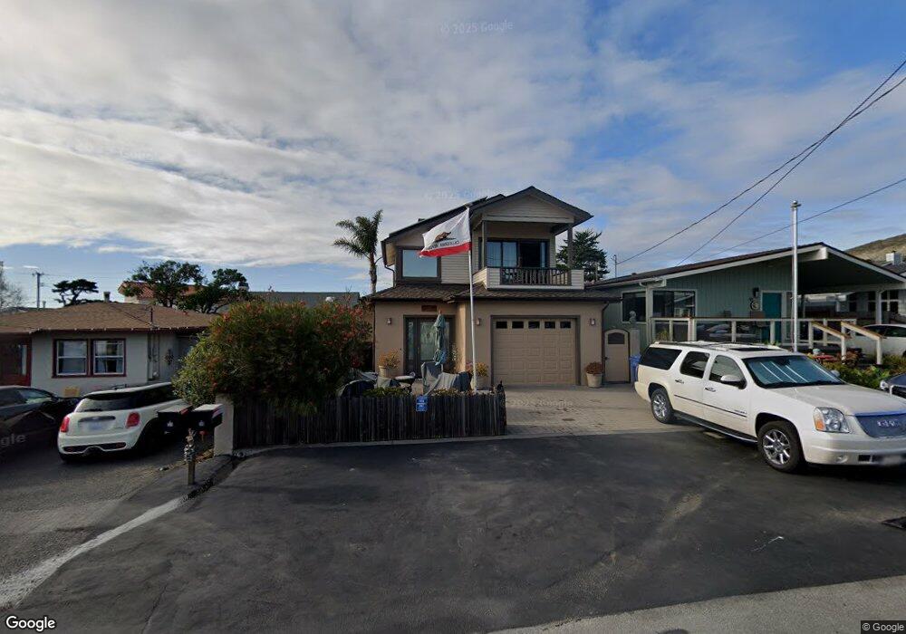
39 10th St Cayucos, CA 93430
Cayucos NeighborhoodEstimated Value: $1,161,865 - $1,839,000
2
Beds
1
Bath
2,032
Sq Ft
$680/Sq Ft
Est. Value
About This Home
This home is located at 39 10th St, Cayucos, CA 93430 and is currently estimated at $1,381,466, approximately $679 per square foot. 39 10th St is a home located in San Luis Obispo County.
Ownership History
Date
Name
Owned For
Owner Type
Purchase Details
Closed on
Feb 14, 2013
Sold by
Hendry Douglas and Hendry Robin P
Bought by
Hendry Douglas S and Hendry Robin Patricia
Current Estimated Value
Purchase Details
Closed on
Sep 24, 1999
Sold by
Stout Edward F and Stout Kathryn C
Bought by
Hendry Douglas and Hendry Robin P
Home Financials for this Owner
Home Financials are based on the most recent Mortgage that was taken out on this home.
Original Mortgage
$200,000
Outstanding Balance
$44,223
Interest Rate
4.45%
Estimated Equity
$1,337,243
Purchase Details
Closed on
Dec 6, 1994
Sold by
Stout Edward F and Stout Kathryn C
Bought by
Stout Edward F and Stout Kathryn C
Create a Home Valuation Report for This Property
The Home Valuation Report is an in-depth analysis detailing your home's value as well as a comparison with similar homes in the area
Home Values in the Area
Average Home Value in this Area
Purchase History
| Date | Buyer | Sale Price | Title Company |
|---|---|---|---|
| Hendry Douglas S | -- | None Available | |
| Hendry Douglas | $260,000 | Cuesta Title Company | |
| Stout Edward F | -- | -- |
Source: Public Records
Mortgage History
| Date | Status | Borrower | Loan Amount |
|---|---|---|---|
| Open | Hendry Douglas | $200,000 |
Source: Public Records
Tax History
| Year | Tax Paid | Tax Assessment Tax Assessment Total Assessment is a certain percentage of the fair market value that is determined by local assessors to be the total taxable value of land and additions on the property. | Land | Improvement |
|---|---|---|---|---|
| 2025 | $7,892 | $756,451 | $276,643 | $479,808 |
| 2024 | $7,806 | $741,619 | $271,219 | $470,400 |
| 2023 | $7,806 | $727,078 | $265,901 | $461,177 |
| 2022 | $7,674 | $712,823 | $260,688 | $452,135 |
| 2021 | $7,566 | $698,847 | $255,577 | $443,270 |
| 2020 | $7,486 | $691,682 | $252,957 | $438,725 |
| 2019 | $7,339 | $678,121 | $247,998 | $430,123 |
| 2018 | $7,195 | $664,826 | $243,136 | $421,690 |
| 2017 | $7,052 | $651,791 | $238,369 | $413,422 |
| 2016 | $6,913 | $639,012 | $233,696 | $405,316 |
| 2015 | $6,854 | $629,414 | $230,186 | $399,228 |
| 2014 | $6,612 | $617,085 | $225,677 | $391,408 |
Source: Public Records
Map
Nearby Homes
- 1234 Pacific Ave
- 1000 Saint Mary Ave
- 1625 Cass Ave Unit 22
- 50 5th St
- 57 17th St
- 510 Park Ave
- 50 S 3rd St
- 31 N 3rd St
- 2023 Circle Dr
- 191 J St
- 96 24th St
- 0 California 1
- 0 Ash Ave Unit SC25116716
- 0 Studio Dr
- 77 N Ocean Ave Unit 8
- 77 N Ocean Ave Unit 12
- 340 D St
- 159 Ash Ave
- 2651 Richard Ave
- 130 Cypress Ave
Your Personal Tour Guide
Ask me questions while you tour the home.