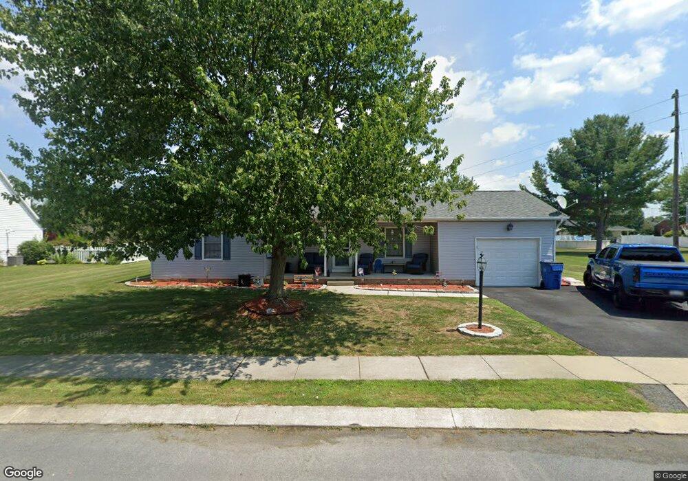
39 Ashfield Dr Unit 16 Littlestown, PA 17340
Estimated Value: $262,629 - $292,000
2
Beds
2
Baths
1,104
Sq Ft
$253/Sq Ft
Est. Value
About This Home
This home is located at 39 Ashfield Dr Unit 16, Littlestown, PA 17340 and is currently estimated at $279,657, approximately $253 per square foot. 39 Ashfield Dr Unit 16 is a home located in Adams County with nearby schools including Rolling Acres El School, Maple Avenue Middle School, and Littlestown Senior High School.
Ownership History
Date
Name
Owned For
Owner Type
Purchase Details
Closed on
Jun 18, 2009
Sold by
Dutterer Wilmer L and Dutterer Carole J
Bought by
Topper Brandi
Current Estimated Value
Home Financials for this Owner
Home Financials are based on the most recent Mortgage that was taken out on this home.
Original Mortgage
$159,060
Outstanding Balance
$101,361
Interest Rate
4.93%
Mortgage Type
FHA
Estimated Equity
$178,297
Create a Home Valuation Report for This Property
The Home Valuation Report is an in-depth analysis detailing your home's value as well as a comparison with similar homes in the area
Home Values in the Area
Average Home Value in this Area
Purchase History
| Date | Buyer | Sale Price | Title Company |
|---|---|---|---|
| Topper Brandi | $162,000 | -- |
Source: Public Records
Mortgage History
| Date | Status | Borrower | Loan Amount |
|---|---|---|---|
| Open | Topper Brandi | $159,060 |
Source: Public Records
Tax History Compared to Growth
Tax History
| Year | Tax Paid | Tax Assessment Tax Assessment Total Assessment is a certain percentage of the fair market value that is determined by local assessors to be the total taxable value of land and additions on the property. | Land | Improvement |
|---|---|---|---|---|
| 2025 | $3,049 | $161,100 | $48,400 | $112,700 |
| 2024 | $2,915 | $161,100 | $48,400 | $112,700 |
| 2023 | $2,857 | $161,100 | $48,400 | $112,700 |
| 2022 | $2,856 | $161,100 | $48,400 | $112,700 |
| 2021 | $2,755 | $161,100 | $48,400 | $112,700 |
| 2020 | $2,715 | $161,100 | $48,400 | $112,700 |
| 2019 | $2,658 | $161,100 | $48,400 | $112,700 |
| 2018 | $2,600 | $161,100 | $48,400 | $112,700 |
| 2017 | $2,510 | $161,100 | $48,400 | $112,700 |
| 2016 | -- | $161,100 | $48,400 | $112,700 |
| 2015 | -- | $161,100 | $48,400 | $112,700 |
| 2014 | -- | $161,100 | $48,400 | $112,700 |
Source: Public Records
Map
Nearby Homes
- 43 Ashfield Dr Unit 14
- 5 Manor Cir Unit 103
- 567 Lumber St
- 559 Lumber St
- 535 Lumber St
- 449 Glenwyn Dr
- 41 Smith Cir
- 349 Basehoar School Rd Unit 5
- 211 E King St
- LOT 9 Mehring Rd
- 162 Newark St
- 61 E King St
- 115 Charles St
- 117 Charles St
- 440 N Queen St
- 140 Apple Grove Ln Unit 425
- 135 Apple Grove Ln Unit 438
- 129 W King St
- 58 N Gala Unit 397
- 630 Mehring Rd Unit 4
- 41 Ashfield Dr Unit 15
- 37 Ashfield Dr Unit 17
- 675 Basehoar School Rd Unit 3
- 689 Basehoar School Rd
- 40 Ashfield Dr Unit 52
- 665 Basehoar School Rd Unit 4
- 38 Ashfield Dr Unit 51
- 705 Basehoar School Rd
- 44 Ashfield Dr Unit 53
- 655 Basehoar School Rd Unit 5
- 34 Ashfield Dr Unit 50
- 45 Ashfield Dr Unit 13
- 684 Basehoar School Rd
- 645 Basehoar School Rd Unit 6
- 46 Ashfield Dr Unit 54
- 33 Ashfield Dr Unit 19
- 710 Basehoar School Rd
- 719 Basehoar School Rd
- 47 Ashfield Dr Unit 12
- 24 Ashfield Dr Unit 48