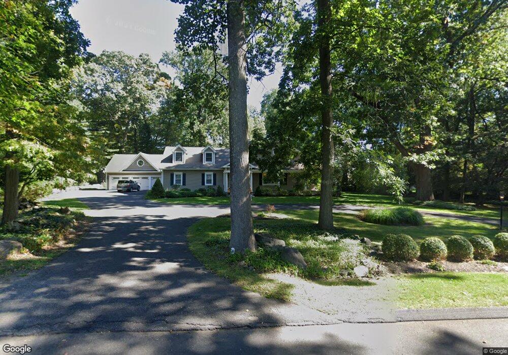
39 Aunt Hack Rd Danbury, CT 06811
Estimated Value: $605,000 - $807,000
3
Beds
3
Baths
3,783
Sq Ft
$191/Sq Ft
Est. Value
About This Home
This home is located at 39 Aunt Hack Rd, Danbury, CT 06811 and is currently estimated at $720,893, approximately $190 per square foot. 39 Aunt Hack Rd is a home located in Fairfield County with nearby schools including Mill Ridge Primary School, Rogers Park Middle School, and Danbury High School.
Ownership History
Date
Name
Owned For
Owner Type
Purchase Details
Closed on
Nov 2, 2010
Sold by
Russo Josephine
Bought by
Russo Josephine and Russo Michel B
Current Estimated Value
Home Financials for this Owner
Home Financials are based on the most recent Mortgage that was taken out on this home.
Original Mortgage
$390,275
Interest Rate
4.35%
Purchase Details
Closed on
Jun 29, 2010
Sold by
Russo Michael B and Russo Josephine
Bought by
Russo Josephine
Purchase Details
Closed on
Dec 4, 2006
Sold by
Lowe Kyle A
Bought by
Russo Michel B and Russo Josephine
Purchase Details
Closed on
May 22, 1989
Sold by
Vancampen Lynn
Bought by
Lowe Ronald
Create a Home Valuation Report for This Property
The Home Valuation Report is an in-depth analysis detailing your home's value as well as a comparison with similar homes in the area
Home Values in the Area
Average Home Value in this Area
Purchase History
| Date | Buyer | Sale Price | Title Company |
|---|---|---|---|
| Russo Josephine | -- | -- | |
| Russo Josephine | -- | -- | |
| Russo Michel B | $434,500 | -- | |
| Lowe Ronald | $237,500 | -- |
Source: Public Records
Mortgage History
| Date | Status | Borrower | Loan Amount |
|---|---|---|---|
| Open | Lowe Ronald | $363,700 | |
| Closed | Lowe Ronald | $390,275 |
Source: Public Records
Tax History
| Year | Tax Paid | Tax Assessment Tax Assessment Total Assessment is a certain percentage of the fair market value that is determined by local assessors to be the total taxable value of land and additions on the property. | Land | Improvement |
|---|---|---|---|---|
| 2025 | $11,007 | $440,440 | $110,740 | $329,700 |
| 2024 | $10,764 | $440,440 | $110,740 | $329,700 |
| 2023 | $10,275 | $440,440 | $110,740 | $329,700 |
| 2022 | $9,761 | $345,900 | $112,100 | $233,800 |
| 2021 | $9,547 | $345,900 | $112,100 | $233,800 |
| 2020 | $9,547 | $345,900 | $112,100 | $233,800 |
| 2019 | $9,547 | $345,900 | $112,100 | $233,800 |
| 2018 | $9,547 | $345,900 | $112,100 | $233,800 |
| 2017 | $8,980 | $310,200 | $106,700 | $203,500 |
| 2016 | $8,897 | $310,200 | $106,700 | $203,500 |
| 2015 | $8,766 | $310,200 | $106,700 | $203,500 |
| 2014 | $8,562 | $310,200 | $106,700 | $203,500 |
Source: Public Records
Map
Nearby Homes
- 15 Lindencrest Dr
- 34 Lindencrest Dr
- 15 Driftway Point Rd
- 6 Joes Hill Rd
- 24 Greenlawn Dr
- 31 Greenlawn Dr
- 22 Driftway Rd
- 40 Middle River Rd
- 85 Winding Ridge Way Unit 85
- 55 Mill Plain Rd Unit 19-3
- 55 Mill Plain Rd Unit 17-6
- 803 Larson Dr Unit 803
- 23 Putnam Ln Unit 23
- 131 Winding Ridge Way Unit 131
- 187-189 Middle River Rd
- 15 Lockwood Dr Unit Lot 51
- 15 Lockwood Dr
- 9 Lockwood Dr Unit Lot 48
- 1025 Country View Rd Unit 1025
- 7 Lockwood Dr Unit Lot 47
- 37 Aunt Hack Rd
- 41 Aunt Hack Rd
- 38 Aunt Hack Rd
- 35 Aunt Hack Rd Unit 37
- 36 Aunt Hack Rd
- 21 Lindencrest Dr
- 40 Aunt Hack Rd
- 19 Lindencrest Dr
- 33 Aunt Hack Rd
- 23 Lindencrest Dr
- 43 Aunt Hack Rd
- 34 Aunt Hack Rd
- 4 Maplewood Dr
- 6 Maplewood Dr
- 42 Aunt Hack Rd
- 2 Maplewood Dr
- 25 Lindencrest Dr
- 2 Cedar Crest Dr
- 4 Cedar Crest Dr
- 8 Maplewood Dr
Your Personal Tour Guide
Ask me questions while you tour the home.