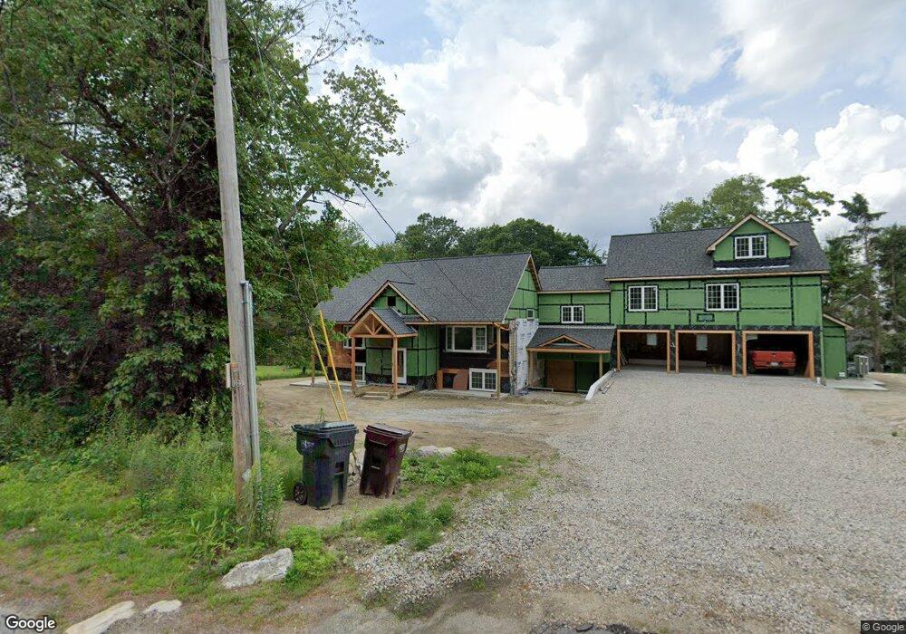
39 Barnes St Auburn, MA 01501
Pondville NeighborhoodEstimated Value: $606,000 - $865,000
3
Beds
2
Baths
3,081
Sq Ft
$248/Sq Ft
Est. Value
About This Home
This home is located at 39 Barnes St, Auburn, MA 01501 and is currently estimated at $764,771, approximately $248 per square foot. 39 Barnes St is a home located in Worcester County with nearby schools including Auburn Senior High School and Shrewsbury Montessori School - Auburn Campus.
Ownership History
Date
Name
Owned For
Owner Type
Purchase Details
Closed on
Oct 4, 2005
Sold by
Cole John C and Cole Karen A
Bought by
Mehmood Bilal
Current Estimated Value
Home Financials for this Owner
Home Financials are based on the most recent Mortgage that was taken out on this home.
Original Mortgage
$250,000
Outstanding Balance
$129,513
Interest Rate
5.84%
Mortgage Type
Purchase Money Mortgage
Estimated Equity
$635,258
Purchase Details
Closed on
May 21, 1992
Sold by
Black Harold F and Black Patricia
Bought by
Cole John C and Cole Karen
Create a Home Valuation Report for This Property
The Home Valuation Report is an in-depth analysis detailing your home's value as well as a comparison with similar homes in the area
Home Values in the Area
Average Home Value in this Area
Purchase History
| Date | Buyer | Sale Price | Title Company |
|---|---|---|---|
| Mehmood Bilal | $327,000 | -- | |
| Cole John C | $130,000 | -- |
Source: Public Records
Mortgage History
| Date | Status | Borrower | Loan Amount |
|---|---|---|---|
| Open | Mehmood Bilal | $250,000 | |
| Previous Owner | Cole John C | $50,000 | |
| Previous Owner | Cole John C | $127,000 | |
| Previous Owner | Cole John C | $30,000 |
Source: Public Records
Tax History
| Year | Tax Paid | Tax Assessment Tax Assessment Total Assessment is a certain percentage of the fair market value that is determined by local assessors to be the total taxable value of land and additions on the property. | Land | Improvement |
|---|---|---|---|---|
| 2025 | $94 | $659,700 | $137,800 | $521,900 |
| 2024 | $9,773 | $654,600 | $132,500 | $522,100 |
| 2023 | $8,412 | $529,700 | $120,600 | $409,100 |
| 2022 | $6,323 | $375,900 | $120,600 | $255,300 |
| 2021 | $137 | $349,400 | $106,800 | $242,600 |
| 2020 | $5,734 | $349,400 | $106,800 | $242,600 |
| 2019 | $6,095 | $330,900 | $104,500 | $226,400 |
| 2018 | $5,864 | $318,000 | $97,800 | $220,200 |
| 2017 | $5,592 | $304,900 | $88,600 | $216,300 |
| 2016 | $4,973 | $274,900 | $91,500 | $183,400 |
| 2015 | $4,698 | $272,200 | $91,500 | $180,700 |
| 2014 | $4,549 | $263,100 | $87,000 | $176,100 |
Source: Public Records
Map
Nearby Homes
- 137 South St
- 6 George St
- 634 Oxford St S
- 751 Washington St Unit 43A
- 61 School St
- 3 S Oxford Rd
- 303 W Main St
- 8 South Terrace
- 49 Prospect St
- 104 Appleton Rd
- 0 Athens St
- 9 B Wellington Rd
- 4 Athens St
- 808 Washington St
- 36 Central St
- 35 Waterman Rd
- 166 Leicester St
- 1 Shady Ln
- 328 Oxford St N
- 196 Horne Way Unit 196
- 41 Barnes St
- 31 Barnes St
- 3 Paul Revere Rd
- 30 Barnes St
- 45 Barnes St
- 4 Paul Revere Rd
- 44 Barnes St
- 6 Paul Revere Rd
- 26 Barnes St
- 7 Paul Revere Rd
- 7 Paul Revere Rd
- 22 Barnes St
- 3 Deer Track Rd
- Lot 3 Deer Hill Rd
- 3-B Deer Hill Rd
- 9 Paul Revere Rd
- 2 Deer Track Rd
- 6 Elizabeth Dr
- 6 Elizabeth Rd
- 6 Elizabeth Rd Unit 2
Your Personal Tour Guide
Ask me questions while you tour the home.