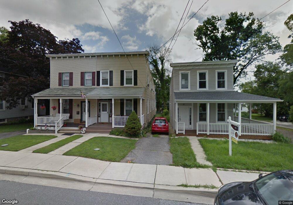
39 Bloomsbury Ave Catonsville, MD 21228
Estimated Value: $330,612
--
Bed
2
Baths
1,972
Sq Ft
$168/Sq Ft
Est. Value
About This Home
This home is located at 39 Bloomsbury Ave, Catonsville, MD 21228 and is currently estimated at $330,612, approximately $167 per square foot. 39 Bloomsbury Ave is a home located in Baltimore County with nearby schools including Catonsville Elementary School, Arbutus Middle School, and Catonsville High School.
Ownership History
Date
Name
Owned For
Owner Type
Purchase Details
Closed on
May 11, 2021
Sold by
Sheppard Scott A
Bought by
Stout Jospeh
Current Estimated Value
Home Financials for this Owner
Home Financials are based on the most recent Mortgage that was taken out on this home.
Original Mortgage
$255,109
Interest Rate
2.93%
Mortgage Type
FHA
Purchase Details
Closed on
Dec 6, 1988
Sold by
Schenk Karl W
Bought by
Sheppard Scott A
Create a Home Valuation Report for This Property
The Home Valuation Report is an in-depth analysis detailing your home's value as well as a comparison with similar homes in the area
Home Values in the Area
Average Home Value in this Area
Purchase History
| Date | Buyer | Sale Price | Title Company |
|---|---|---|---|
| Stout Jospeh | $270,000 | Crown Title Corporation | |
| Sheppard Scott A | $76,300 | -- |
Source: Public Records
Mortgage History
| Date | Status | Borrower | Loan Amount |
|---|---|---|---|
| Previous Owner | Stout Jospeh | $255,109 | |
| Previous Owner | Stout Jospeh | $7,500 |
Source: Public Records
Tax History Compared to Growth
Tax History
| Year | Tax Paid | Tax Assessment Tax Assessment Total Assessment is a certain percentage of the fair market value that is determined by local assessors to be the total taxable value of land and additions on the property. | Land | Improvement |
|---|---|---|---|---|
| 2025 | $3,688 | $255,833 | -- | -- |
| 2024 | $3,688 | $243,367 | $0 | $0 |
| 2023 | $1,891 | $230,900 | $125,000 | $105,900 |
| 2022 | $3,408 | $228,233 | $0 | $0 |
| 2021 | $1,674 | $225,567 | $0 | $0 |
| 2020 | $2,702 | $222,900 | $125,000 | $97,900 |
| 2019 | $2,518 | $207,733 | $0 | $0 |
| 2018 | $3,102 | $192,567 | $0 | $0 |
| 2017 | $2,569 | $177,400 | $0 | $0 |
| 2016 | $1,208 | $171,600 | $0 | $0 |
| 2015 | $1,208 | $165,800 | $0 | $0 |
| 2014 | $1,208 | $160,000 | $0 | $0 |
Source: Public Records
Map
Nearby Homes
- 14 Glenwood Ave
- 16 Locust Dr
- 214 Shady Nook Ct
- 38A Winters Ln
- 4 Holmes Ave
- 42 Winters Ln
- 36 Darrow Dr
- 205 Newburg Ave
- 121 Forest Dr
- 3 Arthur Ave
- 6618 Altamont Ave
- 2 Park Dr
- 19 Dunmore Rd
- 72 N Prospect Ave
- 518 Ingleside Ave
- 133 Wesley Ave
- 19 Somerset Rd
- 429 Lafayette Ave
- 509 Valcour Rd
- 49 Briarwood Rd
- 37 Bloomsbury Ave
- 41 Bloomsbury Ave
- 35 Bloomsbury Ave
- 33 Bloomsbury Ave
- 43 Bloomsbury Ave
- 31 Bloomsbury Ave
- 34 Bloomsbury Ave
- 49 Bloomsbury Ave
- 47 Bloomsbury Ave
- 40 Bloomsbury Ave
- 32 Bloomsbury Ave
- 42 Bloomsbury Ave
- 29 Bloomsbury Ave
- 38 Bloomsbury Ave
- 42 Bloomingdale Ave
- 38 Bloomingdale Ave
- 40 Bloomingdale Ave
- 28 Bloomsbury Ave
- 36 Bloomingdale Ave
- 44 Bloomsbury Ave