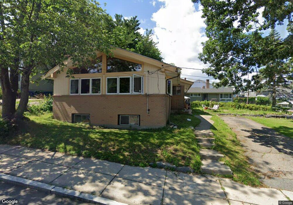
39 Boutwell St Dorchester, MA 02122
Neponset-Port Norfolk NeighborhoodEstimated Value: $655,000 - $804,000
2
Beds
2
Baths
1,341
Sq Ft
$544/Sq Ft
Est. Value
About This Home
This home is located at 39 Boutwell St, Dorchester, MA 02122 and is currently estimated at $728,997, approximately $543 per square foot. 39 Boutwell St is a home located in Suffolk County with nearby schools including Neighborhood House Charter School and St Brendan School.
Ownership History
Date
Name
Owned For
Owner Type
Purchase Details
Closed on
Feb 28, 2024
Sold by
Burns William J
Bought by
Burns Ft and Burns
Current Estimated Value
Purchase Details
Closed on
Jun 27, 1990
Sold by
Burns Stella Est
Bought by
Galas Edmund
Create a Home Valuation Report for This Property
The Home Valuation Report is an in-depth analysis detailing your home's value as well as a comparison with similar homes in the area
Home Values in the Area
Average Home Value in this Area
Purchase History
| Date | Buyer | Sale Price | Title Company |
|---|---|---|---|
| Burns Ft | -- | None Available | |
| Galas Edmund | $150,000 | -- |
Source: Public Records
Mortgage History
| Date | Status | Borrower | Loan Amount |
|---|---|---|---|
| Previous Owner | Galas Edmund | $248,653 | |
| Previous Owner | Galas Edmund | $33,000 | |
| Previous Owner | Galas Edmund | $250,000 |
Source: Public Records
Tax History Compared to Growth
Tax History
| Year | Tax Paid | Tax Assessment Tax Assessment Total Assessment is a certain percentage of the fair market value that is determined by local assessors to be the total taxable value of land and additions on the property. | Land | Improvement |
|---|---|---|---|---|
| 2025 | $6,992 | $603,800 | $219,800 | $384,000 |
| 2024 | $6,379 | $585,200 | $186,200 | $399,000 |
| 2023 | $5,873 | $546,800 | $174,000 | $372,800 |
| 2022 | $5,663 | $520,500 | $165,600 | $354,900 |
| 2021 | $5,392 | $505,300 | $160,800 | $344,500 |
| 2020 | $4,698 | $444,900 | $162,400 | $282,500 |
| 2019 | $4,342 | $412,000 | $125,000 | $287,000 |
| 2018 | $4,034 | $384,900 | $125,000 | $259,900 |
| 2017 | $3,880 | $366,400 | $125,000 | $241,400 |
| 2016 | $3,766 | $342,400 | $125,000 | $217,400 |
| 2015 | $3,700 | $305,500 | $118,500 | $187,000 |
| 2014 | $3,624 | $288,100 | $118,500 | $169,600 |
Source: Public Records
Map
Nearby Homes
- 217 Neponset Ave Unit 33
- 223 Neponset Ave Unit 2
- 3 N Munroe Terrace
- 36 Mckone St Unit 2
- 36 Mckone St
- 36 Mckone St Unit 1
- 108 King St Unit 3
- 104 King St Unit 2
- 96 King St Unit 1
- 51 Coffey St Unit 51C
- 8 Mckone St
- 60 Houghton St Unit 62
- 4 Payne St Unit 5
- 543 Adams St Unit 24
- 6 Agawam St
- 34 Houghton St
- 114 Wrentham St Unit 1
- 41 King St Unit 1
- 45 Chickatawbut St Unit 1
- 43 Chickatawbut St
- 2 Saint Clare Rd
- 43 Boutwell St Unit 45
- 45 Boutwell St Unit 1
- 30 Boutwell St Unit 1
- 32 Boutwell St
- 32 Boutwell St
- 32 Boutwell St Unit 2
- 32 Boutwell St Unit 30
- 32 Boutwell St Unit 32
- 32 Boutwell St Unit 1
- 32 Boutwell St Unit Boutwell
- 32 Boutwell St Unit 3
- 36 Boutwell St
- 36 Boutwell St Unit 2
- 36 Boutwell St Unit 1
- 47 Boutwell St Unit 49
- 6 Saint Clare Rd
- 1 Saint Clare Rd
- 53 Boutwell St
- 40 Boutwell St