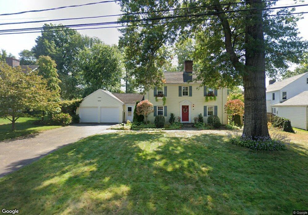
39 Braintree Dr West Hartford, CT 06117
Estimated Value: $596,137 - $678,000
3
Beds
3
Baths
1,862
Sq Ft
$344/Sq Ft
Est. Value
About This Home
This home is located at 39 Braintree Dr, West Hartford, CT 06117 and is currently estimated at $640,284, approximately $343 per square foot. 39 Braintree Dr is a home located in Hartford County with nearby schools including Bugbee School, King Philip Middle School, and Hall High School.
Ownership History
Date
Name
Owned For
Owner Type
Purchase Details
Closed on
May 16, 1997
Sold by
Hostetter James D and Hostetter Irene S
Bought by
Scheffel Steven M and Sheffel Laurie E
Current Estimated Value
Home Financials for this Owner
Home Financials are based on the most recent Mortgage that was taken out on this home.
Original Mortgage
$150,400
Interest Rate
8.12%
Mortgage Type
Unknown
Create a Home Valuation Report for This Property
The Home Valuation Report is an in-depth analysis detailing your home's value as well as a comparison with similar homes in the area
Home Values in the Area
Average Home Value in this Area
Purchase History
| Date | Buyer | Sale Price | Title Company |
|---|---|---|---|
| Scheffel Steven M | $188,000 | -- |
Source: Public Records
Mortgage History
| Date | Status | Borrower | Loan Amount |
|---|---|---|---|
| Open | Scheffel Steven M | $290,000 | |
| Closed | Scheffel Steven M | $200,000 | |
| Closed | Scheffel Steven M | $150,400 |
Source: Public Records
Tax History Compared to Growth
Tax History
| Year | Tax Paid | Tax Assessment Tax Assessment Total Assessment is a certain percentage of the fair market value that is determined by local assessors to be the total taxable value of land and additions on the property. | Land | Improvement |
|---|---|---|---|---|
| 2025 | $11,636 | $259,840 | $122,430 | $137,410 |
| 2024 | $11,004 | $259,840 | $122,430 | $137,410 |
| 2023 | $10,633 | $259,840 | $122,430 | $137,410 |
| 2022 | $10,570 | $259,840 | $122,430 | $137,410 |
| 2021 | $10,265 | $241,990 | $122,430 | $119,560 |
| 2020 | $9,518 | $227,710 | $114,380 | $113,330 |
| 2019 | $9,518 | $227,710 | $114,380 | $113,330 |
| 2018 | $9,336 | $227,710 | $114,380 | $113,330 |
| 2017 | $9,345 | $227,710 | $114,380 | $113,330 |
| 2016 | $10,197 | $258,090 | $120,050 | $138,040 |
| 2015 | $9,887 | $258,090 | $120,050 | $138,040 |
| 2014 | $9,645 | $258,090 | $120,050 | $138,040 |
Source: Public Records
Map
Nearby Homes
- 62 Blue Ridge Ln
- 2581 Albany Ave
- 5 Coolidge Rd
- 2645 Albany Ave
- 30 Farmstead Ln
- 51 Sky View Dr Unit 4
- 53 Whitehill Dr
- 592 Mountain Rd Unit A
- 14 Gledhill Ln
- 35 W Ridge Dr
- 1 King Philip Dr Unit 207
- 6 Old Oak Rd
- 37 W Normandy Dr
- 124 High Ridge Rd
- 129 Middlebrook Rd
- 1272 Trout Brook Dr
- 139 Mohawk Dr
- 1268 Trout Brook Dr
- 209 Ballard Dr
- 473 Fern St
- 56 Harvest Ln
- 37 Braintree Dr
- 50 Harvest Ln
- 64 Harvest Ln Unit 64
- 64 Harvest Ln Unit 25-1
- 33 Braintree Dr
- 74 Pioneer Dr
- 36 Braintree Dr
- 70 Pioneer Dr
- 55 Harvest Ln
- 44 Harvest Ln
- 44 Harvest Ln Unit 44
- 44 Harvest Ln Unit 12-1
- 53 Harvest Ln
- 59 Harvest Ln
- 29 Braintree Dr
- 49 Harvest Ln
- 49 Harvest Ln Unit 49
- 49 Harvest Ln Unit 10-1
- 66 Pioneer Dr