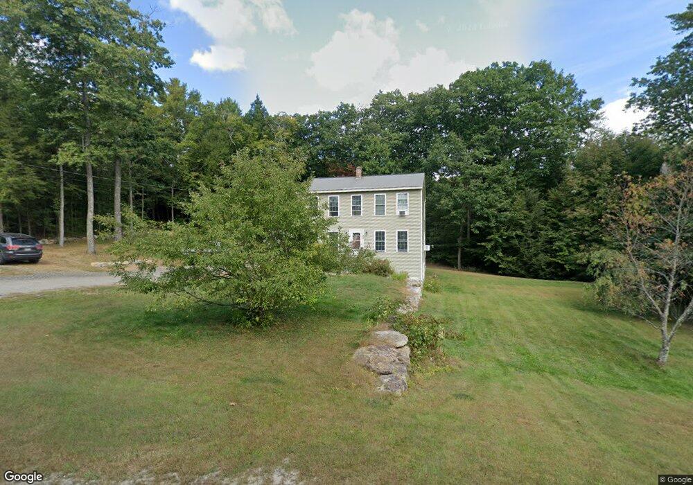
39 Briarwood Dr New Gloucester, ME 04260
Estimated Value: $470,101 - $504,000
3
Beds
2
Baths
832
Sq Ft
$578/Sq Ft
Est. Value
About This Home
This home is located at 39 Briarwood Dr, New Gloucester, ME 04260 and is currently estimated at $481,275, approximately $578 per square foot. 39 Briarwood Dr is a home located in Cumberland County with nearby schools including Gray-New Gloucester High School.
Ownership History
Date
Name
Owned For
Owner Type
Purchase Details
Closed on
Dec 15, 2006
Sold by
Fortin Home Const Inc
Bought by
Tinker Benjamin S and Tinker Amanda C
Current Estimated Value
Home Financials for this Owner
Home Financials are based on the most recent Mortgage that was taken out on this home.
Original Mortgage
$221,400
Outstanding Balance
$131,015
Interest Rate
6.31%
Mortgage Type
Purchase Money Mortgage
Estimated Equity
$350,260
Create a Home Valuation Report for This Property
The Home Valuation Report is an in-depth analysis detailing your home's value as well as a comparison with similar homes in the area
Home Values in the Area
Average Home Value in this Area
Purchase History
| Date | Buyer | Sale Price | Title Company |
|---|---|---|---|
| Tinker Benjamin S | -- | -- | |
| Tinker Benjamin S | -- | -- |
Source: Public Records
Mortgage History
| Date | Status | Borrower | Loan Amount |
|---|---|---|---|
| Open | Tinker Benjamin S | $221,400 | |
| Closed | Tinker Benjamin S | $221,400 |
Source: Public Records
Tax History Compared to Growth
Tax History
| Year | Tax Paid | Tax Assessment Tax Assessment Total Assessment is a certain percentage of the fair market value that is determined by local assessors to be the total taxable value of land and additions on the property. | Land | Improvement |
|---|---|---|---|---|
| 2025 | $3,849 | $248,801 | $79,488 | $169,313 |
| 2024 | $3,705 | $248,801 | $79,488 | $169,313 |
| 2023 | $3,555 | $248,801 | $79,488 | $169,313 |
| 2022 | $3,433 | $248,801 | $79,488 | $169,313 |
| 2021 | $3,433 | $248,801 | $79,488 | $169,313 |
| 2020 | $3,396 | $248,801 | $79,488 | $169,313 |
| 2019 | $3,074 | $181,900 | $61,500 | $120,400 |
| 2018 | $2,874 | $181,900 | $61,500 | $120,400 |
| 2017 | $2,838 | $181,900 | $61,500 | $120,400 |
| 2016 | $2,674 | $181,900 | $61,500 | $120,400 |
| 2015 | $2,665 | $181,900 | $61,500 | $120,400 |
| 2014 | $2,638 | $181,900 | $61,500 | $120,400 |
| 2013 | $2,447 | $181,900 | $61,500 | $120,400 |
Source: Public Records
Map
Nearby Homes
- 155 & 151 Gloucester Hill Rd
- 0018-C Gloucester Hill Rd
- 160 Gloucester Hill Rd
- 29 Rockwood Dr
- 0 Mayall
- 22 Shaw Rd
- TBD Targett Rd
- 10 Cobbs Bridge Rd
- 271 Bennett Rd
- 200 Woodman Rd
- 27 Callaway Dr Unit 27B
- 17 Callaway Dr Unit 17
- 164 Intervale Rd
- 1 Colley Hill Rd
- 24 Swamp Rd
- 343 Shaker Rd
- 244 Allen Rd
- 026-01 Dow Ln
- 284 Allen Rd
- 136 Shaker Rd
- 34 Briarwood Dr
- 57 Briarwood Dr
- 30 Briarwood Dr
- 38 Briarwood Dr
- 42 Briarwood Dr
- 46 Briarwood Dr
- 26 Briarwood Dr
- 60 Briarwood Dr
- 50 Briarwood Dr
- 22 Briarwood Dr
- 20 Briarwood Dr
- 18 Briarwood Dr
- Lot18 Briarwood
- 11 Briarwood Dr
- 14 Briarwood Dr
- 6 Fernwood Ln
- 23 Connor Dr
- 12 Briarwood Dr
- 22 Fernwood Ln
- 9 Briarwood Dr