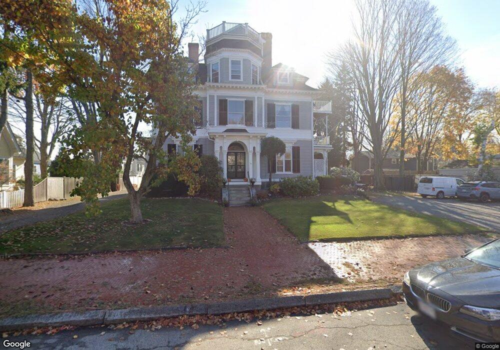
39 Broad St Unit one Newburyport, MA 01950
Estimated Value: $550,000 - $943,000
2
Beds
2
Baths
1,653
Sq Ft
$414/Sq Ft
Est. Value
About This Home
This home is located at 39 Broad St Unit one, Newburyport, MA 01950 and is currently estimated at $685,137, approximately $414 per square foot. 39 Broad St Unit one is a home located in Essex County with nearby schools including Francis T. Bresnahan Elementary School, Edward G. Molin Elementary School, and Rupert A. Nock Middle School.
Ownership History
Date
Name
Owned For
Owner Type
Purchase Details
Closed on
Aug 27, 2018
Sold by
Una Marlborough Ret
Bought by
Pirro Sharon and Tomolonius Barbara A
Current Estimated Value
Home Financials for this Owner
Home Financials are based on the most recent Mortgage that was taken out on this home.
Original Mortgage
$384,000
Outstanding Balance
$334,181
Interest Rate
4.5%
Mortgage Type
New Conventional
Estimated Equity
$350,956
Purchase Details
Closed on
Oct 20, 2017
Sold by
Marlborough Una and Carter Keith
Bought by
Una Marlborough Ret
Purchase Details
Closed on
Dec 31, 2007
Sold by
Marcus Jodi N and Marcus Joshua A
Bought by
Marlborough Una
Home Financials for this Owner
Home Financials are based on the most recent Mortgage that was taken out on this home.
Original Mortgage
$150,000
Interest Rate
6.27%
Mortgage Type
Purchase Money Mortgage
Purchase Details
Closed on
Oct 22, 2003
Sold by
Drysdale C Scott and Drysdale Cynthia L
Bought by
Marcus Joshua A
Purchase Details
Closed on
Nov 15, 2002
Sold by
Wood Beryl L
Bought by
Drysdale C Scott and Drysdale Cynthia L
Home Financials for this Owner
Home Financials are based on the most recent Mortgage that was taken out on this home.
Original Mortgage
$120,000
Interest Rate
6.03%
Mortgage Type
Purchase Money Mortgage
Purchase Details
Closed on
Oct 2, 1987
Sold by
J&L Development Inc
Bought by
Wood R Norman
Create a Home Valuation Report for This Property
The Home Valuation Report is an in-depth analysis detailing your home's value as well as a comparison with similar homes in the area
Home Values in the Area
Average Home Value in this Area
Purchase History
| Date | Buyer | Sale Price | Title Company |
|---|---|---|---|
| Pirro Sharon | $480,000 | -- | |
| Una Marlborough Ret | -- | -- | |
| Marlborough Una | $310,000 | -- | |
| Marcus Joshua A | $354,500 | -- | |
| Drysdale C Scott | $294,900 | -- | |
| Wood R Norman | $199,000 | -- |
Source: Public Records
Mortgage History
| Date | Status | Borrower | Loan Amount |
|---|---|---|---|
| Open | Pirro Sharon | $384,000 | |
| Previous Owner | Wood R Norman | $100,000 | |
| Previous Owner | Wood R Norman | $150,000 | |
| Previous Owner | Wood R Norman | $120,000 |
Source: Public Records
Tax History Compared to Growth
Tax History
| Year | Tax Paid | Tax Assessment Tax Assessment Total Assessment is a certain percentage of the fair market value that is determined by local assessors to be the total taxable value of land and additions on the property. | Land | Improvement |
|---|---|---|---|---|
| 2025 | $5,942 | $620,300 | $0 | $620,300 |
| 2024 | $5,800 | $581,700 | $0 | $581,700 |
| 2023 | $5,776 | $537,800 | $0 | $537,800 |
| 2022 | $5,637 | $469,400 | $0 | $469,400 |
| 2021 | $5,597 | $442,800 | $0 | $442,800 |
| 2020 | $5,573 | $434,000 | $0 | $434,000 |
| 2019 | $5,160 | $394,500 | $0 | $394,500 |
| 2018 | $5,376 | $405,400 | $0 | $405,400 |
| 2017 | $5,212 | $387,500 | $0 | $387,500 |
| 2016 | $4,902 | $366,100 | $0 | $366,100 |
| 2015 | $4,409 | $330,500 | $0 | $330,500 |
Source: Public Records
Map
Nearby Homes
- 13 Broad St
- 27 Warren St Unit 1
- 217 Merrimac St Unit 1
- 288 Merrimac St
- 266 Merrimac St Unit F
- 45 Boardman St Unit 1
- 14 Dexter Ln Unit B
- 14 Dexter Ln Unit A
- 158 Merrimac St Unit 3
- 41 Washington St Unit B
- 44 Washington St Unit C
- 287 1/2 High St
- 126 Merrimac St Unit 35
- 126 Merrimac St Unit 31
- 110 Low St
- 138 Low St
- 2 Court St Unit 4
- 58 Merrimac St Unit 2-5
- 1 Hill St
- 1 Hill St Unit 1
- 39 Broad St Unit 5
- 39 Broad St Unit 4
- 39 Broad St Unit 3
- 39 Broad St Unit 2
- 39 Broad St Unit 1
- 37 Broad St Unit 2
- 37 Broad St
- 58 Carter St
- 56 Carter St
- 41 Broad St
- 60 Carter St Unit 10
- 60 Carter St Unit 64
- 60 Carter St Unit 64
- 60 Carter St Unit 64
- 60 Carter St Unit 64
- 60 Carter St Unit 64
- 60 Carter St Unit 64
- 60 Carter St Unit 64
- 60 Carter St Unit 64
- 60 Carter St Unit 64