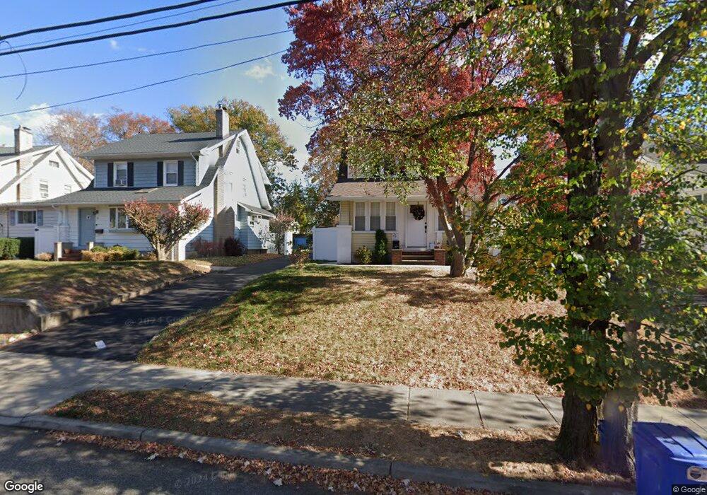
39 Brookside Ave Hawthorne, NJ 07506
Estimated Value: $650,000
3
Beds
1
Bath
1,166
Sq Ft
$557/Sq Ft
Est. Value
About This Home
This home is located at 39 Brookside Ave, Hawthorne, NJ 07506 and is currently estimated at $650,000, approximately $557 per square foot. 39 Brookside Ave is a home located in Passaic County with nearby schools including Hawthorne High School, St Anthony School, and Hawthorne Christian Academy.
Ownership History
Date
Name
Owned For
Owner Type
Purchase Details
Closed on
Jul 1, 2019
Sold by
Sobczak Henry G and Sobczak Lois
Bought by
Vega Timothy and Vega Gisselle
Current Estimated Value
Home Financials for this Owner
Home Financials are based on the most recent Mortgage that was taken out on this home.
Original Mortgage
$357,376
Outstanding Balance
$314,872
Interest Rate
4.1%
Mortgage Type
VA
Estimated Equity
$335,128
Purchase Details
Closed on
Oct 22, 1998
Sold by
Adair John R and Adair Cynthia M
Bought by
Sobczak Henry G and Sobczak Lois J
Home Financials for this Owner
Home Financials are based on the most recent Mortgage that was taken out on this home.
Original Mortgage
$90,000
Interest Rate
6.74%
Create a Home Valuation Report for This Property
The Home Valuation Report is an in-depth analysis detailing your home's value as well as a comparison with similar homes in the area
Home Values in the Area
Average Home Value in this Area
Purchase History
| Date | Buyer | Sale Price | Title Company |
|---|---|---|---|
| Vega Timothy | $349,000 | Carmegoe Title Llc | |
| Sobczak Henry G | $200,000 | -- |
Source: Public Records
Mortgage History
| Date | Status | Borrower | Loan Amount |
|---|---|---|---|
| Open | Vega Timothy | $357,376 | |
| Previous Owner | Sobczak Henry G | $90,000 |
Source: Public Records
Tax History Compared to Growth
Tax History
| Year | Tax Paid | Tax Assessment Tax Assessment Total Assessment is a certain percentage of the fair market value that is determined by local assessors to be the total taxable value of land and additions on the property. | Land | Improvement |
|---|---|---|---|---|
| 2025 | $10,647 | $350,000 | $168,700 | $181,300 |
| 2024 | $10,500 | $350,000 | $168,700 | $181,300 |
| 2022 | $10,325 | $350,000 | $168,700 | $181,300 |
| 2021 | $10,122 | $350,000 | $168,700 | $181,300 |
| 2020 | $9,979 | $350,000 | $168,700 | $181,300 |
| 2019 | $8,643 | $144,600 | $85,000 | $59,600 |
| 2018 | $8,455 | $144,600 | $85,000 | $59,600 |
| 2017 | $8,316 | $144,600 | $85,000 | $59,600 |
| 2016 | $8,200 | $144,600 | $85,000 | $59,600 |
| 2015 | $8,103 | $144,600 | $85,000 | $59,600 |
| 2014 | $7,771 | $144,600 | $85,000 | $59,600 |
Source: Public Records
Map
Nearby Homes
- 34 Brookside Ave
- 23 Brookside Ave
- 510 Goffle Rd
- 105 Brookside Ave
- 75 Mazur Place
- 164 Diamond Bridge Ave Unit 18
- 151 South Ave
- 185 South Ave
- 118 May St
- 63 MacFarlan Ave
- 63 Disepo Ave
- 40 N 19th St
- 274 Goffle Rd
- 72 Franklin Ave
- 80 Elberon Ave
- 5 Carla Ct
- 155 Washington Ave
- 84 Washington Ave
- 106 Spruce Ln
- 37 Brookside Ave
- 33 Brookside Ave
- 41 Brookside Ave
- 43 Brookside Ave
- 31 Brookside Ave
- 45 Brookside Ave
- 29 Brookside Ave
- 38 Bamford Ave
- 49 Brookside Ave
- 25 Brookside Ave
- 38 Brookside Ave
- 34 Bamford Ave
- 42 Bamford Ave
- 30 Bamford Ave
- 21 Brookside Ave
- 53 Brookside Ave
- 30 Brookside Ave
- 46 Bamford Ave
- 50 Brookside Ave
- 26 Bamford Ave