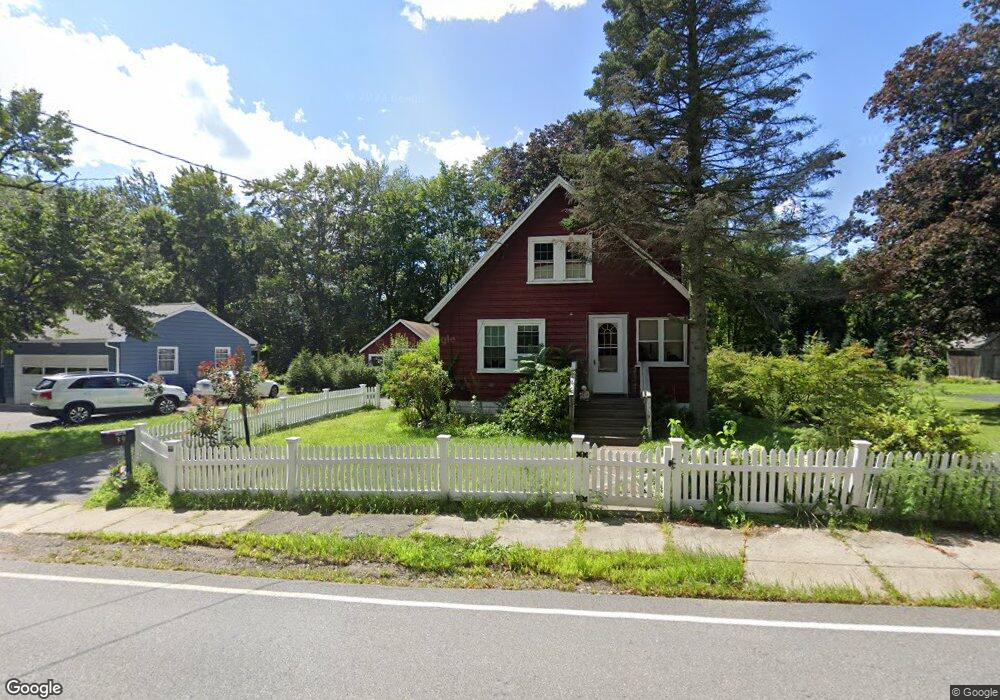
39 Brown St Maynard, MA 01754
Estimated Value: $492,846 - $661,000
3
Beds
2
Baths
1,091
Sq Ft
$511/Sq Ft
Est. Value
About This Home
This home is located at 39 Brown St, Maynard, MA 01754 and is currently estimated at $556,962, approximately $510 per square foot. 39 Brown St is a home located in Middlesex County with nearby schools including Green Meadow School, Fowler School, and Maynard High School.
Create a Home Valuation Report for This Property
The Home Valuation Report is an in-depth analysis detailing your home's value as well as a comparison with similar homes in the area
Home Values in the Area
Average Home Value in this Area
Tax History
| Year | Tax Paid | Tax Assessment Tax Assessment Total Assessment is a certain percentage of the fair market value that is determined by local assessors to be the total taxable value of land and additions on the property. | Land | Improvement |
|---|---|---|---|---|
| 2025 | $7,683 | $430,900 | $272,600 | $158,300 |
| 2024 | $7,188 | $402,000 | $259,600 | $142,400 |
| 2023 | $7,154 | $377,100 | $247,200 | $129,900 |
| 2022 | $6,919 | $337,200 | $207,700 | $129,500 |
| 2021 | $6,865 | $340,700 | $207,700 | $133,000 |
| 2020 | $5,461 | $321,200 | $187,900 | $133,300 |
| 2019 | $6,381 | $303,300 | $179,500 | $123,800 |
| 2018 | $5,236 | $267,300 | $163,200 | $104,100 |
| 2017 | $5,883 | $267,300 | $163,200 | $104,100 |
| 2016 | $5,680 | $267,300 | $163,200 | $104,100 |
| 2015 | $5,482 | $245,700 | $155,800 | $89,900 |
| 2014 | $5,365 | $240,700 | $150,800 | $89,900 |
Source: Public Records
Map
Nearby Homes
- 36 Brown St
- 12 Brown St
- 63 Conant St
- 66 Powder Mill Rd
- 68 Powder Mill Rd
- 70 Powder Mill Rd
- 22 Douglas Ave Unit 2
- 22 Douglas Ave Unit 1
- 153 Summer St
- 23 Deer Path Unit 5
- 13 Arthur St Unit 15
- 5 Hayes St Unit 5
- 31-33 Roosevelt St
- 10 Mill St Unit B
- 30 Brewster Ln
- 40 High St
- 1 Drummer Rd Unit A5
- 41 Taylor Rd
- 128 Parker St Unit 3B
- 31 Drummer Rd Unit 31
Your Personal Tour Guide
Ask me questions while you tour the home.