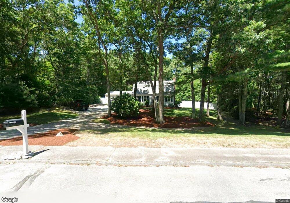
39 Carolina Trail Marshfield, MA 02050
Estimated Value: $800,817 - $989,000
3
Beds
2
Baths
1,896
Sq Ft
$468/Sq Ft
Est. Value
About This Home
This home is located at 39 Carolina Trail, Marshfield, MA 02050 and is currently estimated at $886,454, approximately $467 per square foot. 39 Carolina Trail is a home located in Plymouth County with nearby schools including South River, Furnace Brook Middle School, and Marshfield High School.
Ownership History
Date
Name
Owned For
Owner Type
Purchase Details
Closed on
Aug 12, 2010
Sold by
Mahony Frederick G and Mahony Anne T
Bought by
Mahony Anne T
Current Estimated Value
Purchase Details
Closed on
Sep 12, 1996
Sold by
Flynn Daniel F and Flynn Noreen M
Bought by
Mahony Frederick G and Mahony Anne T
Purchase Details
Closed on
Feb 1, 1989
Sold by
Kelly Richard W
Bought by
Flynn Daniel F
Create a Home Valuation Report for This Property
The Home Valuation Report is an in-depth analysis detailing your home's value as well as a comparison with similar homes in the area
Home Values in the Area
Average Home Value in this Area
Purchase History
| Date | Buyer | Sale Price | Title Company |
|---|---|---|---|
| Mahony Anne T | -- | -- | |
| Mahony Frederick G | $200,000 | -- | |
| Flynn Daniel F | $207,000 | -- |
Source: Public Records
Mortgage History
| Date | Status | Borrower | Loan Amount |
|---|---|---|---|
| Previous Owner | Flynn Daniel F | $180,000 | |
| Previous Owner | Flynn Daniel F | $25,000 |
Source: Public Records
Tax History
| Year | Tax Paid | Tax Assessment Tax Assessment Total Assessment is a certain percentage of the fair market value that is determined by local assessors to be the total taxable value of land and additions on the property. | Land | Improvement |
|---|---|---|---|---|
| 2025 | $6,920 | $699,000 | $323,200 | $375,800 |
| 2024 | $6,779 | $652,500 | $307,900 | $344,600 |
| 2023 | $6,593 | $586,500 | $285,800 | $300,700 |
| 2022 | $6,593 | $509,100 | $253,000 | $256,100 |
| 2021 | $6,377 | $483,500 | $253,000 | $230,500 |
| 2020 | $6,069 | $455,300 | $231,200 | $224,100 |
| 2019 | $5,919 | $442,400 | $231,200 | $211,200 |
| 2018 | $5,857 | $438,100 | $231,200 | $206,900 |
| 2017 | $5,799 | $422,700 | $231,200 | $191,500 |
| 2016 | $5,685 | $409,600 | $231,200 | $178,400 |
| 2015 | $5,386 | $405,300 | $231,200 | $174,100 |
| 2014 | $5,327 | $400,800 | $231,200 | $169,600 |
Source: Public Records
Map
Nearby Homes
- 235 Main St
- 1155 Main St
- 2 Proprietors Dr Unit 25
- 2 Proprietors Dr Unit 26
- 2 Proprietors Dr Unit 27
- 167 Planting Field Rd
- 39 High Beacon Way
- 14 Red Pony Path
- 566 Holly Rd
- 848 Plain St Unit 23
- 451 School St Unit 5-2
- 8 Duxbury St
- 3 Summer St
- 4 Summer St
- 92 Salt Meadow Waye
- 10 Royal Dane Dr Unit 85
- 5 Royal Dane Dr Unit 45
- 1 Valley Path
- 480 Pleasant St
- 1801 Ocean St Unit B31
- 37 Carolina Trail
- 41 Carolina Trail
- 690 Eames Way
- 20 Traceys Pathe
- 40 Carolina Trail
- 35 Carolina Trail
- 43 Carolina Trail
- 18 Traceys Pathe
- 732 Eames Way
- 33 Carolina Trail
- 19 Traceys Pathe
- 45 Carolina Trail
- 42 Carolina Trail
- 16 Traceys Pathe
- 742 Eames Way
- 31 Carolina Trail
- 32 Carolina Trail
- 44 Carolina Trail
- 17 Traceys Pathe
- 14 Traceys Pathe