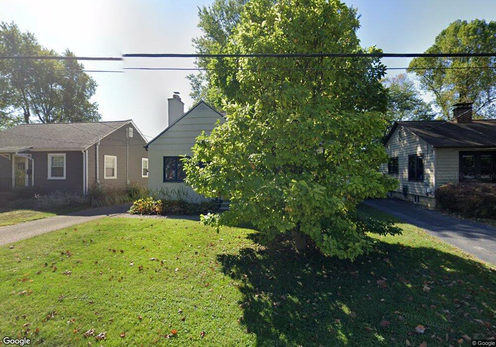
39 Central Ave Westerville, OH 43081
Estimated Value: $300,000 - $360,000
4
Beds
2
Baths
1,433
Sq Ft
$233/Sq Ft
Est. Value
About This Home
This home is located at 39 Central Ave, Westerville, OH 43081 and is currently estimated at $334,162, approximately $233 per square foot. 39 Central Ave is a home located in Franklin County with nearby schools including Whittier Elementary School, Blendon Middle School, and Westerville South High School.
Ownership History
Date
Name
Owned For
Owner Type
Purchase Details
Closed on
Feb 15, 2002
Sold by
Barton George E and Barton Madeline K
Bought by
Coe Stacey
Current Estimated Value
Home Financials for this Owner
Home Financials are based on the most recent Mortgage that was taken out on this home.
Original Mortgage
$98,900
Outstanding Balance
$38,545
Interest Rate
6.25%
Mortgage Type
Purchase Money Mortgage
Estimated Equity
$295,617
Purchase Details
Closed on
Jan 27, 2001
Sold by
Barton George Ernest
Bought by
Barton George Edward and Barton Madeline Kay
Purchase Details
Closed on
Oct 1, 1983
Create a Home Valuation Report for This Property
The Home Valuation Report is an in-depth analysis detailing your home's value as well as a comparison with similar homes in the area
Home Values in the Area
Average Home Value in this Area
Purchase History
| Date | Buyer | Sale Price | Title Company |
|---|---|---|---|
| Coe Stacey | $131,900 | Title First Agency Inc | |
| Barton George Edward | -- | -- | |
| -- | $60,500 | -- |
Source: Public Records
Mortgage History
| Date | Status | Borrower | Loan Amount |
|---|---|---|---|
| Open | Coe Stacey | $98,900 |
Source: Public Records
Tax History Compared to Growth
Tax History
| Year | Tax Paid | Tax Assessment Tax Assessment Total Assessment is a certain percentage of the fair market value that is determined by local assessors to be the total taxable value of land and additions on the property. | Land | Improvement |
|---|---|---|---|---|
| 2024 | $5,313 | $91,320 | $28,280 | $63,040 |
| 2023 | $5,203 | $91,315 | $28,280 | $63,035 |
| 2022 | $4,725 | $63,320 | $17,820 | $45,500 |
| 2021 | $4,765 | $63,320 | $17,820 | $45,500 |
| 2020 | $4,751 | $63,320 | $17,820 | $45,500 |
| 2019 | $4,232 | $53,130 | $14,840 | $38,290 |
| 2018 | $4,107 | $53,130 | $14,840 | $38,290 |
| 2017 | $4,166 | $53,130 | $14,840 | $38,290 |
| 2016 | $4,189 | $48,620 | $17,290 | $31,330 |
| 2015 | $4,061 | $48,620 | $17,290 | $31,330 |
| 2014 | $4,064 | $48,620 | $17,290 | $31,330 |
| 2013 | $1,931 | $46,270 | $16,450 | $29,820 |
Source: Public Records
Map
Nearby Homes
- 470 S State St
- 466 S State St
- 502 Foxtrail Cir E Unit 502
- 476 S State St
- 206 Charring Cross Dr S Unit 2206
- 79 W Park St
- 559 Allview Ct
- 360 Potawatomi Dr
- 53 W College Ave
- 66 Daleview Dr
- 199 E College Ave
- 0 Cherrington Rd Unit 225023909
- 25 King Arthur Blvd
- 417 E Park St
- 465 W Schrock Rd
- 92 N Vine St
- 364 E College Ave
- 368 E College Ave
- 461 Delaware Ct
- 371 Delaware Dr
- 41 Central Ave
- 31 Central Ave
- 27 Central Ave
- 46 Parkview Ave
- 51 Central Ave
- 38 Parkview Ave
- 50 Parkview Ave
- 56 Parkview Ave
- 34 Parkview Ave
- 44 Central Ave
- 55 Central Ave
- 46 Central Ave
- 24 Central Ave
- 18 Central Ave
- 28 Parkview Ave
- 66 Parkview Ave
- 61 Central Ave
- 50 Central Ave
- 47 Parkview Ave
- 47 Parkview Ave