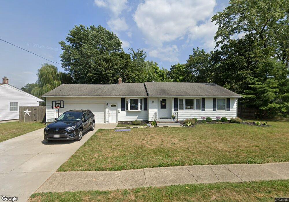
39 Charlotte Ave Hamburg, NY 14075
Estimated Value: $271,000 - $300,000
3
Beds
1
Bath
1,270
Sq Ft
$228/Sq Ft
Est. Value
About This Home
This home is located at 39 Charlotte Ave, Hamburg, NY 14075 and is currently estimated at $289,222, approximately $227 per square foot. 39 Charlotte Ave is a home located in Erie County with nearby schools including Hamburg Middle School, Sts. Peter & Paul Elementary School, and Hamburg Christian Academy.
Ownership History
Date
Name
Owned For
Owner Type
Purchase Details
Closed on
Oct 21, 2016
Sold by
Kester Robert Earl and Kester Suzanne Mary
Bought by
Kester Kaitlyn R
Current Estimated Value
Home Financials for this Owner
Home Financials are based on the most recent Mortgage that was taken out on this home.
Original Mortgage
$132,554
Outstanding Balance
$107,283
Interest Rate
3.25%
Mortgage Type
FHA
Estimated Equity
$181,939
Purchase Details
Closed on
Nov 8, 1995
Create a Home Valuation Report for This Property
The Home Valuation Report is an in-depth analysis detailing your home's value as well as a comparison with similar homes in the area
Home Values in the Area
Average Home Value in this Area
Purchase History
| Date | Buyer | Sale Price | Title Company |
|---|---|---|---|
| Kester Kaitlyn R | $135,000 | None Available | |
| -- | -- | -- |
Source: Public Records
Mortgage History
| Date | Status | Borrower | Loan Amount |
|---|---|---|---|
| Open | Kester Kaitlyn R | $132,554 |
Source: Public Records
Tax History Compared to Growth
Tax History
| Year | Tax Paid | Tax Assessment Tax Assessment Total Assessment is a certain percentage of the fair market value that is determined by local assessors to be the total taxable value of land and additions on the property. | Land | Improvement |
|---|---|---|---|---|
| 2024 | $6,463 | $70,600 | $7,800 | $62,800 |
| 2023 | $6,334 | $70,600 | $7,800 | $62,800 |
| 2022 | $6,079 | $70,600 | $7,800 | $62,800 |
| 2021 | $4,485 | $70,600 | $7,800 | $62,800 |
| 2020 | $5,788 | $70,600 | $7,800 | $62,800 |
| 2019 | $4,906 | $70,600 | $7,800 | $62,800 |
| 2018 | $5,651 | $70,600 | $7,800 | $62,800 |
| 2017 | $1,494 | $70,600 | $7,800 | $62,800 |
| 2016 | $4,940 | $70,600 | $7,800 | $62,800 |
| 2015 | -- | $70,600 | $7,800 | $62,800 |
| 2014 | -- | $70,600 | $7,800 | $62,800 |
Source: Public Records
Map
Nearby Homes
- 88 Raymond St
- 82 Raymond St
- 27 Huntington Ct
- 6309 Boston State Rd
- 11 Hunt Ave
- 187 Hunt Ave
- 42 Sandra Place
- 25 Brendel Ave
- 6145 Mckinley Pkwy Unit 5
- 6145 Mckinley Pkwy Unit 31
- 66 Elizabeth St
- 21 Dudley Ave
- 5985 Mckinley Pkwy
- 4700 Newton Rd
- 38 Oliver Place
- 55 Therin Dr
- 43 Oliver Place
- 87 Maple Ave
- 4373 Clark St
- 157 Maple Ave
- 47 Charlotte Ave
- 144 Huntington Ct
- 138 Huntington Ct
- 4430 Newton Rd
- 42 Charlotte Ave
- 96 Newton Rd
- 4436 Newton Rd
- 143 Huntington Ct
- 54 Charlotte Ave
- 132 Huntington Ct
- 137 Huntington Ct
- 67 Charlotte Ave
- 126 Huntington Ct
- 131 Huntington Ct
- 4426 Valley View Ave
- 90 Newton Rd
- 73 Charlotte Ave
- 120 Huntington Ct
- 109 Sharon Ave
- 68 Charlotte Ave