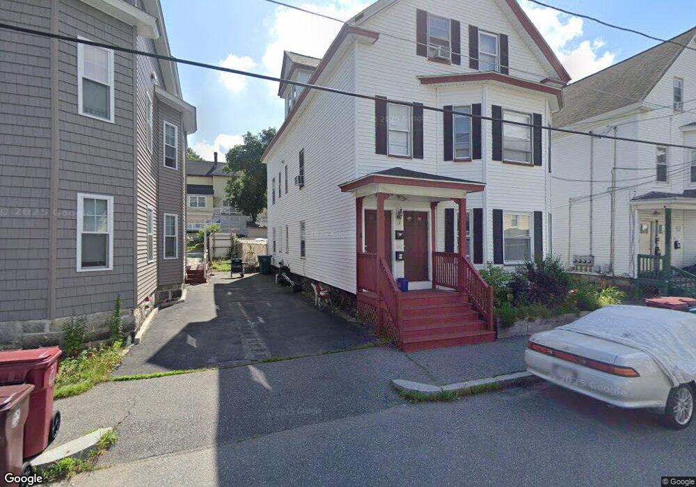
39 Clare St Lowell, MA 01854
Acre NeighborhoodEstimated Value: $680,000 - $752,000
9
Beds
3
Baths
3,399
Sq Ft
$210/Sq Ft
Est. Value
About This Home
This home is located at 39 Clare St, Lowell, MA 01854 and is currently estimated at $714,667, approximately $210 per square foot. 39 Clare St is a home located in Middlesex County with nearby schools including Charlotte M. Murkland Elementary School, Joseph McAvinnue Elementary School, and Charles W. Morey Elementary School.
Create a Home Valuation Report for This Property
The Home Valuation Report is an in-depth analysis detailing your home's value as well as a comparison with similar homes in the area
Home Values in the Area
Average Home Value in this Area
Tax History
| Year | Tax Paid | Tax Assessment Tax Assessment Total Assessment is a certain percentage of the fair market value that is determined by local assessors to be the total taxable value of land and additions on the property. | Land | Improvement |
|---|---|---|---|---|
| 2025 | $6,561 | $571,500 | $94,900 | $476,600 |
| 2024 | $6,253 | $525,000 | $88,700 | $436,300 |
| 2023 | $6,139 | $494,300 | $77,100 | $417,200 |
| 2022 | $5,699 | $449,100 | $70,100 | $379,000 |
| 2021 | $4,955 | $368,100 | $61,000 | $307,100 |
| 2020 | $4,426 | $331,300 | $52,000 | $279,300 |
| 2019 | $4,267 | $303,900 | $45,900 | $258,000 |
| 2018 | $3,880 | $269,600 | $43,700 | $225,900 |
| 2017 | $3,675 | $246,300 | $39,700 | $206,600 |
| 2016 | $3,443 | $227,100 | $39,700 | $187,400 |
| 2015 | $3,269 | $211,200 | $40,900 | $170,300 |
| 2013 | $2,939 | $195,800 | $54,400 | $141,400 |
Source: Public Records
Map
Nearby Homes
- 19 Oliver St
- 116 Walker St
- 113 School St Unit 12
- 1017 Middlesex St Unit 5
- 169 Salem St
- 3 Butman Place
- 312 Wilder St
- 187 Varnum Ave
- 38 Starbird St
- 104 Woodward Ave
- 89 Mammoth Rd
- 70 Austin St Unit 15
- 491 Dutton St Unit 305
- 491 Dutton St Unit 409
- 491 Dutton St Unit 504
- 143 Westford St
- 45 Harvard St Unit 5 3rd fl
- 45 Marshall St
- 1311 Middlesex St
- 129 Cabot St
Your Personal Tour Guide
Ask me questions while you tour the home.