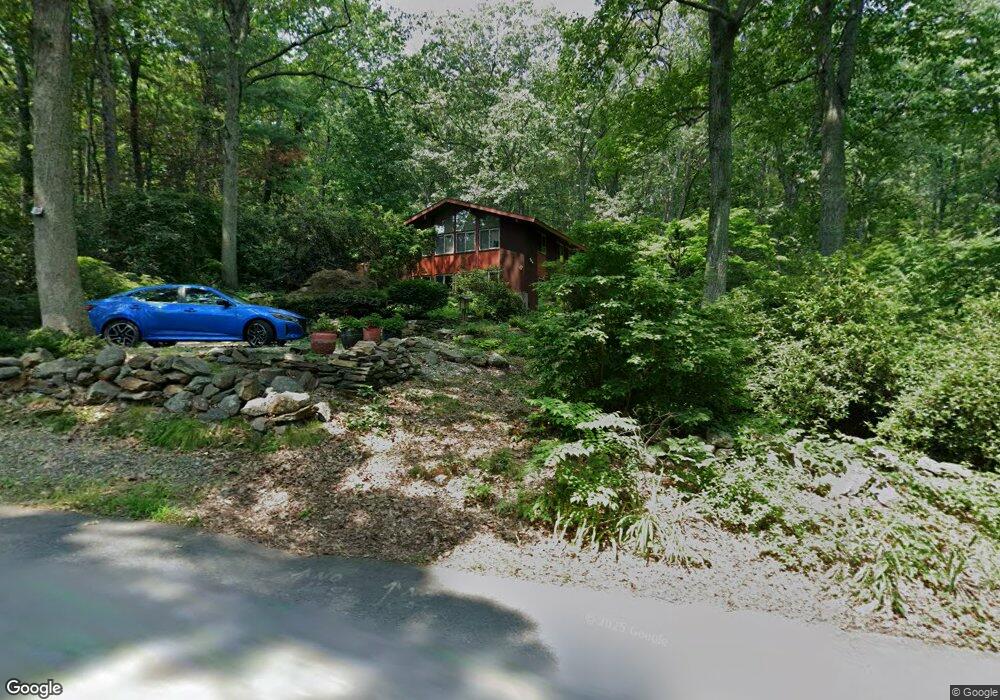
39 Cleaves Hill Rd Harvard, MA 01451
Estimated Value: $863,475 - $1,032,000
3
Beds
3
Baths
2,000
Sq Ft
$463/Sq Ft
Est. Value
About This Home
This home is located at 39 Cleaves Hill Rd, Harvard, MA 01451 and is currently estimated at $925,619, approximately $462 per square foot. 39 Cleaves Hill Rd is a home located in Worcester County.
Ownership History
Date
Name
Owned For
Owner Type
Purchase Details
Closed on
Nov 8, 2004
Sold by
Jorgensen Susan C
Bought by
Bretz Greta Star and Bretz Joshua H
Current Estimated Value
Home Financials for this Owner
Home Financials are based on the most recent Mortgage that was taken out on this home.
Original Mortgage
$465,000
Outstanding Balance
$230,967
Interest Rate
5.71%
Mortgage Type
Purchase Money Mortgage
Estimated Equity
$694,652
Create a Home Valuation Report for This Property
The Home Valuation Report is an in-depth analysis detailing your home's value as well as a comparison with similar homes in the area
Home Values in the Area
Average Home Value in this Area
Purchase History
| Date | Buyer | Sale Price | Title Company |
|---|---|---|---|
| Bretz Greta Star | $585,000 | -- |
Source: Public Records
Mortgage History
| Date | Status | Borrower | Loan Amount |
|---|---|---|---|
| Open | Bretz Greta Star | $465,000 |
Source: Public Records
Tax History Compared to Growth
Tax History
| Year | Tax Paid | Tax Assessment Tax Assessment Total Assessment is a certain percentage of the fair market value that is determined by local assessors to be the total taxable value of land and additions on the property. | Land | Improvement |
|---|---|---|---|---|
| 2025 | $11,514 | $735,700 | $294,500 | $441,200 |
| 2024 | $11,281 | $757,100 | $294,500 | $462,600 |
| 2023 | $10,792 | $649,700 | $274,600 | $375,100 |
| 2022 | $8,819 | $492,400 | $269,000 | $223,400 |
| 2021 | $226 | $485,000 | $269,000 | $216,000 |
| 2020 | $4,716 | $450,800 | $269,000 | $181,800 |
| 2019 | $7,759 | $445,400 | $269,000 | $176,400 |
| 2018 | $7,546 | $440,000 | $269,000 | $171,000 |
| 2017 | $3,828 | $384,200 | $229,000 | $155,200 |
| 2016 | $6,650 | $368,400 | $229,000 | $139,400 |
| 2015 | $6,730 | $378,300 | $225,000 | $153,300 |
| 2014 | $6,465 | $378,300 | $225,000 | $153,300 |
Source: Public Records
Map
Nearby Homes
- 220 Swanson Rd Unit 605
- 220 Swanson Rd Unit 606
- 220 Swanson Rd Unit 604
- 176 Swanson Rd Unit 309
- 166 Littleton Rd Unit 3
- 42 Swanson Ct Unit 14A
- 50 Spencer Rd Unit 36
- 53 Swanson Ct Unit 36C
- 58 Spencer Rd Unit 18K
- 24 Fairbanks St
- 11 Fairbanks St Unit 2
- 5 Fairbank St
- 4 Bolton Rd
- 87 Ayer Rd
- 310 Codman Hill Rd Unit 35D
- 332 Old Littleton Rd
- 139 Picnic St
- 1155 Burroughs Rd
- 18A S Shaker Rd
- 45 S Shaker Rd
- 37 Cleaves Hill Rd
- 27 Cleaves Hill Rd
- 107 Littleton County Rd
- 20 Cleaves Hill Rd
- 111 Littleton County Rd
- 88 Littleton County Rd
- 20 Pinnacle Rd
- 86 Littleton County Rd
- 116 Littleton County Rd
- 115 Littleton County Rd
- 28 Pinnacle Rd
- 21 Cleaves Hill Rd
- 24 Pinnacle Rd
- 32 Pinnacle Rd
- 84 Littleton County Rd
- 82 Littleton County Rd
- 10 Cleaves Hill Rd
- 41 Pinnacle Rd
- 49 Pinnacle Rd
- 6 Cleaves Hill Rd