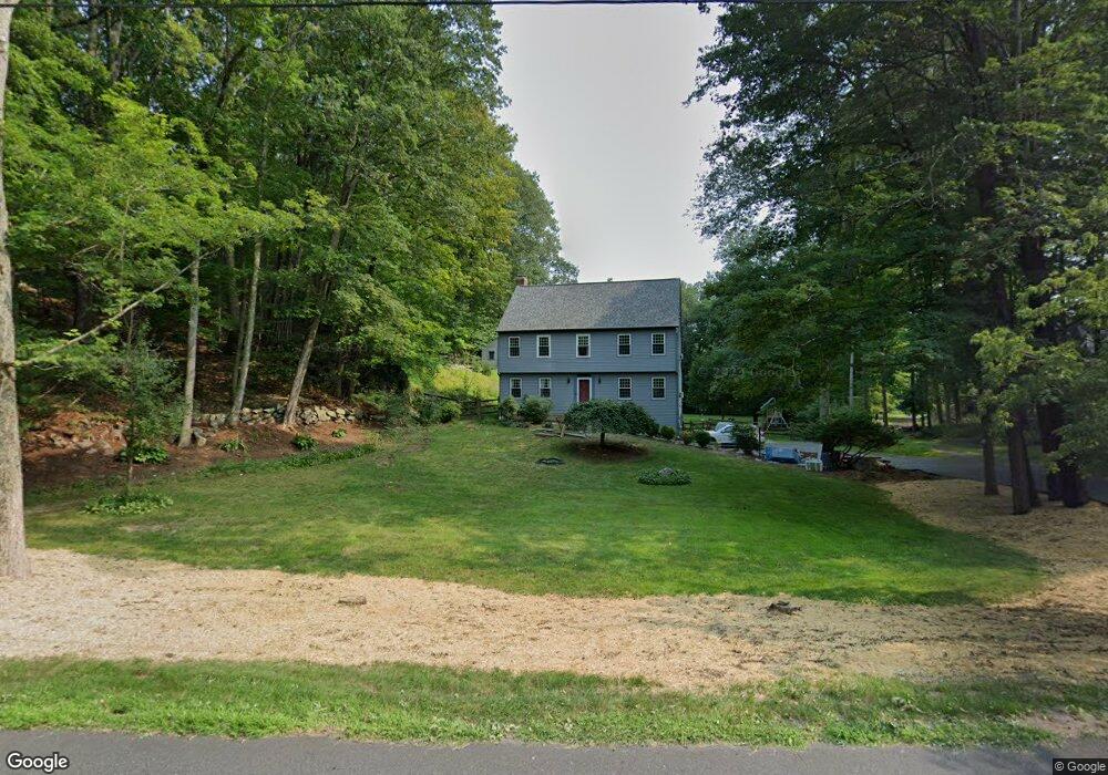
39 Cold Spring Rd Newtown, CT 06470
Estimated Value: $725,000 - $880,000
4
Beds
3
Baths
2,590
Sq Ft
$309/Sq Ft
Est. Value
About This Home
This home is located at 39 Cold Spring Rd, Newtown, CT 06470 and is currently estimated at $800,585, approximately $309 per square foot. 39 Cold Spring Rd is a home located in Fairfield County with nearby schools including Middle Gate Elementary School, Reed Intermediate School, and Newtown Middle School.
Ownership History
Date
Name
Owned For
Owner Type
Purchase Details
Closed on
Apr 30, 1997
Sold by
Morlock Paul A and Morlock Valerie B
Bought by
Cameron Ross G and Cameron Mary A
Current Estimated Value
Home Financials for this Owner
Home Financials are based on the most recent Mortgage that was taken out on this home.
Original Mortgage
$234,500
Interest Rate
7.85%
Mortgage Type
Unknown
Create a Home Valuation Report for This Property
The Home Valuation Report is an in-depth analysis detailing your home's value as well as a comparison with similar homes in the area
Home Values in the Area
Average Home Value in this Area
Purchase History
| Date | Buyer | Sale Price | Title Company |
|---|---|---|---|
| Cameron Ross G | $335,000 | -- | |
| Cameron Ross G | $335,000 | -- |
Source: Public Records
Mortgage History
| Date | Status | Borrower | Loan Amount |
|---|---|---|---|
| Open | Cameron Ross G | $317,000 | |
| Open | Cameron Ross G | $660,000 | |
| Closed | Cameron Ross G | $234,500 |
Source: Public Records
Tax History
| Year | Tax Paid | Tax Assessment Tax Assessment Total Assessment is a certain percentage of the fair market value that is determined by local assessors to be the total taxable value of land and additions on the property. | Land | Improvement |
|---|---|---|---|---|
| 2025 | $12,704 | $442,020 | $162,380 | $279,640 |
| 2024 | $11,921 | $442,020 | $162,380 | $279,640 |
| 2023 | $11,599 | $442,020 | $162,380 | $279,640 |
| 2022 | $11,061 | $319,040 | $121,520 | $197,520 |
| 2021 | $11,055 | $319,040 | $121,520 | $197,520 |
| 2020 | $11,090 | $319,040 | $121,520 | $197,520 |
| 2019 | $11,093 | $319,040 | $121,520 | $197,520 |
| 2018 | $10,924 | $319,040 | $121,520 | $197,520 |
| 2017 | $10,398 | $306,990 | $129,730 | $177,260 |
| 2016 | $10,315 | $306,990 | $129,730 | $177,260 |
| 2015 | $10,152 | $306,990 | $129,730 | $177,260 |
| 2014 | $10,226 | $306,990 | $129,730 | $177,260 |
Source: Public Records
Map
Nearby Homes
- 301 S Main St Unit 6
- 10 Trout Brook Cir Unit 10
- 49 Copper Creek Cir
- 19 Botsford Hill Rd
- 2 Abbey Ln
- 4 Abbey Ln
- 44 Orchard Hill Rd
- 39 Platts Hill Rd
- 46 Little Brook Ln
- 909 Main St
- 58 Botsford Hill Rd
- 263 & 271 S Main St
- 342 S Main St
- 2 Ridge Valley Rd
- 167 Toddy Hill Rd
- 4 Old Gate Ln
- 10 White Oak Farm Rd
- 59 Cedar Hill Rd
- 5 Kensington Rd
- 202 Windgate Cir Unit E
- 35 Cold Spring Rd
- 41 Cold Spring Rd
- 12 Cold Spring Rd
- 26 Washbrook Rd
- 45 Cold Spring Rd
- 38 Cold Spring Rd
- 28 Washbrook Rd
- 40 Cold Spring Rd
- 24 Washbrook Rd
- 16 Washbrook Rd
- 12 Washbrook Rd
- 18 Washbrook Rd
- 20 Washbrook Rd
- 47 Cold Spring Rd
- 14 Washbrook Rd
- 79 Huntingtown Rd
- 32 Washbrook Rd
- 10 Washbrook Rd
- 83 Huntingtown Rd
Your Personal Tour Guide
Ask me questions while you tour the home.