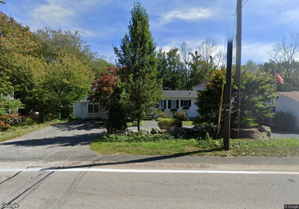
39 Cornet Stetson Rd Scituate, MA 02066
Estimated Value: $749,000 - $1,055,000
3
Beds
2
Baths
2,623
Sq Ft
$358/Sq Ft
Est. Value
About This Home
This home is located at 39 Cornet Stetson Rd, Scituate, MA 02066 and is currently estimated at $938,939, approximately $357 per square foot. 39 Cornet Stetson Rd is a home located in Plymouth County with nearby schools including Jenkins Elementary School, Lester J. Gates Middle School, and Scituate High School.
Ownership History
Date
Name
Owned For
Owner Type
Purchase Details
Closed on
Jun 14, 2023
Sold by
Finn Stephen J and Finn Debra M
Bought by
Finn Ft and Finn
Current Estimated Value
Purchase Details
Closed on
Nov 20, 1998
Sold by
Clancy Rt and Connolly
Bought by
Finn Stephen J and Finn Debra M
Home Financials for this Owner
Home Financials are based on the most recent Mortgage that was taken out on this home.
Original Mortgage
$158,650
Interest Rate
6.49%
Mortgage Type
Purchase Money Mortgage
Create a Home Valuation Report for This Property
The Home Valuation Report is an in-depth analysis detailing your home's value as well as a comparison with similar homes in the area
Home Values in the Area
Average Home Value in this Area
Purchase History
| Date | Buyer | Sale Price | Title Company |
|---|---|---|---|
| Finn Ft | -- | None Available | |
| Finn Stephen J | $167,000 | -- |
Source: Public Records
Mortgage History
| Date | Status | Borrower | Loan Amount |
|---|---|---|---|
| Previous Owner | Finn Stephen J | $90,000 | |
| Previous Owner | Finn Stephen J | $60,000 | |
| Previous Owner | Finn Stephen J | $154,100 | |
| Previous Owner | Finn Stephen J | $158,650 |
Source: Public Records
Tax History Compared to Growth
Tax History
| Year | Tax Paid | Tax Assessment Tax Assessment Total Assessment is a certain percentage of the fair market value that is determined by local assessors to be the total taxable value of land and additions on the property. | Land | Improvement |
|---|---|---|---|---|
| 2025 | $8,369 | $837,700 | $343,800 | $493,900 |
| 2024 | $6,023 | $581,400 | $312,600 | $268,800 |
| 2023 | $5,676 | $510,000 | $267,500 | $242,500 |
| 2022 | $5,646 | $447,400 | $226,600 | $220,800 |
| 2021 | $5,393 | $404,600 | $215,800 | $188,800 |
| 2020 | $5,131 | $380,100 | $207,500 | $172,600 |
| 2019 | $5,063 | $368,500 | $203,400 | $165,100 |
| 2018 | $4,876 | $349,500 | $213,500 | $136,000 |
| 2017 | $4,774 | $338,800 | $202,800 | $136,000 |
| 2016 | $4,641 | $328,200 | $192,200 | $136,000 |
| 2015 | $4,299 | $328,200 | $192,200 | $136,000 |
Source: Public Records
Map
Nearby Homes
- 17 Old Oaken Bucket Rd
- 19 Ford Place Unit 3
- 19 Ford Place Unit 1
- 9 Cushing Park Rd
- 29 Ladds Way Unit 29
- 64 Carolyn Cir
- 32 Carolyn Cir
- 252 Winter St
- 115 Elm St
- 111 Elm St
- 59 Greenfield Ln
- 25 Webster Farm Way
- 23 Webster Farm Way
- 3 Webster Farm Way
- 5 Webster Farm Way
- 3 Grace Way Unit 3
- 1 Grace Way Unit 1
- 27 Grace Way
- 2 Webster Farm Way
- 131 Maple St
- 33 Cornet Stetson Rd
- 45 Cornet Stetson Rd
- 36 Cornet Stetson Rd
- 29 Cornet Stetson Rd
- 47 Cornet Stetson Rd
- 175 Judge Cushing Rd
- 28 Cornet Stetson Rd
- 46 Cornet Stetson Rd
- 179 Judge Cushing Rd
- 183 Judge Cushing Rd
- 245 Chief Justice Cushing Hwy
- 255 Chief Justice Cushing Hwy
- 22 Cornet Stetson Rd
- 241 Chief Justice Cushing Hwy
- 53 Cornet Stetson Rd
- Lot A Old Oaken Bucket Rd
- 155 Judge Cushing Rd
- 23 Old Oaken Bucket Rd
- 180 Cushing Rd
- 261 Chief Justice Cushing Hwy