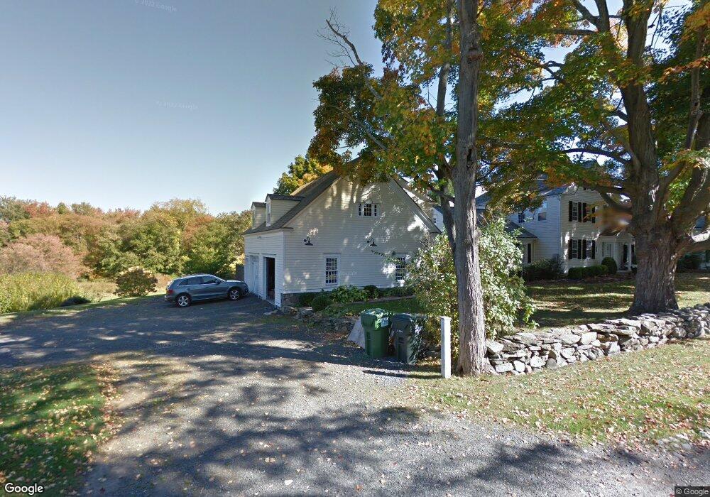
39 Deep Brook Rd Newtown, CT 06470
Estimated Value: $937,000 - $1,381,000
6
Beds
4
Baths
4,800
Sq Ft
$246/Sq Ft
Est. Value
About This Home
This home is located at 39 Deep Brook Rd, Newtown, CT 06470 and is currently estimated at $1,178,824, approximately $245 per square foot. 39 Deep Brook Rd is a home located in Fairfield County with nearby schools including Head O'Meadow Elementary School, Reed Intermediate School, and Newtown Middle School.
Ownership History
Date
Name
Owned For
Owner Type
Purchase Details
Closed on
Jun 30, 2000
Sold by
Stadley Margaret S
Bought by
Fletcher David A and Fletcher Maura O
Current Estimated Value
Create a Home Valuation Report for This Property
The Home Valuation Report is an in-depth analysis detailing your home's value as well as a comparison with similar homes in the area
Home Values in the Area
Average Home Value in this Area
Purchase History
| Date | Buyer | Sale Price | Title Company |
|---|---|---|---|
| Fletcher David A | $705,000 | -- | |
| Fletcher David A | $705,000 | -- |
Source: Public Records
Mortgage History
| Date | Status | Borrower | Loan Amount |
|---|---|---|---|
| Open | Fletcher David A | $525,000 | |
| Closed | Fletcher David A | $118,000 | |
| Closed | Fletcher David A | $500,000 |
Source: Public Records
Tax History
| Year | Tax Paid | Tax Assessment Tax Assessment Total Assessment is a certain percentage of the fair market value that is determined by local assessors to be the total taxable value of land and additions on the property. | Land | Improvement |
|---|---|---|---|---|
| 2025 | $16,146 | $561,810 | $133,990 | $427,820 |
| 2024 | $15,152 | $561,810 | $133,990 | $427,820 |
| 2023 | $14,742 | $561,810 | $133,990 | $427,820 |
| 2022 | $13,757 | $396,790 | $90,330 | $306,460 |
| 2021 | $13,749 | $396,790 | $90,330 | $306,460 |
| 2020 | $13,792 | $396,790 | $90,330 | $306,460 |
| 2019 | $13,684 | $393,570 | $90,330 | $303,240 |
| 2018 | $13,476 | $393,570 | $90,330 | $303,240 |
| 2017 | $13,637 | $402,640 | $103,250 | $299,390 |
| 2016 | $13,529 | $402,640 | $103,250 | $299,390 |
| 2015 | $13,315 | $402,640 | $103,250 | $299,390 |
| 2014 | $13,412 | $402,640 | $103,250 | $299,390 |
Source: Public Records
Map
Nearby Homes
- 9A Point o Rocks Rd
- 55 Sugar St Unit 9
- 55 Sugar St Unit 31
- 55 Sugar St Unit 33
- 55 Sugar St Unit 3
- 55 Sugar St Unit 20
- 55 Sugar St Unit 28
- 55 Sugar St Unit 14
- 55 Sugar St Unit 12
- 55 Sugar St Unit 27
- 55 Sugar St Unit 10
- 18 Head of Meadow Rd
- 3 Grand Place
- 59 Cedar Hill Rd
- 4 Old Gate Ln
- 92 Head of Meadow Rd
- 5 Mount Pleasant Rd
- 263 & 271 S Main St
- 342 S Main St
- 1 Reservoir Rd
- 50 Deep Brook Rd
- 36 Deep Brook Rd
- 3 Point o Rocks Rd
- 48 Deep Brook Rd
- 5 Point o Rocks Rd
- 18 Deep Brook Rd
- 52 Elm Dr
- 17 Valley View Rd
- 15 Valley View Rd
- 19 Valley View Rd
- 21 Valley View Rd
- 23 Valley View Rd
- 14 Valley View Rd
- 12 Valley View Rd
- 16 Valley View Rd
- 18 Valley View Rd
- 25 Valley View Rd
- 20 Valley View Rd
- 9 Point o Rocks Rd
- 4 Bonnie Brae Dr
Your Personal Tour Guide
Ask me questions while you tour the home.