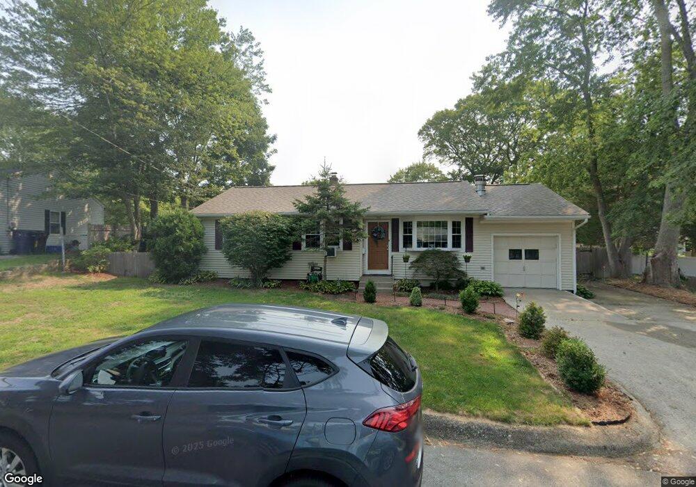
39 Dupont Cir North Kingstown, RI 02852
Quidnessett NeighborhoodEstimated Value: $453,000 - $494,000
3
Beds
2
Baths
1,050
Sq Ft
$446/Sq Ft
Est. Value
About This Home
This home is located at 39 Dupont Cir, North Kingstown, RI 02852 and is currently estimated at $467,876, approximately $445 per square foot. 39 Dupont Cir is a home located in Washington County with nearby schools including Forest Park Elementary School, Davisville Middle School, and North Kingstown Sr. High School.
Ownership History
Date
Name
Owned For
Owner Type
Purchase Details
Closed on
Dec 8, 1998
Sold by
Sylvestre George R and Sylvestre Laci J
Bought by
Asher Thomas J and Asher Lynne D
Current Estimated Value
Home Financials for this Owner
Home Financials are based on the most recent Mortgage that was taken out on this home.
Original Mortgage
$93,960
Interest Rate
6.68%
Mortgage Type
VA
Purchase Details
Closed on
Apr 18, 1996
Sold by
Soule James L and Soule Geraldine
Bought by
Sylvestre George R and Sylvestre Laci
Home Financials for this Owner
Home Financials are based on the most recent Mortgage that was taken out on this home.
Original Mortgage
$123,400
Interest Rate
7.34%
Purchase Details
Closed on
Oct 19, 1988
Sold by
Kensil Brian
Bought by
Laule James
Home Financials for this Owner
Home Financials are based on the most recent Mortgage that was taken out on this home.
Original Mortgage
$111,500
Interest Rate
10.48%
Create a Home Valuation Report for This Property
The Home Valuation Report is an in-depth analysis detailing your home's value as well as a comparison with similar homes in the area
Home Values in the Area
Average Home Value in this Area
Purchase History
| Date | Buyer | Sale Price | Title Company |
|---|---|---|---|
| Asher Thomas J | $115,500 | -- | |
| Sylvestre George R | $126,000 | -- | |
| Laule James | $120,000 | -- |
Source: Public Records
Mortgage History
| Date | Status | Borrower | Loan Amount |
|---|---|---|---|
| Open | Laule James | $66,196 | |
| Closed | Laule James | $93,960 | |
| Previous Owner | Laule James | $123,400 | |
| Previous Owner | Laule James | $111,500 |
Source: Public Records
Tax History Compared to Growth
Tax History
| Year | Tax Paid | Tax Assessment Tax Assessment Total Assessment is a certain percentage of the fair market value that is determined by local assessors to be the total taxable value of land and additions on the property. | Land | Improvement |
|---|---|---|---|---|
| 2025 | $4,495 | $407,200 | $196,700 | $210,500 |
| 2024 | $4,617 | $322,000 | $143,500 | $178,500 |
| 2023 | $4,617 | $322,000 | $143,500 | $178,500 |
| 2022 | $4,527 | $322,000 | $143,500 | $178,500 |
| 2021 | $4,219 | $241,100 | $92,100 | $149,000 |
| 2020 | $4,120 | $241,100 | $92,100 | $149,000 |
| 2019 | $4,120 | $241,100 | $92,100 | $149,000 |
| 2018 | $3,802 | $200,400 | $88,700 | $111,700 |
| 2017 | $3,725 | $200,400 | $88,700 | $111,700 |
| 2016 | $3,619 | $200,400 | $88,700 | $111,700 |
| 2015 | $3,526 | $182,700 | $88,700 | $94,000 |
| 2014 | $2,695 | $182,700 | $88,700 | $94,000 |
Source: Public Records
Map
Nearby Homes
- 55 Dahlia Dr
- 5 Krzak Rd
- 59 King Phillip Dr
- 186 Heritage Rd
- 132 King Phillip Dr
- 99 Peachtree Rd
- 32A Krzak Rd
- 77 Fairfield Dr
- 45 Saw Mill Dr Unit 205
- 60 Saw Mill Dr Unit 308
- 86 Hancock Dr
- 219 Brookhaven Rd
- 185 Brookhaven Rd
- 21 Lake Dr
- 85 Sachem Rd
- 109 Suffolk Dr
- 509 School St
- 22 Nised Dr
- 34 Arrow Ln
- 590 Davisville Rd
- 45 Dupont Cir
- 31 Dupont Cir
- 25 Catherine Dr
- 32 Dupont Cir
- 37 Catherine Dr
- 15 Catherine Dr
- 35 Sand Hill Dr
- 25 Dupont Cir
- 24 Dupont Cir
- 17 Sand Hill Dr
- 49 Mitola Dr
- 30 Catherine Dr
- 20 Catherine Dr
- 15 Dupont Cir
- 11 Sand Hill Dr
- 28 Sand Hill Dr
- 25 Mitola Dr
- 10 Catherine Dr
- 20 Sand Hill Dr
- 53 Catherine Dr