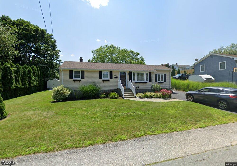
39 E Beardsworth Rd Tiverton, RI 02878
North Tiverton NeighborhoodEstimated Value: $439,898 - $486,000
3
Beds
1
Bath
1,550
Sq Ft
$300/Sq Ft
Est. Value
About This Home
This home is located at 39 E Beardsworth Rd, Tiverton, RI 02878 and is currently estimated at $464,475, approximately $299 per square foot. 39 E Beardsworth Rd is a home located in Newport County with nearby schools including Tiverton High School, Argosy Collegiate Charter School, and Holy Trinity School.
Ownership History
Date
Name
Owned For
Owner Type
Purchase Details
Closed on
Feb 3, 2011
Sold by
Desrosiers Karen L and Desrosiers Steven J
Bought by
Saint Annes Cu
Current Estimated Value
Purchase Details
Closed on
May 27, 2005
Sold by
Pelletier Judith Ann
Bought by
Desrosieb Steven J and Desrosieb Karen L
Home Financials for this Owner
Home Financials are based on the most recent Mortgage that was taken out on this home.
Original Mortgage
$250,000
Interest Rate
5.94%
Mortgage Type
Purchase Money Mortgage
Create a Home Valuation Report for This Property
The Home Valuation Report is an in-depth analysis detailing your home's value as well as a comparison with similar homes in the area
Home Values in the Area
Average Home Value in this Area
Purchase History
| Date | Buyer | Sale Price | Title Company |
|---|---|---|---|
| Saint Annes Cu | $250,000 | -- | |
| Desrosieb Steven J | $250,000 | -- |
Source: Public Records
Mortgage History
| Date | Status | Borrower | Loan Amount |
|---|---|---|---|
| Previous Owner | Desrosieb Steven J | $38,037 | |
| Previous Owner | Desrosieb Steven J | $25,772 | |
| Previous Owner | Desrosieb Steven J | $250,000 |
Source: Public Records
Tax History
| Year | Tax Paid | Tax Assessment Tax Assessment Total Assessment is a certain percentage of the fair market value that is determined by local assessors to be the total taxable value of land and additions on the property. | Land | Improvement |
|---|---|---|---|---|
| 2025 | $3,718 | $336,500 | $111,500 | $225,000 |
| 2024 | $3,718 | $336,500 | $111,500 | $225,000 |
| 2023 | $4,090 | $274,500 | $104,200 | $170,300 |
| 2022 | $4,016 | $274,500 | $104,200 | $170,300 |
| 2021 | $3,917 | $274,500 | $104,200 | $170,300 |
| 2020 | $3,822 | $236,100 | $76,600 | $159,500 |
| 2019 | $3,728 | $236,100 | $76,600 | $159,500 |
| 2018 | $3,870 | $236,100 | $76,600 | $159,500 |
| 2017 | $3,416 | $179,300 | $74,100 | $105,200 |
| 2016 | $3,432 | $179,300 | $74,100 | $105,200 |
| 2015 | $3,432 | $179,300 | $74,100 | $105,200 |
| 2014 | $3,412 | $176,800 | $71,200 | $105,600 |
Source: Public Records
Map
Nearby Homes
- 31 E Beardsworth Rd
- 38 Doris Ave
- 38 E Beardsworth Rd
- 50 E Beardsworth Rd
- 30 E Beardsworth Rd
- 59 E Beardsworth Rd
- 47 James E Beardsworth Rd
- 32 Doris Ave
- 62 E Beardsworth Rd
- 137 Kenyon Rd
- 129 Kenyon Rd
- 145 Kenyon Rd
- 41 Doris Ave
- 35 Doris Ave
- 18 Doris Ave
- 22 E Beardsworth Rd
- 121 Kenyon Rd
- 55 Doris Ave
- 15 E Beardsworth Rd
- 27 Doris Ave
Your Personal Tour Guide
Ask me questions while you tour the home.