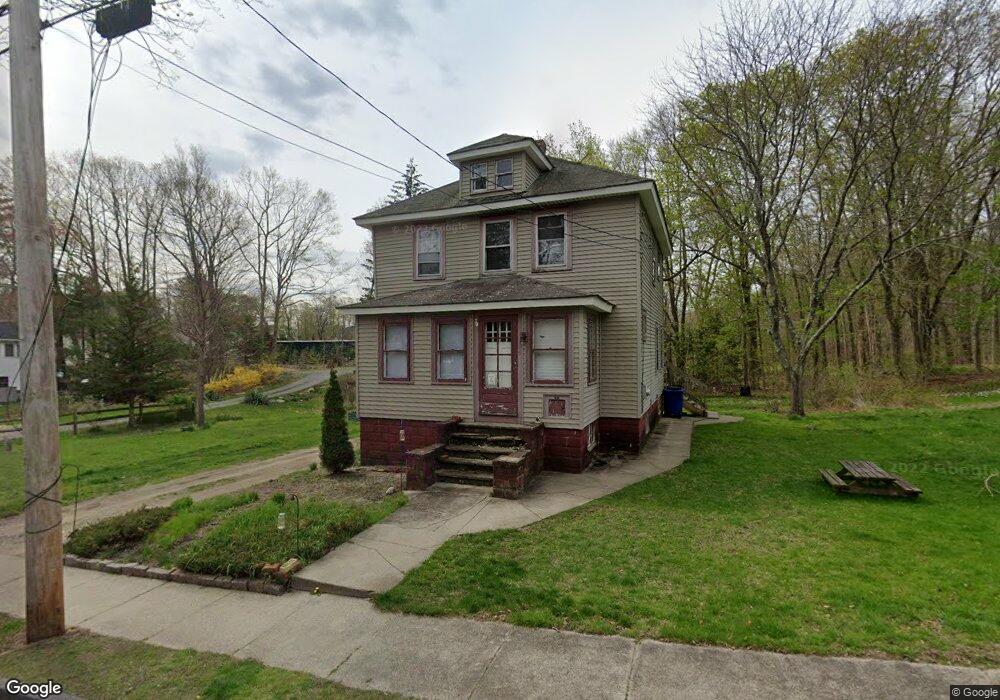
39 Fairfield St Maynard, MA 01754
Estimated Value: $530,642 - $600,000
3
Beds
3
Baths
1,458
Sq Ft
$377/Sq Ft
Est. Value
About This Home
This home is located at 39 Fairfield St, Maynard, MA 01754 and is currently estimated at $549,411, approximately $376 per square foot. 39 Fairfield St is a home located in Middlesex County with nearby schools including Green Meadow School, Fowler School, and Maynard High School.
Ownership History
Date
Name
Owned For
Owner Type
Purchase Details
Closed on
Dec 22, 2020
Sold by
Kallio Vivian
Bought by
Mann Jeffrey L and Caley Samantha B
Current Estimated Value
Home Financials for this Owner
Home Financials are based on the most recent Mortgage that was taken out on this home.
Original Mortgage
$241,500
Outstanding Balance
$215,007
Interest Rate
2.7%
Mortgage Type
New Conventional
Estimated Equity
$334,404
Purchase Details
Closed on
Dec 29, 1993
Sold by
Helander Edwin E
Bought by
Kallio Vivian A
Create a Home Valuation Report for This Property
The Home Valuation Report is an in-depth analysis detailing your home's value as well as a comparison with similar homes in the area
Home Values in the Area
Average Home Value in this Area
Purchase History
| Date | Buyer | Sale Price | Title Company |
|---|---|---|---|
| Mann Jeffrey L | $250,000 | None Available | |
| Kallio Vivian A | $45,500 | -- |
Source: Public Records
Mortgage History
| Date | Status | Borrower | Loan Amount |
|---|---|---|---|
| Open | Mann Jeffrey L | $241,500 |
Source: Public Records
Tax History
| Year | Tax Paid | Tax Assessment Tax Assessment Total Assessment is a certain percentage of the fair market value that is determined by local assessors to be the total taxable value of land and additions on the property. | Land | Improvement |
|---|---|---|---|---|
| 2025 | $7,974 | $447,200 | $285,800 | $161,400 |
| 2024 | $7,483 | $418,500 | $272,200 | $146,300 |
| 2023 | $7,689 | $405,300 | $259,300 | $146,000 |
| 2022 | $7,465 | $363,800 | $217,800 | $146,000 |
| 2021 | $7,987 | $396,400 | $217,800 | $178,600 |
| 2020 | $7,757 | $375,800 | $197,000 | $178,800 |
| 2019 | $7,442 | $353,700 | $188,200 | $165,500 |
| 2018 | $7,037 | $310,800 | $171,100 | $139,700 |
| 2017 | $6,841 | $310,800 | $171,100 | $139,700 |
| 2016 | $6,605 | $310,800 | $171,100 | $139,700 |
| 2015 | $6,278 | $281,400 | $163,300 | $118,100 |
| 2014 | $6,159 | $276,300 | $158,200 | $118,100 |
Source: Public Records
Map
Nearby Homes
- 13 Arthur St Unit 15
- 31-33 Roosevelt St
- 5 Hayes St Unit 5
- 28 Waltham St Unit A
- 22 Douglas Ave Unit 2
- 22 Douglas Ave Unit 1
- 41 Taylor Rd
- 66 Powder Mill Rd
- 68 Powder Mill Rd
- 70 Powder Mill Rd
- 12 Brown St
- 10 Mill St Unit B
- 2 & 6 Powder Mill Rd
- 23 Deer Path Unit 5
- 24 Deer Path Unit 5
- 36 Brown St
- 153 Summer St
- 57 Longfellow Rd
- 63 Conant St
- 377 Willis Rd
- 41 Fairfield St
- 35 1/2 Fairfield St
- 43 Fairfield St
- 42 Fairfield St
- 44 Fairfield St
- 40 Fairfield St
- 46 Fairfield St
- 35 Fairfield St
- 38 Fairfield St
- 39 Elmwood St
- 41 Elmwood St
- 12 Louise St
- 37 Elmwood St
- 47-49 Elmwood St Unit 47
- 47-49 Elmwood St Unit 49
- 47-49 Elmwood St
- 33 Fairfield St
- 51 Parker St
- 26 Chandler St
- 33 Elmwood St
Your Personal Tour Guide
Ask me questions while you tour the home.