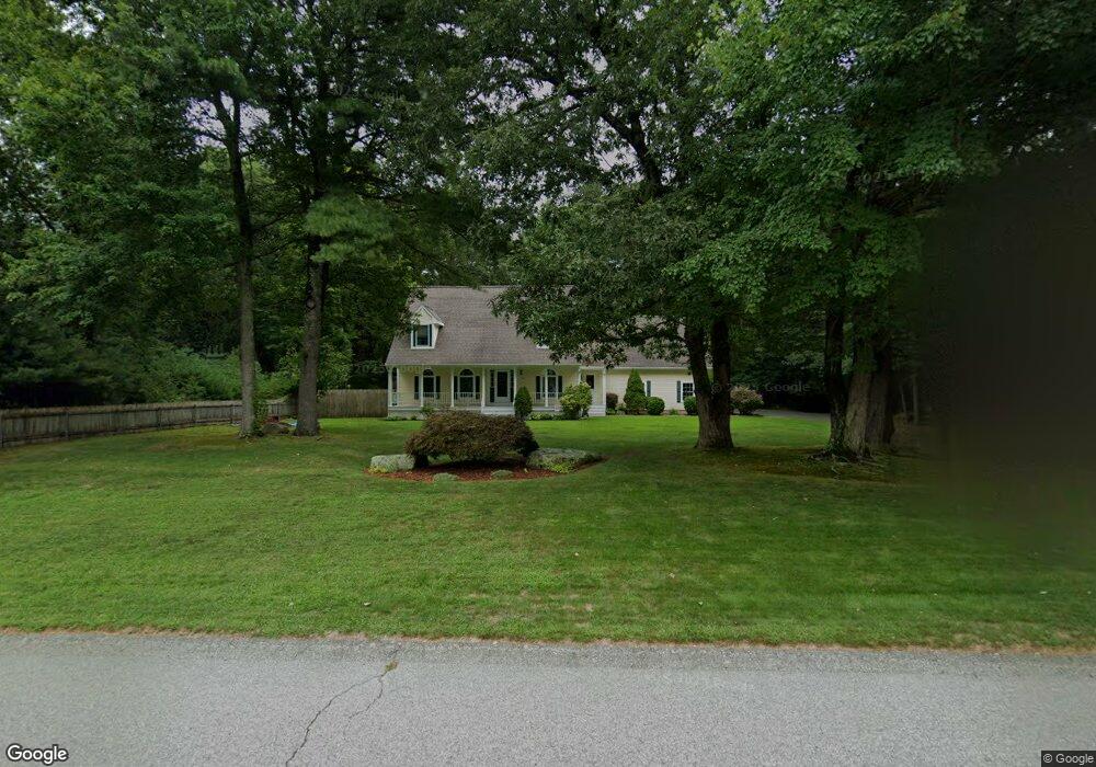
39 Forsythia Ln Westport, MA 02790
North Westport NeighborhoodEstimated Value: $713,866 - $775,000
3
Beds
2
Baths
2,030
Sq Ft
$366/Sq Ft
Est. Value
About This Home
This home is located at 39 Forsythia Ln, Westport, MA 02790 and is currently estimated at $742,467, approximately $365 per square foot. 39 Forsythia Ln is a home located in Bristol County with nearby schools including Alice A. Macomber Primary School, Westport Elementary School, and Westport Middle-High School.
Create a Home Valuation Report for This Property
The Home Valuation Report is an in-depth analysis detailing your home's value as well as a comparison with similar homes in the area
Home Values in the Area
Average Home Value in this Area
Tax History Compared to Growth
Tax History
| Year | Tax Paid | Tax Assessment Tax Assessment Total Assessment is a certain percentage of the fair market value that is determined by local assessors to be the total taxable value of land and additions on the property. | Land | Improvement |
|---|---|---|---|---|
| 2025 | $4,618 | $619,800 | $212,300 | $407,500 |
| 2024 | $4,607 | $596,000 | $196,900 | $399,100 |
| 2023 | $4,740 | $580,900 | $187,600 | $393,300 |
| 2022 | $4,429 | $522,300 | $187,600 | $334,700 |
| 2021 | $11,408 | $505,400 | $170,700 | $334,700 |
| 2020 | $4,204 | $498,700 | $164,000 | $334,700 |
| 2019 | $3,341 | $504,200 | $164,000 | $340,200 |
| 2018 | $3,345 | $446,500 | $180,300 | $266,200 |
| 2017 | $3,312 | $449,600 | $180,300 | $269,300 |
| 2016 | $3,475 | $439,300 | $180,300 | $259,000 |
| 2015 | $3,353 | $422,800 | $180,300 | $242,500 |
Source: Public Records
Map
Nearby Homes
- 33 Forsythia Ln
- 41 Forsythia Ln
- 27 Forsythia Ln
- 34 Forsythia Ln
- 40 Forsynthia
- 43 Forsythia Ln
- 40 Forsythia Ln
- 86 Center St
- 48 Forsythia Ln
- 45 Forsythia Ln
- 2 Forsythia Ln
- 87 Center St
- 52 Forsythia Ln
- 47 Forsythia Ln
- 7 Forsythia Ln
- 49 Forsythia Ln
- 10 Forsythia Ln
- 71 Center St
- 1 Appletree Ln
- 58 Forsythia Ln