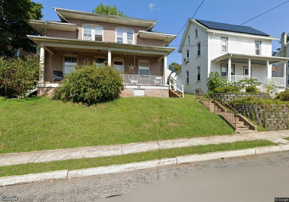
39 Green St Souderton, PA 18964
Estimated Value: $326,488 - $350,000
3
Beds
1
Bath
1,344
Sq Ft
$252/Sq Ft
Est. Value
About This Home
This home is located at 39 Green St, Souderton, PA 18964 and is currently estimated at $339,122, approximately $252 per square foot. 39 Green St is a home located in Montgomery County with nearby schools including West Broad Street Elementary School, Indian Crest Middle School, and Souderton Area Senior High School.
Ownership History
Date
Name
Owned For
Owner Type
Purchase Details
Closed on
Jul 10, 2005
Sold by
Yerger Scott M
Bought by
Yoder Paul S and Yoder Elizabeth A
Current Estimated Value
Home Financials for this Owner
Home Financials are based on the most recent Mortgage that was taken out on this home.
Original Mortgage
$19,300
Outstanding Balance
$10,145
Interest Rate
5.67%
Mortgage Type
Future Advance Clause Open End Mortgage
Estimated Equity
$328,977
Purchase Details
Closed on
Feb 27, 2002
Sold by
Buckley Gary and Buckley Joan E
Bought by
Yerger Scott M
Create a Home Valuation Report for This Property
The Home Valuation Report is an in-depth analysis detailing your home's value as well as a comparison with similar homes in the area
Home Values in the Area
Average Home Value in this Area
Purchase History
| Date | Buyer | Sale Price | Title Company |
|---|---|---|---|
| Yoder Paul S | $193,000 | -- | |
| Yerger Scott M | $82,000 | -- |
Source: Public Records
Mortgage History
| Date | Status | Borrower | Loan Amount |
|---|---|---|---|
| Open | Yoder Paul S | $19,300 | |
| Open | Yoder Paul S | $154,400 |
Source: Public Records
Tax History Compared to Growth
Tax History
| Year | Tax Paid | Tax Assessment Tax Assessment Total Assessment is a certain percentage of the fair market value that is determined by local assessors to be the total taxable value of land and additions on the property. | Land | Improvement |
|---|---|---|---|---|
| 2025 | $4,574 | $101,290 | $45,570 | $55,720 |
| 2024 | $4,574 | $101,290 | $45,570 | $55,720 |
| 2023 | $4,302 | $101,290 | $45,570 | $55,720 |
| 2022 | $4,183 | $101,290 | $45,570 | $55,720 |
| 2021 | $4,081 | $101,290 | $45,570 | $55,720 |
| 2020 | $4,019 | $101,290 | $45,570 | $55,720 |
| 2019 | $3,976 | $101,290 | $45,570 | $55,720 |
| 2018 | $958 | $101,290 | $45,570 | $55,720 |
| 2017 | $3,863 | $101,290 | $45,570 | $55,720 |
| 2016 | $3,823 | $101,290 | $45,570 | $55,720 |
| 2015 | $3,756 | $101,290 | $45,570 | $55,720 |
| 2014 | $3,756 | $101,290 | $45,570 | $55,720 |
Source: Public Records
Map
Nearby Homes
- 44 Diamond St
- 227 Ridge Ave
- 17 N 2nd St
- 208 E Broad St
- 44 Adams Ave
- 554 Harleysville Pike
- 110 Washington Ave
- 428 E Broad St
- 517 Hemsing Cir
- 124 Hollybush Cir
- 536 Valley Ln
- 3 Carousel Dr
- 223 W Reliance Rd
- 103 Arlington Ln
- 316 Penn Ave
- 35 Chancery Ct Unit 35
- 532 Lincoln Ave
- 51 Cambridge Ct Unit 51
- 216 W Cherry Ln Unit MAGNOLIA
- 216 W Cherry Ln Unit DEVONSHIRE
- 41 Green St
- 37 Green St
- 47 Green St Unit 47
- 51 Green St
- 53 Green St
- 34 Diamond St
- 27 Green St Unit 3
- 27 Green St Unit 3
- 27 Green St Unit 2
- 27 Green St Unit 5
- 27 Green St
- 27 Green St Unit 2
- 27 Green St Unit 4
- 52 Diamond St
- 50 Diamond St
- 54 Diamond St
- 48 Diamond St
- 46 Diamond St
- 56 Diamond St
- 58 Diamond St