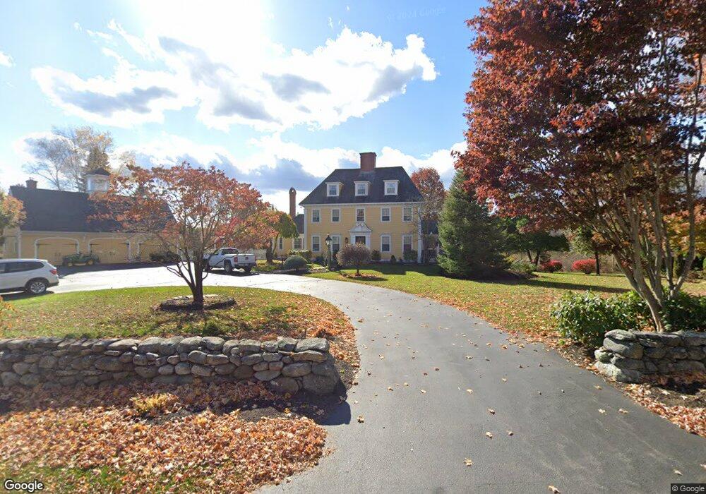
39 Highland Rd South Hampton, NH 03827
Estimated Value: $1,037,000 - $1,522,450
3
Beds
4
Baths
3,505
Sq Ft
$347/Sq Ft
Est. Value
About This Home
This home is located at 39 Highland Rd, South Hampton, NH 03827 and is currently estimated at $1,215,613, approximately $346 per square foot. 39 Highland Rd is a home located in Rockingham County with nearby schools including South Hampton Barnard School, Winnacunnet High School, and Amesbury Seventh-Day Adventist School.
Ownership History
Date
Name
Owned For
Owner Type
Purchase Details
Closed on
Nov 6, 2017
Sold by
Simas James L and Simas Rachel M
Bought by
Bouchard Peter and Mcneil-Bouchard Jennifer
Current Estimated Value
Home Financials for this Owner
Home Financials are based on the most recent Mortgage that was taken out on this home.
Original Mortgage
$401,540
Outstanding Balance
$229,113
Interest Rate
5%
Mortgage Type
Adjustable Rate Mortgage/ARM
Estimated Equity
$986,500
Create a Home Valuation Report for This Property
The Home Valuation Report is an in-depth analysis detailing your home's value as well as a comparison with similar homes in the area
Home Values in the Area
Average Home Value in this Area
Purchase History
| Date | Buyer | Sale Price | Title Company |
|---|---|---|---|
| Bouchard Peter | $535,389 | -- |
Source: Public Records
Mortgage History
| Date | Status | Borrower | Loan Amount |
|---|---|---|---|
| Open | Bouchard Peter | $401,540 |
Source: Public Records
Tax History
| Year | Tax Paid | Tax Assessment Tax Assessment Total Assessment is a certain percentage of the fair market value that is determined by local assessors to be the total taxable value of land and additions on the property. | Land | Improvement |
|---|---|---|---|---|
| 2024 | $17,106 | $1,239,535 | $511,335 | $728,200 |
| 2023 | $17,106 | $1,239,532 | $511,332 | $728,200 |
| 2022 | $17,364 | $874,327 | $325,027 | $549,300 |
| 2021 | $17,425 | $874,332 | $325,032 | $549,300 |
| 2020 | $16,604 | $874,331 | $325,031 | $549,300 |
| 2019 | $15,286 | $856,333 | $325,033 | $531,300 |
| 2018 | $14,275 | $856,330 | $325,030 | $531,300 |
| 2017 | $11,793 | $612,924 | $198,724 | $414,200 |
| 2016 | $11,174 | $612,924 | $198,724 | $414,200 |
| 2015 | $12,216 | $612,924 | $198,724 | $414,200 |
| 2014 | $11,462 | $612,925 | $198,725 | $414,200 |
| 2012 | $10,821 | $733,634 | $242,900 | $490,734 |
Source: Public Records
Map
Nearby Homes
- 253 Amesbury Rd
- 51 Locust St
- 269 South Rd
- 195 Amesbury Rd
- 449 New Zealand Rd
- 9 True Ln
- 24 Adder Ln
- 12 Locke Hill Ln
- 39 Unicorn Cir
- 149 Market St
- 20 Mason Ct
- 188 Kensington Rd
- 5 Russell St Unit 1
- 127 Kensington Rd
- 101 Market St Unit B
- 27 Lake St
- 48 Orchard St
- 25 Cedar St Unit 4
- 4 Boardman St
- 8 Winter St
Your Personal Tour Guide
Ask me questions while you tour the home.