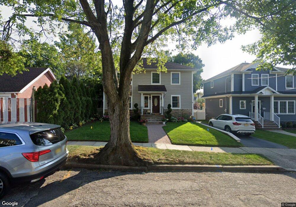
39 Hobart Ave Rutherford, NJ 07070
Estimated Value: $740,000 - $954,000
Studio
--
Bath
2,418
Sq Ft
$359/Sq Ft
Est. Value
About This Home
This home is located at 39 Hobart Ave, Rutherford, NJ 07070 and is currently estimated at $868,369, approximately $359 per square foot. 39 Hobart Ave is a home located in Bergen County with nearby schools including Rutherford High School, Bergen Arts and Sciences Charter School, and Yeshiva Ktana Of Passaic Boys.
Ownership History
Date
Name
Owned For
Owner Type
Purchase Details
Closed on
Nov 30, 2011
Sold by
Gargas Marek and Travers Lynette
Bought by
Travers Alphonsus
Current Estimated Value
Home Financials for this Owner
Home Financials are based on the most recent Mortgage that was taken out on this home.
Original Mortgage
$404,000
Outstanding Balance
$276,363
Interest Rate
4.01%
Mortgage Type
Purchase Money Mortgage
Estimated Equity
$592,006
Purchase Details
Closed on
Jul 21, 2011
Sold by
Witterschein Thomas
Bought by
Gargas Marek
Home Financials for this Owner
Home Financials are based on the most recent Mortgage that was taken out on this home.
Original Mortgage
$168,000
Interest Rate
4.51%
Mortgage Type
Purchase Money Mortgage
Create a Home Valuation Report for This Property
The Home Valuation Report is an in-depth analysis detailing your home's value as well as a comparison with similar homes in the area
Home Values in the Area
Average Home Value in this Area
Purchase History
| Date | Buyer | Sale Price | Title Company |
|---|---|---|---|
| Travers Alphonsus | $517,500 | -- | |
| Gargas Marek | $240,000 | -- |
Source: Public Records
Mortgage History
| Date | Status | Borrower | Loan Amount |
|---|---|---|---|
| Open | Travers Alphonsus | $404,000 | |
| Previous Owner | Gargas Marek | $168,000 |
Source: Public Records
Tax History
| Year | Tax Paid | Tax Assessment Tax Assessment Total Assessment is a certain percentage of the fair market value that is determined by local assessors to be the total taxable value of land and additions on the property. | Land | Improvement |
|---|---|---|---|---|
| 2025 | $15,811 | $552,000 | $260,000 | $292,000 |
| 2024 | $15,411 | $506,600 | $260,000 | $246,600 |
| 2023 | $15,041 | $506,600 | $260,000 | $246,600 |
| 2022 | $15,041 | $506,600 | $260,000 | $246,600 |
| 2021 | $14,838 | $506,600 | $260,000 | $246,600 |
| 2020 | $14,443 | $506,600 | $260,000 | $246,600 |
| 2019 | $13,876 | $506,600 | $260,000 | $246,600 |
| 2018 | $13,683 | $506,600 | $260,000 | $246,600 |
| 2017 | $13,491 | $506,600 | $260,000 | $246,600 |
| 2016 | $13,192 | $506,600 | $260,000 | $246,600 |
| 2015 | $12,832 | $506,600 | $260,000 | $246,600 |
| 2014 | $12,432 | $506,600 | $260,000 | $246,600 |
Source: Public Records
Map
Nearby Homes
- 48 Hastings Ave Unit B
- 48 Hastings Ave
- 151 Jackson Ave
- 64 Beech St
- 134 Hastings Ave
- 140 Francisco Ave
- 24 Sunderland Ave
- 246 Springfield Ave
- 82 Herrick St
- 95 Atkins Terrace
- 86 Montross Ave
- 96 South Pkwy
- 185 Park Ave
- 199 Union Ave Unit 2F
- 5 Bobbink Terrace
- 328 Carmita Ave
- 155 Union Ave Unit 201
- 178 Marietta Ave
- 5-13 Ascension St Unit 1H
- 429 Riverside Ave
- 41 Hobart Ave
- 82 Vanderburgh Ave
- 80 Vanderburgh Ave
- 84 Vanderburgh Ave
- 414 Union Ave
- 418 Union Ave
- 422 Union Ave
- 422 Union Ave Unit 1
- 53 Hobart Ave
- 78 Vanderburgh Ave
- 88 Vanderburgh Ave
- 36 Hobart Ave
- 40 Hobart Ave
- 426 Union Ave
- 44 Hobart Ave
- 74 Vanderburgh Ave
- 92 Vanderburgh Ave
- 57 Hobart Ave
- 48 Hobart Ave
- 432 Union Ave
Your Personal Tour Guide
Ask me questions while you tour the home.