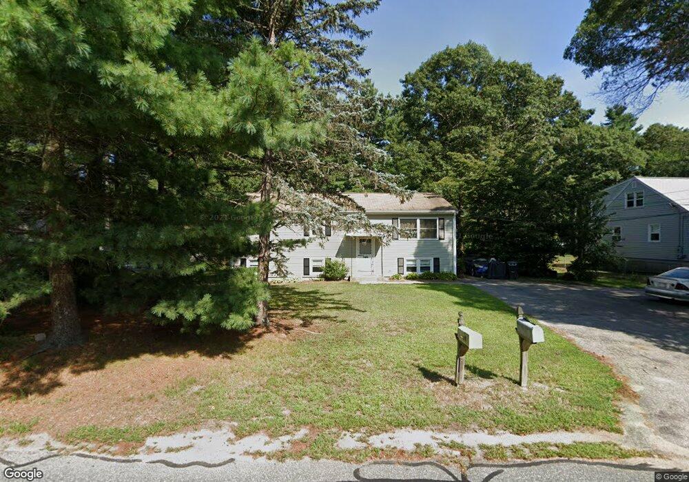
39 Hollister Rd Unit 1 Swansea, MA 02777
Monroes-South Seekonk NeighborhoodEstimated Value: $463,000 - $528,000
3
Beds
2
Baths
2,288
Sq Ft
$218/Sq Ft
Est. Value
About This Home
This home is located at 39 Hollister Rd Unit 1, Swansea, MA 02777 and is currently estimated at $498,218, approximately $217 per square foot. 39 Hollister Rd Unit 1 is a home located in Bristol County with nearby schools including Joseph Case High School, Barrington Christian Academy, and St. Andrews School.
Ownership History
Date
Name
Owned For
Owner Type
Purchase Details
Closed on
Nov 7, 2025
Sold by
Soderlund Ft and Soderlund
Bought by
Soderlund Lyn M
Current Estimated Value
Purchase Details
Closed on
Jun 27, 2016
Sold by
Soderlund Stephen C and Soderlund Mary L
Bought by
Soderlund Ft and Soderlund
Purchase Details
Closed on
Nov 9, 2012
Sold by
Provazza William A
Bought by
Soderlund Stephen C and Soderlund Mary L
Create a Home Valuation Report for This Property
The Home Valuation Report is an in-depth analysis detailing your home's value as well as a comparison with similar homes in the area
Home Values in the Area
Average Home Value in this Area
Purchase History
| Date | Buyer | Sale Price | Title Company |
|---|---|---|---|
| Soderlund Lyn M | -- | -- | |
| Soderlund Lyn M | -- | -- | |
| Soderlund Ft | -- | -- | |
| Soderlund Ft | -- | -- | |
| Soderlund Stephen C | $212,000 | -- | |
| Provazza William A | -- | -- | |
| Soderlund Stephen C | $212,000 | -- | |
| Soderlund Stephen C | $212,000 | -- | |
| Provazza William A | -- | -- | |
| Soderlund Stephen C | $212,000 | -- |
Source: Public Records
Tax History Compared to Growth
Tax History
| Year | Tax Paid | Tax Assessment Tax Assessment Total Assessment is a certain percentage of the fair market value that is determined by local assessors to be the total taxable value of land and additions on the property. | Land | Improvement |
|---|---|---|---|---|
| 2025 | $4,649 | $390,000 | $165,000 | $225,000 |
| 2024 | $4,772 | $398,000 | $165,000 | $233,000 |
| 2023 | $4,548 | $346,400 | $120,600 | $225,800 |
| 2022 | $4,340 | $301,600 | $109,600 | $192,000 |
| 2021 | $4,387 | $280,700 | $109,600 | $171,100 |
| 2020 | $4,372 | $280,600 | $109,600 | $171,000 |
| 2019 | $4,149 | $267,500 | $98,100 | $169,400 |
| 2018 | $3,869 | $253,200 | $95,800 | $157,400 |
| 2017 | $3,235 | $243,600 | $95,800 | $147,800 |
| 2016 | $3,137 | $232,000 | $82,700 | $149,300 |
| 2015 | $2,931 | $223,200 | $82,700 | $140,500 |
| 2014 | $2,664 | $207,500 | $82,700 | $124,800 |
Source: Public Records
Map
Nearby Homes
- 249 Barneyville Rd
- 5 Connor Ln
- 195 Barney Ave
- 7 Cheshire Dr
- 15 George w Finnerty Rd
- 27 Christine Dr
- 292 Sowams Rd
- 2 Simmons Rd
- 127 Mason St
- 7 Jill Ct
- 20 Burr Ave
- 22 Mayfield Rd
- 0 Mabel Dr
- 6 Kenmore Ct
- 24 Nod Rd
- 6 Hazelton Rd
- 107 & 107R Walker
- 107 Walker St
- 17 Sassafras Rd
- 0 Old Fall River Rd Unit 73399047
- 39 Hollister Rd
- 39 Hollister Rd
- 27 Hollister Rd
- 43 Hollister Rd
- 30 Hollister Rd
- 61 Hollister Rd
- 42 Hollister Rd
- 11 Hollister Rd
- 52 Hollister Rd
- 804 Warren Ave
- 69 Hollister Rd
- 10 Hollister Rd
- 62 Hollister Rd
- 820 Warren Ave
- 0 Hampden Ln Unit 845868
- 0 Hampden Ln Unit 947279
- 0 Hampden Ln Unit 947698
- 0 Hampden Ln Unit 957258
- 0 Hampden Ln Unit 957279
- 0 Hampden Ln Unit 957291