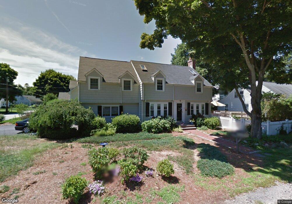
39 Hoover Ave Westwood, MA 02090
Estimated Value: $998,602 - $1,128,000
3
Beds
3
Baths
1,876
Sq Ft
$561/Sq Ft
Est. Value
About This Home
This home is located at 39 Hoover Ave, Westwood, MA 02090 and is currently estimated at $1,053,151, approximately $561 per square foot. 39 Hoover Ave is a home located in Norfolk County with nearby schools including Westwood High School, St Catherine Of Siena School, and Xaverian Brothers High School.
Create a Home Valuation Report for This Property
The Home Valuation Report is an in-depth analysis detailing your home's value as well as a comparison with similar homes in the area
Home Values in the Area
Average Home Value in this Area
Tax History Compared to Growth
Tax History
| Year | Tax Paid | Tax Assessment Tax Assessment Total Assessment is a certain percentage of the fair market value that is determined by local assessors to be the total taxable value of land and additions on the property. | Land | Improvement |
|---|---|---|---|---|
| 2025 | $10,825 | $845,700 | $482,900 | $362,800 |
| 2024 | $10,580 | $825,900 | $460,000 | $365,900 |
| 2023 | $9,422 | $658,900 | $383,300 | $275,600 |
| 2022 | $8,687 | $585,750 | $324,150 | $261,600 |
| 2021 | $8,567 | $579,650 | $308,700 | $270,950 |
| 2020 | $8,308 | $572,550 | $308,700 | $263,850 |
| 2019 | $8,105 | $553,250 | $294,000 | $259,250 |
| 2018 | $8,001 | $530,200 | $294,000 | $236,200 |
| 2017 | $7,536 | $517,250 | $294,000 | $223,250 |
| 2016 | $7,366 | $502,450 | $294,000 | $208,450 |
| 2015 | $6,834 | $448,400 | $294,000 | $154,400 |
Source: Public Records
Map
Nearby Homes
- 42 Buckmaster Rd
- 33 Hoover Ave
- 54 Buckmaster Rd
- 35 Sexton Ave
- 38 Buckmaster Rd
- 40 Hoover Ave
- 49 Buckmaster Rd
- 43 Buckmaster Rd
- 34 Hoover Ave
- 53 Buckmaster Rd
- 39 Buckmaster Rd
- 32 Buckmaster Rd
- 57 Buckmaster Rd
- 57 Buckmaster Rd Unit 57
- 37 Buckmaster Rd
- 27 Sexton Ave
- 57 Sexton Ave
- 26 Buckmaster Rd
- 42 Sexton Ave
- 31 Buckmaster Rd