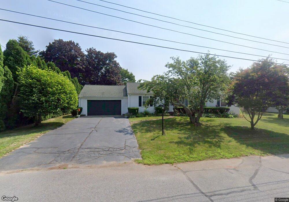
39 Joseph St North Dartmouth, MA 02747
Idlewood NeighborhoodEstimated Value: $535,036 - $699,000
2
Beds
2
Baths
1,226
Sq Ft
$494/Sq Ft
Est. Value
About This Home
This home is located at 39 Joseph St, North Dartmouth, MA 02747 and is currently estimated at $605,759, approximately $494 per square foot. 39 Joseph St is a home located in Bristol County with nearby schools including Dartmouth High School, Friends Academy, and Nazarene Christian Academy.
Ownership History
Date
Name
Owned For
Owner Type
Purchase Details
Closed on
Jul 9, 2007
Sold by
Damota Hortensia P and Damota Joao P
Bought by
Damota Irt
Current Estimated Value
Purchase Details
Closed on
Dec 16, 1994
Sold by
Hadley Paul S and Hadley Sheryl S
Bought by
Damota Joao P and Damota Hortensia P
Home Financials for this Owner
Home Financials are based on the most recent Mortgage that was taken out on this home.
Original Mortgage
$45,000
Interest Rate
9.03%
Mortgage Type
Purchase Money Mortgage
Purchase Details
Closed on
Aug 5, 1994
Sold by
Jason Alan C and Lobo Patricia E
Bought by
Hadley Paul S and Hadley Sheryl Sue
Home Financials for this Owner
Home Financials are based on the most recent Mortgage that was taken out on this home.
Original Mortgage
$123,900
Interest Rate
8.4%
Mortgage Type
Purchase Money Mortgage
Create a Home Valuation Report for This Property
The Home Valuation Report is an in-depth analysis detailing your home's value as well as a comparison with similar homes in the area
Home Values in the Area
Average Home Value in this Area
Purchase History
| Date | Buyer | Sale Price | Title Company |
|---|---|---|---|
| Damota Irt | -- | -- | |
| Damota Joao P | $140,000 | -- | |
| Hadley Paul S | $130,500 | -- |
Source: Public Records
Mortgage History
| Date | Status | Borrower | Loan Amount |
|---|---|---|---|
| Previous Owner | Hadley Paul S | $45,000 | |
| Previous Owner | Hadley Paul S | $123,900 |
Source: Public Records
Tax History Compared to Growth
Tax History
| Year | Tax Paid | Tax Assessment Tax Assessment Total Assessment is a certain percentage of the fair market value that is determined by local assessors to be the total taxable value of land and additions on the property. | Land | Improvement |
|---|---|---|---|---|
| 2025 | $3,892 | $430,000 | $181,700 | $248,300 |
| 2024 | $3,827 | $418,700 | $181,700 | $237,000 |
| 2023 | $3,702 | $382,000 | $167,400 | $214,600 |
| 2022 | $3,594 | $346,900 | $167,400 | $179,500 |
| 2021 | $3,387 | $312,700 | $148,600 | $164,100 |
| 2020 | $3,401 | $312,600 | $155,500 | $157,100 |
| 2019 | $3,252 | $299,700 | $144,400 | $155,300 |
| 2018 | $3,037 | $282,600 | $144,400 | $138,200 |
| 2017 | $2,954 | $277,600 | $141,600 | $136,000 |
| 2016 | $2,990 | $282,600 | $154,700 | $127,900 |
| 2015 | $2,804 | $266,800 | $137,200 | $129,600 |
| 2014 | $2,719 | $260,400 | $133,300 | $127,100 |
Source: Public Records
Map
Nearby Homes
- 24 Wayne Memorial Dr
- 6 Strathmore Rd
- 219 Chase Rd
- 10 Westview Dr
- 14 Westview Dr
- 46 Old Westport Rd
- 135 Old Westport Rd
- 29 Elizabeth Ct
- 1406 Tucker Rd
- 25 Westwood Dr
- Lot 6 Rafael Rd
- 33 Rosewood Terrace
- 0 Victoria St Unit 73457953
- 50 Gaywood St
- 59 Longwood Ave
- 6 Walters Way
- 0 Norfolk Ave Unit 73403282
- 295 Commonwealth Ave
- 317 Commonwealth Ave
- 35 Suffolk Ave
- 35 Joseph St
- 43 Joseph St
- 9 Wayne Memorial Dr
- 31 Joseph St
- 10 Wayne Memorial Dr
- 21 Joseph St
- 19 Wayne Memorial Dr
- 0 Wayne Memorial Drive & Cox Blv Unit 65556
- 1049 Tucker Rd
- 30 Joseph St
- 1057 Tucker Rd
- 25 Joseph St
- 11 Wayne Memorial Dr
- 26 Joseph St
- 25 Wayne Memorial Dr
- 1063 Tucker Rd
- 1045 Tucker Rd
- 12 Wayne Memorial Dr
- 61 Joseph St
- 1037 Tucker Rd