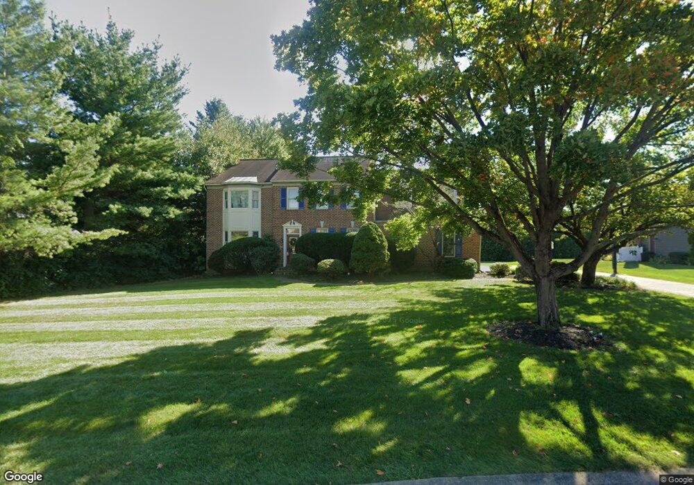
39 Kings Pointe Lititz, PA 17543
Kissel Hill NeighborhoodEstimated Value: $596,000 - $676,000
5
Beds
3
Baths
2,568
Sq Ft
$249/Sq Ft
Est. Value
About This Home
This home is located at 39 Kings Pointe, Lititz, PA 17543 and is currently estimated at $639,832, approximately $249 per square foot. 39 Kings Pointe is a home located in Lancaster County with nearby schools including Reidenbaugh Elementary School, Landis Run Intermediate School, and Manheim Township Middle School.
Ownership History
Date
Name
Owned For
Owner Type
Purchase Details
Closed on
Mar 19, 1999
Sold by
Martin Kathleen H and Kogon Gary B
Bought by
Mcdonald Michael P and Mcdonald Mary K
Current Estimated Value
Home Financials for this Owner
Home Financials are based on the most recent Mortgage that was taken out on this home.
Original Mortgage
$202,450
Outstanding Balance
$48,955
Interest Rate
6.74%
Mortgage Type
VA
Estimated Equity
$590,877
Create a Home Valuation Report for This Property
The Home Valuation Report is an in-depth analysis detailing your home's value as well as a comparison with similar homes in the area
Home Values in the Area
Average Home Value in this Area
Purchase History
| Date | Buyer | Sale Price | Title Company |
|---|---|---|---|
| Mcdonald Michael P | $210,000 | -- |
Source: Public Records
Mortgage History
| Date | Status | Borrower | Loan Amount |
|---|---|---|---|
| Open | Mcdonald Michael P | $202,450 |
Source: Public Records
Tax History Compared to Growth
Tax History
| Year | Tax Paid | Tax Assessment Tax Assessment Total Assessment is a certain percentage of the fair market value that is determined by local assessors to be the total taxable value of land and additions on the property. | Land | Improvement |
|---|---|---|---|---|
| 2025 | $7,251 | $335,100 | $92,500 | $242,600 |
| 2024 | $7,251 | $335,100 | $92,500 | $242,600 |
| 2023 | $7,062 | $335,100 | $92,500 | $242,600 |
| 2022 | $6,943 | $335,100 | $92,500 | $242,600 |
| 2021 | $6,788 | $335,100 | $92,500 | $242,600 |
| 2020 | $6,788 | $335,100 | $92,500 | $242,600 |
| 2019 | $6,722 | $335,100 | $92,500 | $242,600 |
| 2018 | $4,956 | $335,100 | $92,500 | $242,600 |
| 2017 | $5,669 | $222,800 | $53,800 | $169,000 |
| 2016 | $5,669 | $222,800 | $53,800 | $169,000 |
| 2015 | $1,425 | $222,800 | $53,800 | $169,000 |
| 2014 | $4,045 | $222,800 | $53,800 | $169,000 |
Source: Public Records
Map
Nearby Homes
- 382 Rumford Rd
- 315 Sarsen Dr
- 297 Sarsen Dr
- 391 Ecker Dr
- 421 Southampton Dr
- 512 Northampton Dr Unit 43
- 335 Royal Hunt Way
- 513 Northampton Dr
- 505 Northampton Dr Unit 2
- 2717 Kreider Rd
- 494 Stonehenge Dr
- 327 Squire Ln
- 381 Sarsen Dr
- 393 Fern Ln Unit 8
- 398 Fern Ln Unit 7
- 294 Fletcher Dr - Parkside Phase 5 Lot 40
- 436 Thatcher Ln
- 449 Thatcher Ln
- 0 Westfield Model Parkside Phase 5 Unit PALA2071304
- 301 Fletcher Dr - Parkside Phase 5 Lot 36
- 45 Kings Pointe
- 33 Kings Pointe
- 275 Kingsbridge Dr
- 279 Kingsbridge Dr
- 345 N Farm Dr
- 27 Kings Pointe
- 15 Kings Pointe
- 9 Kings Pointe
- 21 Kings Pointe
- 283 Kingsbridge Dr
- 3 Kings Pointe
- 342 N Farm Dr
- 338 N Farm Dr
- 263 Kingsbridge Dr
- 331 Koser Rd
- 335 Koser Rd
- 327 Koser Rd
- 184 Kings Gate Dr
- 333 N Farm Dr
- 274 Kingsbridge Dr