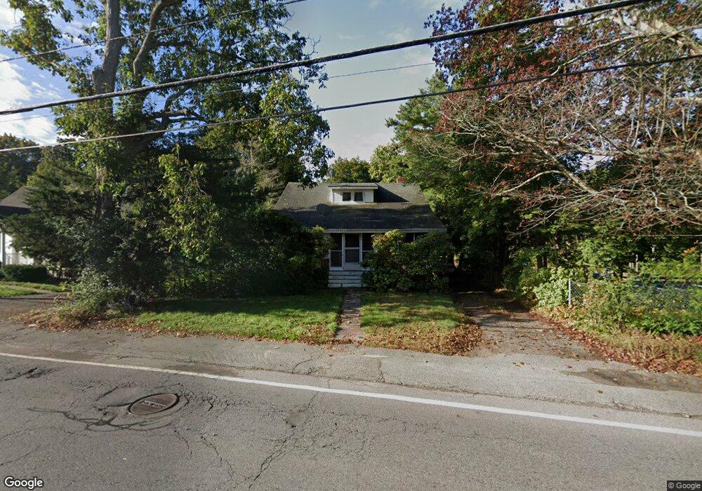
39 Linwood St Holbrook, MA 02343
Estimated Value: $482,000 - $546,000
3
Beds
1
Bath
1,582
Sq Ft
$328/Sq Ft
Est. Value
About This Home
This home is located at 39 Linwood St, Holbrook, MA 02343 and is currently estimated at $518,585, approximately $327 per square foot. 39 Linwood St is a home located in Norfolk County with nearby schools including John F. Kennedy Elementary School, Holbrook Middle High School, and Boston Higashi School.
Create a Home Valuation Report for This Property
The Home Valuation Report is an in-depth analysis detailing your home's value as well as a comparison with similar homes in the area
Home Values in the Area
Average Home Value in this Area
Tax History Compared to Growth
Tax History
| Year | Tax Paid | Tax Assessment Tax Assessment Total Assessment is a certain percentage of the fair market value that is determined by local assessors to be the total taxable value of land and additions on the property. | Land | Improvement |
|---|---|---|---|---|
| 2025 | $56 | $426,400 | $198,400 | $228,000 |
| 2024 | $5,091 | $378,800 | $169,600 | $209,200 |
| 2023 | $5,561 | $361,600 | $164,000 | $197,600 |
| 2022 | $5,229 | $317,100 | $142,600 | $174,500 |
| 2021 | $5,125 | $297,600 | $133,300 | $164,300 |
| 2020 | $5,278 | $287,300 | $129,400 | $157,900 |
| 2019 | $5,100 | $262,100 | $108,600 | $153,500 |
| 2018 | $5,246 | $253,800 | $105,400 | $148,400 |
| 2017 | $5,143 | $246,100 | $105,400 | $140,700 |
| 2016 | $4,250 | $216,400 | $87,200 | $129,200 |
| 2015 | $3,967 | $207,900 | $83,900 | $124,000 |
| 2014 | $3,902 | $207,900 | $83,900 | $124,000 |
Source: Public Records
Map
Nearby Homes
- 5 Brookville Ave
- 38 Stephen Dr
- 261 Jon Dr
- 18 Brookfield Dr
- 719 S Franklin St Unit L Block 1
- 719 S Franklin St Unit D Block 1
- 719 S Franklin St Unit C Block 1
- 12 Hamilton Way
- 170 Elsie Rd
- 285 Hovendon Ave
- 690 N Quincy St
- 29 Belair Dr
- 68 Spring St
- 40 Christopher Rd
- 60 Bonney St
- 28 Border Rd
- 505 Hampton Way Unit 505
- 55 Border Rd
- 61 Kent St
- 53 Kent St