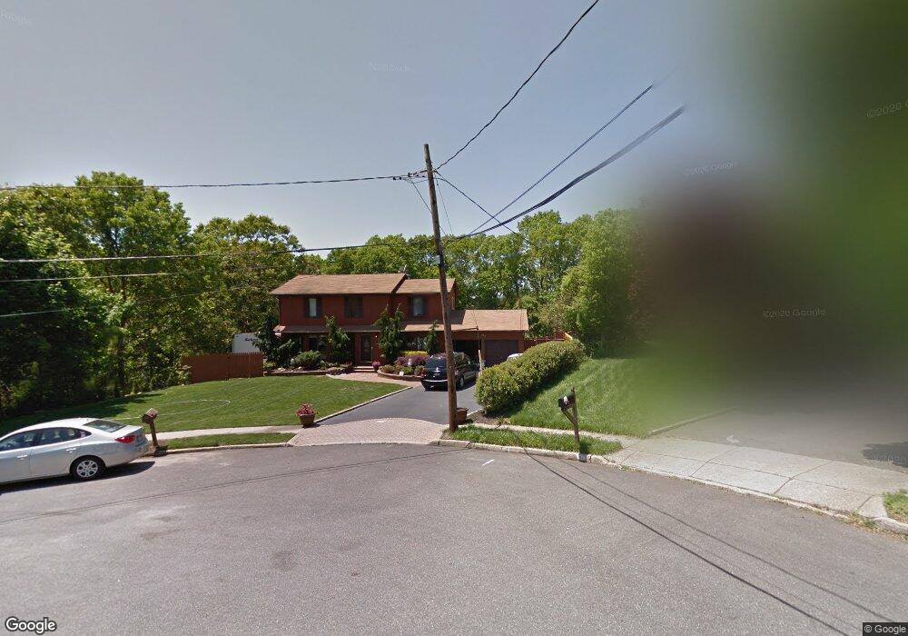
39 Lori Way Hauppauge, NY 11788
Estimated Value: $693,000 - $834,000
--
Bed
--
Bath
--
Sq Ft
0.39
Acres
About This Home
This home is located at 39 Lori Way, Hauppauge, NY 11788 and is currently estimated at $783,263. 39 Lori Way is a home located in Suffolk County with nearby schools including Hauppauge Middle School and Hauppauge High School.
Ownership History
Date
Name
Owned For
Owner Type
Purchase Details
Closed on
Dec 7, 2009
Sold by
Simon Stephen
Bought by
Best Stanton and Best Linda
Current Estimated Value
Purchase Details
Closed on
Aug 16, 2001
Sold by
Panagatos Maria E
Bought by
Panagatos Peter and Panagatos Maria E
Home Financials for this Owner
Home Financials are based on the most recent Mortgage that was taken out on this home.
Original Mortgage
$200,000
Interest Rate
6.91%
Purchase Details
Closed on
Oct 31, 1996
Sold by
Breinlinger Robert and Breinlinger Lynn Marie
Bought by
Panagatos Maria G
Create a Home Valuation Report for This Property
The Home Valuation Report is an in-depth analysis detailing your home's value as well as a comparison with similar homes in the area
Home Values in the Area
Average Home Value in this Area
Purchase History
| Date | Buyer | Sale Price | Title Company |
|---|---|---|---|
| Best Stanton | $474,500 | -- | |
| Panagatos Peter | -- | Stewart Title | |
| Panagatos Maria G | $223,500 | Commonwealth Land Title Ins |
Source: Public Records
Mortgage History
| Date | Status | Borrower | Loan Amount |
|---|---|---|---|
| Previous Owner | Panagatos Peter | $200,000 |
Source: Public Records
Tax History Compared to Growth
Tax History
| Year | Tax Paid | Tax Assessment Tax Assessment Total Assessment is a certain percentage of the fair market value that is determined by local assessors to be the total taxable value of land and additions on the property. | Land | Improvement |
|---|---|---|---|---|
| 2024 | -- | $53,000 | $11,300 | $41,700 |
| 2023 | -- | $53,000 | $11,300 | $41,700 |
| 2022 | $9,100 | $53,000 | $11,300 | $41,700 |
| 2021 | $9,100 | $53,000 | $11,300 | $41,700 |
| 2020 | $9,371 | $53,000 | $11,300 | $41,700 |
| 2019 | $9,100 | $0 | $0 | $0 |
| 2018 | -- | $53,000 | $11,300 | $41,700 |
| 2017 | $9,608 | $53,000 | $11,300 | $41,700 |
| 2016 | $9,217 | $53,000 | $11,300 | $41,700 |
| 2015 | -- | $53,000 | $11,300 | $41,700 |
| 2014 | -- | $53,000 | $11,300 | $41,700 |
Source: Public Records
Map
Nearby Homes
- 6 Rolling Wood Ct
- 246 Roosevelt Blvd
- 11 Joyce Dr
- 126 Roosevelt Blvd
- 43 Harrison Ave
- 23 Ridge Ct
- 0 Bridge Rd Unit KEY814925
- 3 Milford Dr
- 154 Mac Arthur Blvd
- 375 Oakland Ave
- 1010 Motor Pkwy
- 20 Macarthur Blvd
- 385 Salem Ct
- 346 Ridgefield Rd
- 123 Feller Dr
- 229 Feller Dr
- 228 Feller Dr
- 87 Columbus Ave
- 57 Adams Rd Unit 1H
- 71 Adams Rd Unit 1G