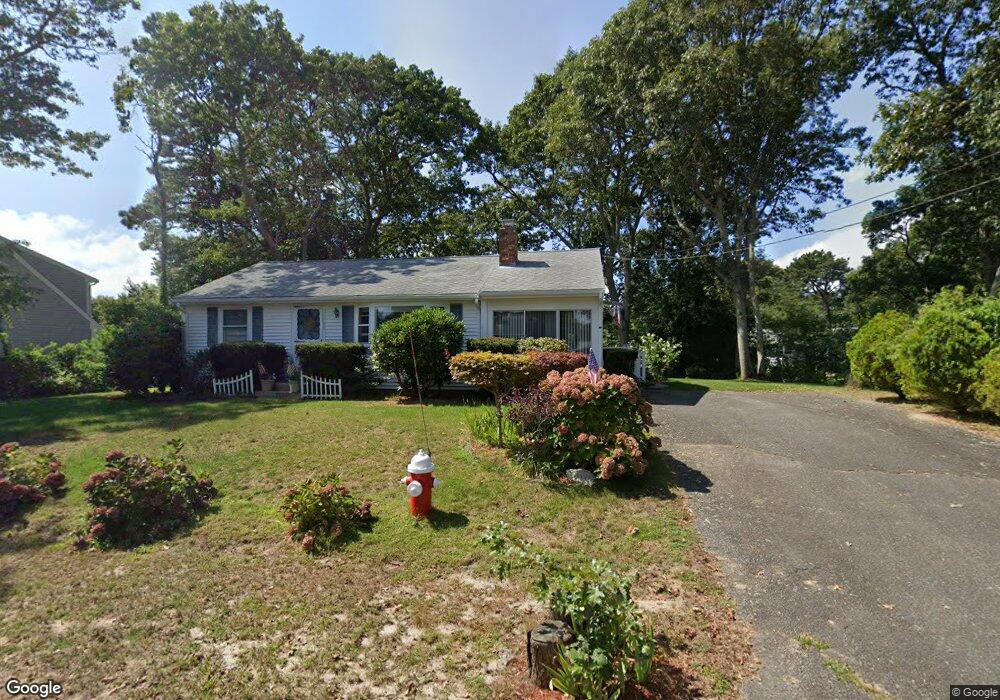
39 Michaels Ave Dennis Port, MA 02639
Dennis Port NeighborhoodEstimated Value: $598,000 - $776,000
3
Beds
2
Baths
1,298
Sq Ft
$536/Sq Ft
Est. Value
About This Home
This home is located at 39 Michaels Ave, Dennis Port, MA 02639 and is currently estimated at $696,082, approximately $536 per square foot. 39 Michaels Ave is a home located in Barnstable County with nearby schools including Dennis-Yarmouth Regional High School and St. Pius X. School.
Create a Home Valuation Report for This Property
The Home Valuation Report is an in-depth analysis detailing your home's value as well as a comparison with similar homes in the area
Home Values in the Area
Average Home Value in this Area
Tax History Compared to Growth
Tax History
| Year | Tax Paid | Tax Assessment Tax Assessment Total Assessment is a certain percentage of the fair market value that is determined by local assessors to be the total taxable value of land and additions on the property. | Land | Improvement |
|---|---|---|---|---|
| 2025 | $2,860 | $660,600 | $217,800 | $442,800 |
| 2024 | $2,729 | $621,600 | $209,500 | $412,100 |
| 2023 | $2,639 | $565,100 | $190,400 | $374,700 |
| 2022 | $2,512 | $448,600 | $171,600 | $277,000 |
| 2021 | $2,552 | $423,300 | $192,200 | $231,100 |
| 2020 | $2,306 | $378,000 | $168,200 | $209,800 |
| 2019 | $2,169 | $351,500 | $164,900 | $186,600 |
| 2018 | $2,058 | $324,600 | $157,000 | $167,600 |
| 2017 | $1,895 | $308,100 | $145,800 | $162,300 |
| 2016 | $1,920 | $294,100 | $157,000 | $137,100 |
| 2015 | $1,882 | $294,100 | $157,000 | $137,100 |
| 2014 | $1,725 | $271,600 | $134,500 | $137,100 |
Source: Public Records
Map
Nearby Homes
- 80 Michaels Ave
- 19 Standish Way
- 12 Spoonbill Rd
- 71 Main St
- 4 Coffey Ln
- 125 Main St Unit 3
- 31 Easy St
- 22 Wixon Rd
- 15 Woodside Park Rd
- 72 Bassett Ln
- 268 Main St
- 61 Trotters Ln
- 37 Ocean Dr Unit 2
- 95 Center St
- 26 Center St
- 64 Beaten Rd
- 3 Pinefield Ln
- 112 Old Wharf Rd Unit E4
- 112 Old Wharf Rd Unit E1
- 154 Old Wharf Rd Unit 26