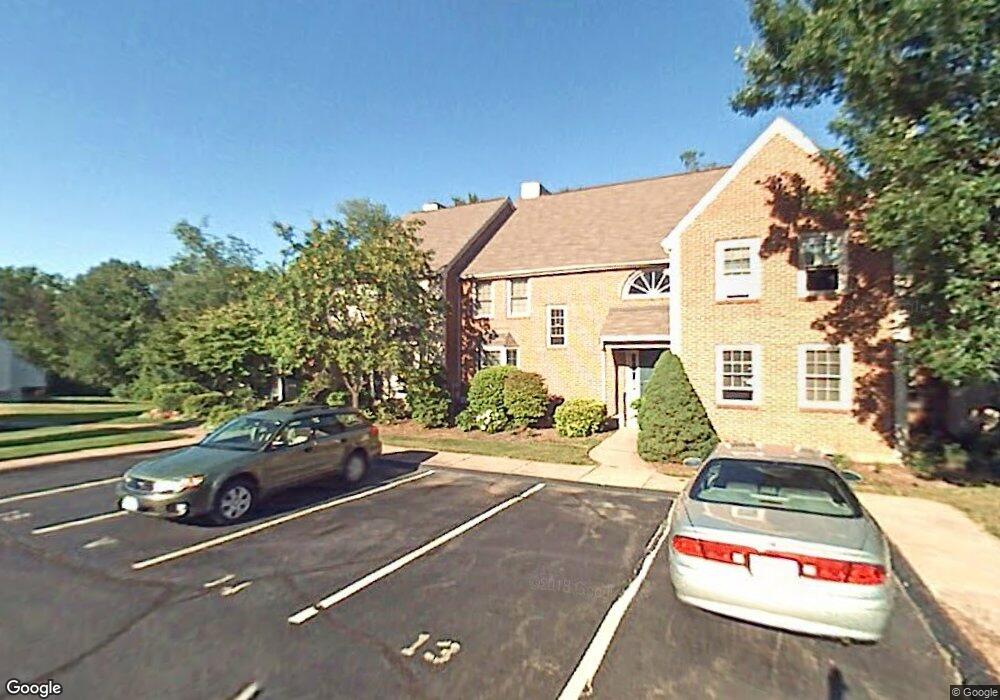
39 Orchard Brook Dr Wethersfield, CT 06109
Estimated Value: $305,000 - $331,929
2
Beds
2
Baths
1,258
Sq Ft
$254/Sq Ft
Est. Value
About This Home
This home is located at 39 Orchard Brook Dr, Wethersfield, CT 06109 and is currently estimated at $318,982, approximately $253 per square foot. 39 Orchard Brook Dr is a home located in Hartford County with nearby schools including Samuel B. Webb Elementary School, Silas Deane Middle School, and Wethersfield High School.
Ownership History
Date
Name
Owned For
Owner Type
Purchase Details
Closed on
Aug 25, 2010
Sold by
Roberts James E and Roberts Sarah A
Bought by
Siuda Tania
Current Estimated Value
Home Financials for this Owner
Home Financials are based on the most recent Mortgage that was taken out on this home.
Original Mortgage
$81,500
Outstanding Balance
$53,750
Interest Rate
4.57%
Estimated Equity
$265,232
Purchase Details
Closed on
Aug 30, 1996
Sold by
Adamcek Marie P and Adamcek Patricia J
Bought by
Roberts James F and Roberts Sarah A
Home Financials for this Owner
Home Financials are based on the most recent Mortgage that was taken out on this home.
Original Mortgage
$42,000
Interest Rate
8.25%
Mortgage Type
Unknown
Create a Home Valuation Report for This Property
The Home Valuation Report is an in-depth analysis detailing your home's value as well as a comparison with similar homes in the area
Home Values in the Area
Average Home Value in this Area
Purchase History
| Date | Buyer | Sale Price | Title Company |
|---|---|---|---|
| Siuda Tania | $177,500 | -- | |
| Roberts James F | $104,000 | -- |
Source: Public Records
Mortgage History
| Date | Status | Borrower | Loan Amount |
|---|---|---|---|
| Open | Roberts James F | $81,500 | |
| Previous Owner | Roberts James F | $75,000 | |
| Previous Owner | Roberts James F | $39,200 | |
| Previous Owner | Roberts James F | $42,000 |
Source: Public Records
Tax History
| Year | Tax Paid | Tax Assessment Tax Assessment Total Assessment is a certain percentage of the fair market value that is determined by local assessors to be the total taxable value of land and additions on the property. | Land | Improvement |
|---|---|---|---|---|
| 2025 | $6,581 | $159,660 | $0 | $159,660 |
| 2024 | $4,878 | $112,870 | $0 | $112,870 |
| 2023 | $4,716 | $112,870 | $0 | $112,870 |
| 2022 | $4,637 | $112,870 | $0 | $112,870 |
| 2021 | $4,590 | $112,870 | $0 | $112,870 |
| 2020 | $4,593 | $112,870 | $0 | $112,870 |
| 2019 | $4,598 | $112,870 | $0 | $112,870 |
| 2018 | $4,616 | $113,200 | $0 | $113,200 |
| 2017 | $4,502 | $113,200 | $0 | $113,200 |
| 2016 | $4,363 | $113,200 | $0 | $113,200 |
| 2015 | $4,323 | $113,200 | $0 | $113,200 |
| 2014 | $4,159 | $113,200 | $0 | $113,200 |
Source: Public Records
Map
Nearby Homes
- 7 Barrington Dr Unit C
- 62 Harold Dr
- 274 Cedarwood Ln
- 76 Luca Lane Homesite 8
- 61 Luca Ln
- 8 Stella Dr
- 104 Willow St
- 101 Collier Rd
- 378 Cypress Rd
- 0 Collier Rd
- 32 Flagler St
- 6 Vinnie Dr
- 5 Robeth Ln
- 229 Cottonwood Rd Unit 229
- 14 Ivy Ln
- 98 Crown Ridge
- 47 Forest Dr
- 20 Forest Dr
- 19 Tanner Crossing Unit 19
- 508 Highland St
- 50 Orchard Brook Dr
- 49 Orchard Brook Dr
- 48 Orchard Brook Dr
- 47 Orchard Brook Dr
- 46 Orchard Brook Dr
- 45 Orchard Brook Dr
- 44 Orchard Brook Dr
- 43 Orchard Brook Dr
- 42 Orchard Brook Dr
- 41 Orchard Brook Dr
- 40 Orchard Brook Dr
- 38 Orchard Brook Dr
- 37 Orchard Brook Dr
- 36 Orchard Brook Dr
- 35 Orchard Brook Dr
- 34 Orchard Brook Dr
- 33 Orchard Brook Dr
- 32 Orchard Brook Dr
- 31 Orchard Brook Dr
- 30 Orchard Brook Dr