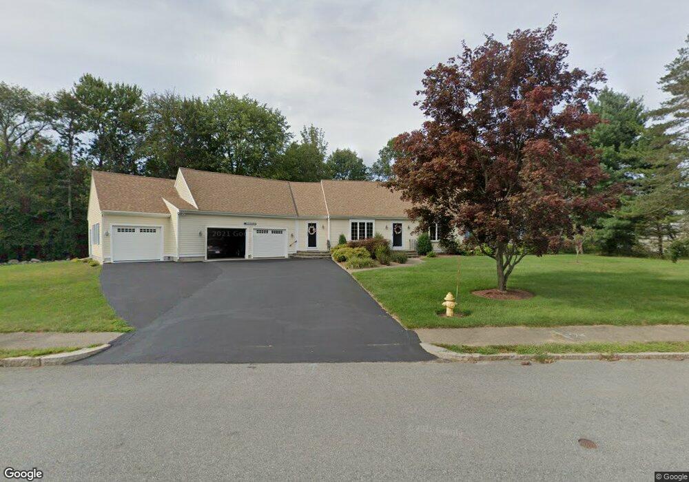
39 Patricia Dr Abington, MA 02351
Estimated Value: $630,000 - $906,000
3
Beds
2
Baths
2,376
Sq Ft
$340/Sq Ft
Est. Value
About This Home
This home is located at 39 Patricia Dr, Abington, MA 02351 and is currently estimated at $807,381, approximately $339 per square foot. 39 Patricia Dr is a home located in Plymouth County with nearby schools including Woodsdale School, Beaver Brook Elementary School, and Abington Middle School.
Ownership History
Date
Name
Owned For
Owner Type
Purchase Details
Closed on
Jan 10, 2022
Sold by
Donovan William J and Donovan Costance A
Bought by
William J Donovan Ft
Current Estimated Value
Purchase Details
Closed on
Feb 14, 2017
Sold by
Donovan Richard O and Donovan Joan M
Bought by
Donovan William J and Donovan Constance A
Purchase Details
Closed on
Dec 30, 1986
Bought by
Donovan Richard O and Donovan Joan M
Create a Home Valuation Report for This Property
The Home Valuation Report is an in-depth analysis detailing your home's value as well as a comparison with similar homes in the area
Home Values in the Area
Average Home Value in this Area
Purchase History
| Date | Buyer | Sale Price | Title Company |
|---|---|---|---|
| William J Donovan Ft | -- | None Available | |
| Donovan William J | $502,000 | -- | |
| Donovan Richard O | $90,000 | -- |
Source: Public Records
Mortgage History
| Date | Status | Borrower | Loan Amount |
|---|---|---|---|
| Previous Owner | Donovan Richard O | $90,000 | |
| Previous Owner | Donovan Richard O | $100,000 | |
| Previous Owner | Donovan Richard O | $36,000 |
Source: Public Records
Tax History Compared to Growth
Tax History
| Year | Tax Paid | Tax Assessment Tax Assessment Total Assessment is a certain percentage of the fair market value that is determined by local assessors to be the total taxable value of land and additions on the property. | Land | Improvement |
|---|---|---|---|---|
| 2025 | $10,346 | $792,200 | $265,900 | $526,300 |
| 2024 | $10,185 | $761,200 | $271,300 | $489,900 |
| 2023 | $10,686 | $752,000 | $237,800 | $514,200 |
| 2022 | $10,517 | $691,000 | $195,900 | $495,100 |
| 2021 | $10,537 | $639,400 | $209,800 | $429,600 |
| 2020 | $10,158 | $597,500 | $181,000 | $416,500 |
| 2019 | $9,709 | $558,300 | $181,000 | $377,300 |
| 2018 | $9,721 | $545,500 | $181,000 | $364,500 |
| 2017 | $9,217 | $502,300 | $181,000 | $321,300 |
| 2016 | $8,415 | $469,300 | $173,100 | $296,200 |
| 2015 | $7,655 | $450,300 | $173,100 | $277,200 |
Source: Public Records
Map
Nearby Homes
- 451 Lincoln St
- 332 Hancock St
- 840 Hancock St
- 209 Hancock St
- 164 Hancock St
- 14 Kingswood Dr Unit 3
- 337 Randolph St
- 116 Hancock St
- 14 Jamieson St
- 257 Rockland St Unit 257
- 676 Bedford St
- 0 Bedford St
- 1353 Washington St
- 1210 Washington St
- 1077 Bedford St
- 1085 Bedford St
- 333 Groveland St
- 20 Cleverly St Unit B2
- 44 Old Forge Rd
- 133 Andrew Ford Way
- 40 Patricia Dr
- 554 Hancock St
- 568 Hancock St
- 518 Hancock St
- 214 Patricia Dr
- 508 Hancock St
- 578 Hancock St
- 588 Hancock St
- 198 Patricia Dr
- 533 Hancock St
- 0 Hancock St
- 914 Hancock St
- 000 Hancock St
- 62 Patricia Dr
- 563 Hancock St
- 33 Loganberry Dr
- 73 Patricia Dr
- 13 Loganberry Dr
- 201 Patricia Dr
- 590 Hancock St