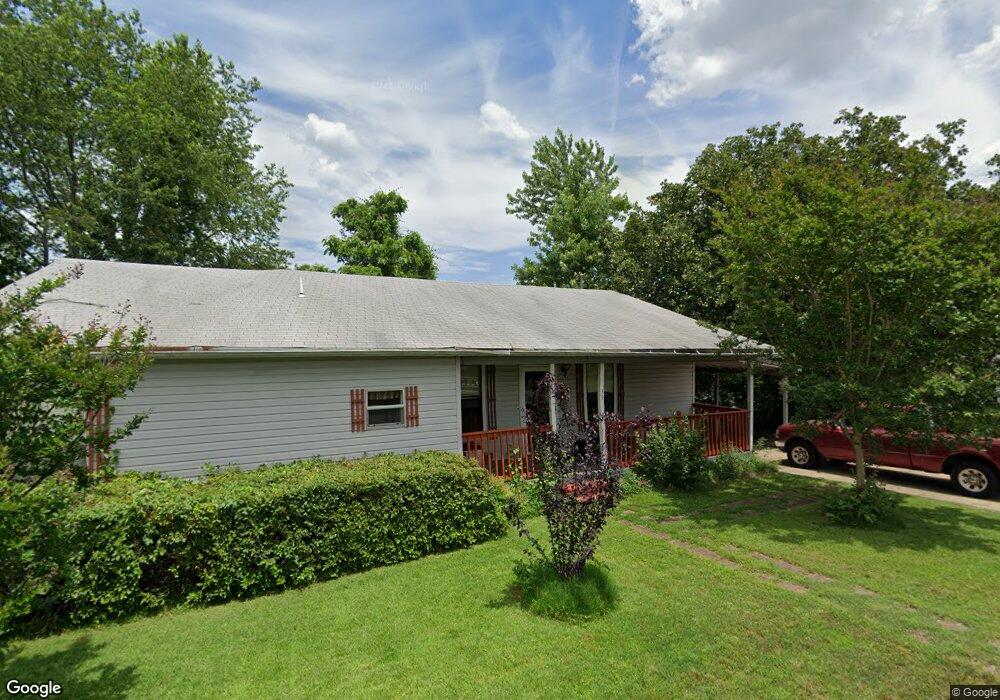
39 Perin Rd North Little Rock, AR 72118
Amboy NeighborhoodEstimated Value: $151,750 - $204,000
--
Bed
1
Bath
1,552
Sq Ft
$118/Sq Ft
Est. Value
About This Home
This home is located at 39 Perin Rd, North Little Rock, AR 72118 and is currently estimated at $183,688, approximately $118 per square foot. 39 Perin Rd is a home located in Pulaski County with nearby schools including Sylvan Hills Elementary School, Sylvan Hills Middle School, and Sylvan Hills High School.
Ownership History
Date
Name
Owned For
Owner Type
Purchase Details
Closed on
Nov 21, 2005
Sold by
Hamaker John L and Hamaker Billie Jean
Bought by
Hamaker John L and Hamaker Billie Jean
Current Estimated Value
Purchase Details
Closed on
Apr 29, 2003
Sold by
Mccormack Millie and Eaton Ronald A
Bought by
Eaton Ronald A
Home Financials for this Owner
Home Financials are based on the most recent Mortgage that was taken out on this home.
Original Mortgage
$64,452
Interest Rate
5.77%
Mortgage Type
VA
Create a Home Valuation Report for This Property
The Home Valuation Report is an in-depth analysis detailing your home's value as well as a comparison with similar homes in the area
Home Values in the Area
Average Home Value in this Area
Purchase History
| Date | Buyer | Sale Price | Title Company |
|---|---|---|---|
| Hamaker John L | -- | -- | |
| Eaton Ronald A | $70,000 | Stewart Title |
Source: Public Records
Mortgage History
| Date | Status | Borrower | Loan Amount |
|---|---|---|---|
| Closed | Eaton Ronald A | $64,452 |
Source: Public Records
Tax History Compared to Growth
Tax History
| Year | Tax Paid | Tax Assessment Tax Assessment Total Assessment is a certain percentage of the fair market value that is determined by local assessors to be the total taxable value of land and additions on the property. | Land | Improvement |
|---|---|---|---|---|
| 2025 | $1,366 | $27,389 | $2,640 | $24,749 |
| 2024 | $1,252 | $27,389 | $2,640 | $24,749 |
| 2023 | $1,252 | $27,389 | $2,640 | $24,749 |
| 2022 | $1,195 | $27,389 | $2,640 | $24,749 |
| 2021 | $1,138 | $19,230 | $1,020 | $18,210 |
| 2020 | $763 | $19,230 | $1,020 | $18,210 |
| 2019 | $763 | $19,230 | $1,020 | $18,210 |
| 2018 | $788 | $19,230 | $1,020 | $18,210 |
| 2017 | $748 | $19,230 | $1,020 | $18,210 |
| 2016 | $1,045 | $17,660 | $900 | $16,760 |
| 2015 | $385 | $6,505 | $900 | $5,605 |
| 2014 | $385 | $6,505 | $900 | $5,605 |
Source: Public Records
Map
Nearby Homes
- 47 Perin Rd
- 126 Cobblestone Cir
- 0 Timberline Dr
- 501 Silverwood Trail
- 6312 Rolling Hills Dr
- 6317 Rolling Hills Dr
- 1010 Claycut Cir
- 9 Blackstone Cir
- 813 Silver Hill Rd
- 10 Silverwood Ct
- 6324 Allwood Dr
- 6312 Allwood Dr
- 1115 Claycut Cir
- 1209 Silverwood Trail
- 13 Stanwood Loop
- 1204 N Point Ln
- 5732 Camp Robinson Rd
- 34 Jaynelle Place
- 60 Oakview Dr
- 801 Green Hills Dr