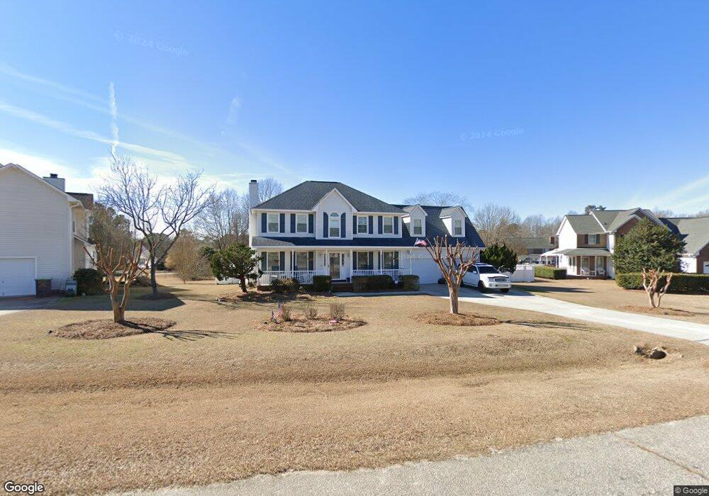
39 Queens Ct Angier, NC 27501
Estimated Value: $323,000 - $364,000
3
Beds
3
Baths
2,064
Sq Ft
$164/Sq Ft
Est. Value
About This Home
This home is located at 39 Queens Ct, Angier, NC 27501 and is currently estimated at $337,473, approximately $163 per square foot. 39 Queens Ct is a home located in Harnett County with nearby schools including Angier Elementary School, North Harnett Primary School, and Harnett Central Middle School.
Ownership History
Date
Name
Owned For
Owner Type
Purchase Details
Closed on
Apr 1, 1996
Bought by
Griggs Anthony
Current Estimated Value
Create a Home Valuation Report for This Property
The Home Valuation Report is an in-depth analysis detailing your home's value as well as a comparison with similar homes in the area
Home Values in the Area
Average Home Value in this Area
Purchase History
| Date | Buyer | Sale Price | Title Company |
|---|---|---|---|
| Griggs Anthony | $149,000 | -- |
Source: Public Records
Tax History
| Year | Tax Paid | Tax Assessment Tax Assessment Total Assessment is a certain percentage of the fair market value that is determined by local assessors to be the total taxable value of land and additions on the property. | Land | Improvement |
|---|---|---|---|---|
| 2025 | $1,287 | $222,852 | $0 | $0 |
| 2024 | $1,287 | $222,852 | $0 | $0 |
| 2023 | $1,270 | $222,852 | $0 | $0 |
| 2022 | $1,165 | $222,852 | $0 | $0 |
| 2021 | $1,165 | $176,760 | $0 | $0 |
| 2020 | $1,165 | $176,760 | $0 | $0 |
| 2019 | $1,519 | $176,760 | $0 | $0 |
| 2018 | $1,150 | $176,760 | $0 | $0 |
| 2017 | $1,150 | $176,760 | $0 | $0 |
| 2016 | $1,051 | $164,610 | $0 | $0 |
| 2015 | $1,420 | $164,610 | $0 | $0 |
| 2014 | $1,420 | $164,610 | $0 | $0 |
Source: Public Records
Map
Nearby Homes
- 93 Stone Apairy Dr
- 50 Stone Apairy Dr
- 221 Honeydew Dr
- 78 Stone Apiary Dr
- 203 Honeydew Dr
- 229 Honeydew Dr
- 239 Honeydew Dr
- 257 Honeydew Dr
- 267 Honeydew Dr
- 210 Honeydew Dr
- 222 Honeydew Dr
- 198 Honeydew Dr
- 190 Honeydew Dr
- 238 Honeydew Dr
- 180 Honeydew Dr
- 170 Honeydew Dr
- 256 Honeydew Dr
- 114 Honeydew Dr
- 8110 Nc 210 N
- 14 Green Laurel Dr
Your Personal Tour Guide
Ask me questions while you tour the home.