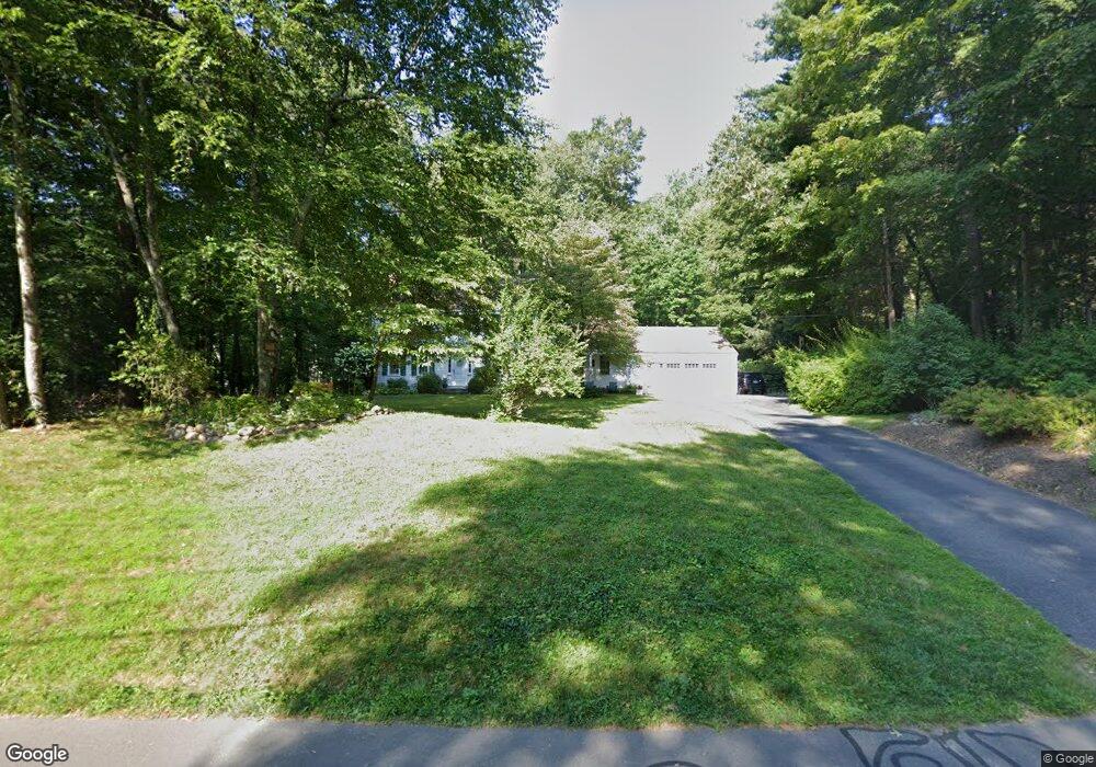
39 Quorn Hunt Rd West Simsbury, CT 06092
Estimated Value: $612,000 - $754,169
4
Beds
3
Baths
2,260
Sq Ft
$297/Sq Ft
Est. Value
About This Home
This home is located at 39 Quorn Hunt Rd, West Simsbury, CT 06092 and is currently estimated at $671,542, approximately $297 per square foot. 39 Quorn Hunt Rd is a home located in Hartford County with nearby schools including Tootin' Hills School, Henry James Memorial School, and Simsbury High School.
Ownership History
Date
Name
Owned For
Owner Type
Purchase Details
Closed on
Aug 1, 2006
Sold by
Wall Mary E
Bought by
Hewes Adam T and Hewes Kelly S
Current Estimated Value
Purchase Details
Closed on
Apr 5, 1995
Sold by
Est Rooney Bridget and Barlow Malcolm F
Bought by
Rooney Partick M and Rooney Sophie J
Create a Home Valuation Report for This Property
The Home Valuation Report is an in-depth analysis detailing your home's value as well as a comparison with similar homes in the area
Home Values in the Area
Average Home Value in this Area
Purchase History
| Date | Buyer | Sale Price | Title Company |
|---|---|---|---|
| Hewes Adam T | $468,000 | -- | |
| Rooney Partick M | $48,000 | -- |
Source: Public Records
Mortgage History
| Date | Status | Borrower | Loan Amount |
|---|---|---|---|
| Open | Rooney Partick M | $183,000 | |
| Closed | Rooney Partick M | $205,888 | |
| Closed | Rooney Partick M | $216,550 |
Source: Public Records
Tax History Compared to Growth
Tax History
| Year | Tax Paid | Tax Assessment Tax Assessment Total Assessment is a certain percentage of the fair market value that is determined by local assessors to be the total taxable value of land and additions on the property. | Land | Improvement |
|---|---|---|---|---|
| 2025 | $10,732 | $314,160 | $93,730 | $220,430 |
| 2024 | $10,465 | $314,160 | $93,730 | $220,430 |
| 2023 | $9,997 | $314,160 | $93,730 | $220,430 |
| 2022 | $9,139 | $236,590 | $100,720 | $135,870 |
| 2021 | $9,139 | $236,590 | $100,720 | $135,870 |
| 2020 | $8,775 | $236,590 | $100,720 | $135,870 |
| 2019 | $8,830 | $236,590 | $100,720 | $135,870 |
| 2018 | $8,893 | $236,590 | $100,720 | $135,870 |
| 2017 | $8,337 | $215,090 | $98,350 | $116,740 |
| 2016 | $7,984 | $215,090 | $98,350 | $116,740 |
| 2015 | $7,984 | $215,090 | $98,350 | $116,740 |
| 2014 | $7,988 | $215,090 | $98,350 | $116,740 |
Source: Public Records
Map
Nearby Homes
- 8 Quorn Hunt Rd
- 10 Sachems Trail
- 143 N Mountain Rd
- 23 Red Fox Run
- 15 Red Fox Run
- 21 Christmas Tree Hill
- 121 Gracey Rd
- 42 Garrett Rd
- 265 E Hill Rd
- 18 Meadowlark Rd
- 269 W Mountain Rd
- 391 Cherry Brook Rd
- 5 Fox Den Rd
- 6 Highwood Rd
- 301 Bushy Hill Rd
- 302 Bushy Hill Rd
- 395 Bushy Hill Rd
- 152 E Hill Rd
- 10 Mountain Spring Rd
- 207 Cherry Brook Rd
- 35 Quorn Hunt Rd
- 41 Quorn Hunt Rd
- 40 Quorn Hunt Rd
- 44 Quorn Hunt Rd
- 36 Quorn Hunt Rd
- 45 Quorn Hunt Rd
- 30 Quorn Hunt Rd
- 29 Quorn Hunt Rd
- 48 Quorn Hunt Rd
- 15 Birch Rd
- 26 Quorn Hunt Rd
- 11 Birch Rd
- 54 Quorn Hunt Rd
- 47 Quorn Hunt Rd
- 9 Birch Rd
- 25 Quorn Hunt Rd
- 24 Quorn Hunt Rd
- 5 Birch Rd
- 51 Quorn Hunt Rd
- 20 Quorn Hunt Rd