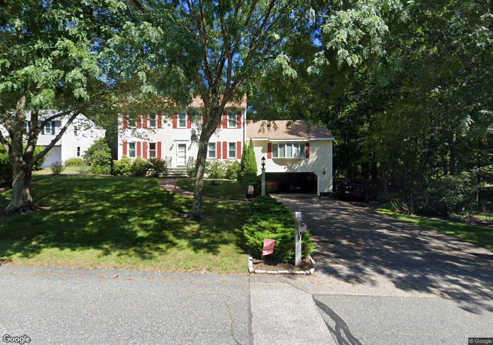
39 Raymond Way Ashland, MA 01721
Estimated Value: $840,899 - $925,000
3
Beds
3
Baths
2,352
Sq Ft
$375/Sq Ft
Est. Value
About This Home
This home is located at 39 Raymond Way, Ashland, MA 01721 and is currently estimated at $881,225, approximately $374 per square foot. 39 Raymond Way is a home located in Middlesex County with nearby schools including William Pittaway Elementary School, Henry E. Warren Elementary School, and David Mindess Elementary School.
Ownership History
Date
Name
Owned For
Owner Type
Purchase Details
Closed on
Mar 29, 2023
Sold by
Merloni Christopher J and Merloni Susan M
Bought by
C & Susan Merloni Lt
Current Estimated Value
Purchase Details
Closed on
Sep 16, 1991
Sold by
Zell Corp
Bought by
Merloni Christopher J
Create a Home Valuation Report for This Property
The Home Valuation Report is an in-depth analysis detailing your home's value as well as a comparison with similar homes in the area
Home Values in the Area
Average Home Value in this Area
Purchase History
| Date | Buyer | Sale Price | Title Company |
|---|---|---|---|
| C & Susan Merloni Lt | -- | None Available | |
| Merloni Christopher J | $165,000 | -- | |
| Merloni Christopher J | $165,000 | -- |
Source: Public Records
Mortgage History
| Date | Status | Borrower | Loan Amount |
|---|---|---|---|
| Previous Owner | Merloni Christopher J | $200,000 | |
| Previous Owner | Merloni Christopher J | $206,000 |
Source: Public Records
Tax History Compared to Growth
Tax History
| Year | Tax Paid | Tax Assessment Tax Assessment Total Assessment is a certain percentage of the fair market value that is determined by local assessors to be the total taxable value of land and additions on the property. | Land | Improvement |
|---|---|---|---|---|
| 2025 | $9,641 | $755,000 | $259,400 | $495,600 |
| 2024 | $9,345 | $705,800 | $259,400 | $446,400 |
| 2023 | $8,619 | $625,900 | $247,300 | $378,600 |
| 2022 | $8,728 | $549,600 | $224,600 | $325,000 |
| 2021 | $8,330 | $522,900 | $224,600 | $298,300 |
| 2020 | $8,120 | $502,500 | $228,200 | $274,300 |
| 2019 | $7,930 | $487,100 | $228,200 | $258,900 |
| 2018 | $7,886 | $474,800 | $232,800 | $242,000 |
| 2017 | $7,847 | $469,900 | $234,000 | $235,900 |
| 2016 | $7,703 | $453,100 | $231,100 | $222,000 |
| 2015 | $7,503 | $433,700 | $219,800 | $213,900 |
| 2014 | $7,361 | $423,300 | $202,800 | $220,500 |
Source: Public Records
Map
Nearby Homes
- 8 Raymond Way
- 277 Meeting House Path
- 97 Meeting House Path Unit 97
- 74 Meeting House Path
- 72 Meeting House Path
- 120 Prospect St
- 157 Leland Farm Rd
- 152 Turner Rd Unit 43
- 152 Turner Rd Unit 14
- 147 Turner Rd Unit 80
- 63 Trailside Way Unit 63
- 59 Turner Rd
- 67 Spyglass Hill Dr
- 49 Prospect St
- 306 Trailside Way
- 84 E Bluff Rd
- 102 Captain Eames Cir
- 25 Prospect St
- 150 Westfield Dr
- 76 Algonquin Trail
- 43 Raymond Way
- 35 Raymond Way
- 27 Donna Lee Ln
- 47 Raymond Way
- 36 Raymond Way
- 40 Raymond Way
- 31 Raymond Way
- 23 Donna Lee Ln
- 31 Donna Lee Ln
- 51 Raymond Way
- 46 Raymond Way
- 55 Raymond Way
- 50 Raymond Way
- 35 Donna Lee Ln
- 30 Raymond Way
- 19 Donna Lee Ln
- 56 Raymond Way
- 59 Raymond Way
- 28 Donna Lee Ln
- 11 Edward Dr