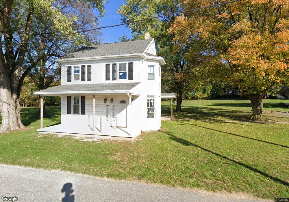
39 Red Tank Rd Boiling Springs, PA 17007
Estimated Value: $200,000 - $239,000
2
Beds
1
Bath
974
Sq Ft
$229/Sq Ft
Est. Value
About This Home
This home is located at 39 Red Tank Rd, Boiling Springs, PA 17007 and is currently estimated at $223,418, approximately $229 per square foot. 39 Red Tank Rd is a home located in Cumberland County with nearby schools including W.G. Rice Elementary School, Yellow Breeches Middle School, and Boiling Springs High School.
Ownership History
Date
Name
Owned For
Owner Type
Purchase Details
Closed on
May 23, 2023
Sold by
Bumbarger Andrew A
Bought by
Bumbarger Andrew A and Bumbarger Allison
Current Estimated Value
Purchase Details
Closed on
Dec 30, 2019
Sold by
Sweet Neil W
Bought by
Bumbarger Andrew A
Home Financials for this Owner
Home Financials are based on the most recent Mortgage that was taken out on this home.
Original Mortgage
$121,250
Interest Rate
3.6%
Mortgage Type
New Conventional
Purchase Details
Closed on
May 19, 2004
Sold by
Brady Larry
Bought by
Sweet Neil
Home Financials for this Owner
Home Financials are based on the most recent Mortgage that was taken out on this home.
Original Mortgage
$76,000
Interest Rate
5.75%
Mortgage Type
New Conventional
Create a Home Valuation Report for This Property
The Home Valuation Report is an in-depth analysis detailing your home's value as well as a comparison with similar homes in the area
Home Values in the Area
Average Home Value in this Area
Purchase History
| Date | Buyer | Sale Price | Title Company |
|---|---|---|---|
| Bumbarger Andrew A | -- | None Listed On Document | |
| Bumbarger Andrew A | $125,000 | Netco Title Company | |
| Sweet Neil | $95,000 | -- |
Source: Public Records
Mortgage History
| Date | Status | Borrower | Loan Amount |
|---|---|---|---|
| Previous Owner | Bumbarger Andrew A | $121,250 | |
| Previous Owner | Sweet Neil | $76,000 |
Source: Public Records
Tax History Compared to Growth
Tax History
| Year | Tax Paid | Tax Assessment Tax Assessment Total Assessment is a certain percentage of the fair market value that is determined by local assessors to be the total taxable value of land and additions on the property. | Land | Improvement |
|---|---|---|---|---|
| 2025 | $2,318 | $136,100 | $79,800 | $56,300 |
| 2024 | $2,204 | $136,100 | $79,800 | $56,300 |
| 2023 | $2,052 | $136,100 | $79,800 | $56,300 |
| 2022 | $1,999 | $136,100 | $79,800 | $56,300 |
| 2021 | $1,914 | $136,100 | $79,800 | $56,300 |
| 2020 | $1,875 | $136,100 | $79,800 | $56,300 |
| 2019 | $1,840 | $136,100 | $79,800 | $56,300 |
| 2018 | $1,798 | $136,100 | $79,800 | $56,300 |
| 2017 | $1,655 | $136,100 | $79,800 | $56,300 |
| 2016 | -- | $136,100 | $79,800 | $56,300 |
| 2015 | -- | $136,100 | $79,800 | $56,300 |
| 2014 | -- | $136,100 | $79,800 | $56,300 |
Source: Public Records
Map
Nearby Homes
- 400 Autumn Dr
- 529 Mountain Rd
- 610 Woodland Ave
- 8 E Locust St
- 0 E Locust St Unit PACB2047480
- 420 Chestnut St
- 204 Highland Terrace Way
- 410 Walnut St
- 391 Chestnut Dr
- 238 Parkway Dr
- 7 Highland Terrace Ct
- 109 Sycamore Dr
- 200 Westgate Dr
- 201 Hilltop Rd
- 10 Silver Maple Dr
- 303 W Pine St
- 101 Westgate Dr
- 3 Maurice Rd
- 258 Bonnybrook Rd
- 711 W Pine St