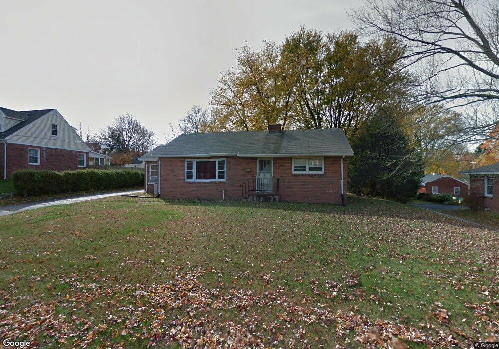
39 Rhode Island St Holyoke, MA 01040
Estimated Value: $276,000 - $307,279
3
Beds
1
Bath
1,176
Sq Ft
$248/Sq Ft
Est. Value
About This Home
This home is located at 39 Rhode Island St, Holyoke, MA 01040 and is currently estimated at $291,570, approximately $247 per square foot. 39 Rhode Island St is a home located in Hampden County with nearby schools including Lt. Elmer J. McMahon Elementary School, Holyoke High School, and Holyoke Community Charter School.
Ownership History
Date
Name
Owned For
Owner Type
Purchase Details
Closed on
Dec 30, 2002
Sold by
Provoda Margaret E
Bought by
Ginty Michael J and Ginty Michael
Current Estimated Value
Home Financials for this Owner
Home Financials are based on the most recent Mortgage that was taken out on this home.
Original Mortgage
$126,000
Outstanding Balance
$53,753
Interest Rate
6.02%
Mortgage Type
Purchase Money Mortgage
Estimated Equity
$237,817
Create a Home Valuation Report for This Property
The Home Valuation Report is an in-depth analysis detailing your home's value as well as a comparison with similar homes in the area
Home Values in the Area
Average Home Value in this Area
Purchase History
| Date | Buyer | Sale Price | Title Company |
|---|---|---|---|
| Ginty Michael J | $140,000 | -- |
Source: Public Records
Mortgage History
| Date | Status | Borrower | Loan Amount |
|---|---|---|---|
| Open | Ginty Michael J | $126,000 |
Source: Public Records
Tax History Compared to Growth
Tax History
| Year | Tax Paid | Tax Assessment Tax Assessment Total Assessment is a certain percentage of the fair market value that is determined by local assessors to be the total taxable value of land and additions on the property. | Land | Improvement |
|---|---|---|---|---|
| 2025 | $4,442 | $254,400 | $63,200 | $191,200 |
| 2024 | $4,194 | $221,300 | $60,200 | $161,100 |
| 2023 | $4,017 | $214,100 | $60,200 | $153,900 |
| 2022 | $3,898 | $202,400 | $60,200 | $142,200 |
| 2021 | $3,708 | $192,400 | $57,600 | $134,800 |
| 2020 | $3,482 | $182,500 | $57,600 | $124,900 |
| 2019 | $3,364 | $174,400 | $57,600 | $116,800 |
| 2018 | $3,220 | $168,300 | $57,600 | $110,700 |
| 2017 | $3,226 | $168,300 | $57,600 | $110,700 |
| 2016 | $3,195 | $167,100 | $59,500 | $107,600 |
| 2015 | $3,182 | $167,100 | $59,500 | $107,600 |
Source: Public Records
Map
Nearby Homes
- 7 Vermont St
- 244 Ontario Ave
- 85 Woodland St
- 84 Woodland St
- Lot A Homestead Ave
- 695 Homestead Ave
- 155 Huron Ave
- 86 Lynch Dr
- 89 Meadowbrook Rd
- 78 Hitchcock St
- 25 W Glen St
- 9-11 Oakwood Ave
- 70-72 Westfield Rd
- 55 Hitchcock St
- 43 King St
- 10 Humeston Slope
- 56 Laurel St
- 34 Maple Crest Cir Unit D
- 33 Maple Crest Cir Unit D
- 7 Maple Crest Cir Unit E
- 31 Rhode Island St
- 47 Rhode Island St
- 40 Vermont St
- 30 Vermont St
- 50 Vermont St
- 40 Rhode Island St
- 48 Rhode Island St
- 58 Rhode Island St
- 32 Rhode Island St
- 23 Rhode Island St
- 22 Vermont St
- 20 Rhode Island St
- 60 Vermont St
- 37 Vermont St
- 47 Vermont St
- 2 Florida Dr
- 15 Rhode Island St
- 29 Vermont St
- 31 Connecticut St
- 12 Vermont St