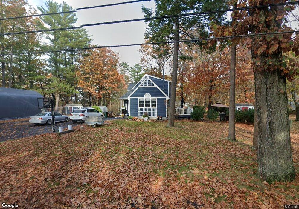
39 S Martin Rd Amesbury, MA 01913
Estimated Value: $704,866 - $757,000
3
Beds
2
Baths
1,652
Sq Ft
$448/Sq Ft
Est. Value
About This Home
This home is located at 39 S Martin Rd, Amesbury, MA 01913 and is currently estimated at $739,967, approximately $447 per square foot. 39 S Martin Rd is a home located in Essex County with nearby schools including Amesbury High School, River Valley Charter School, and Amesbury Seventh-Day Adventist School.
Ownership History
Date
Name
Owned For
Owner Type
Purchase Details
Closed on
May 25, 2012
Sold by
Zogg Daniel
Bought by
Zogg Daniel and Zogg Angela M
Current Estimated Value
Purchase Details
Closed on
May 21, 2012
Sold by
Zogg Daniel and Zogg Angela M
Bought by
Zogg Daniel
Purchase Details
Closed on
Jul 29, 2011
Sold by
Coons Anita
Bought by
Zogg Daniel and Zogg Angela M
Home Financials for this Owner
Home Financials are based on the most recent Mortgage that was taken out on this home.
Original Mortgage
$274,550
Interest Rate
4.52%
Mortgage Type
Purchase Money Mortgage
Purchase Details
Closed on
Nov 10, 2010
Sold by
39 S Martin Road Rt
Bought by
Coons Anita
Purchase Details
Closed on
Apr 23, 2003
Sold by
Coons Anita
Bought by
39 Martin Road South R
Purchase Details
Closed on
Sep 29, 1994
Sold by
Gardner Carl E
Bought by
Nichols Tyler P
Create a Home Valuation Report for This Property
The Home Valuation Report is an in-depth analysis detailing your home's value as well as a comparison with similar homes in the area
Home Values in the Area
Average Home Value in this Area
Purchase History
| Date | Buyer | Sale Price | Title Company |
|---|---|---|---|
| Zogg Daniel | -- | -- | |
| Zogg Daniel | -- | -- | |
| Zogg Daniel | $289,000 | -- | |
| Coons Anita | -- | -- | |
| 39 Martin Road South R | -- | -- | |
| 39 Martin Road South R | -- | -- | |
| Nichols Tyler P | $129,000 | -- |
Source: Public Records
Mortgage History
| Date | Status | Borrower | Loan Amount |
|---|---|---|---|
| Previous Owner | Zogg Daniel | $274,550 | |
| Previous Owner | 39 Martin Road South R | $152,500 |
Source: Public Records
Tax History Compared to Growth
Tax History
| Year | Tax Paid | Tax Assessment Tax Assessment Total Assessment is a certain percentage of the fair market value that is determined by local assessors to be the total taxable value of land and additions on the property. | Land | Improvement |
|---|---|---|---|---|
| 2025 | $9,849 | $643,700 | $242,700 | $401,000 |
| 2024 | $10,094 | $645,400 | $229,000 | $416,400 |
| 2023 | $8,905 | $545,000 | $199,000 | $346,000 |
| 2022 | $8,141 | $460,200 | $173,100 | $287,100 |
| 2021 | $7,519 | $412,000 | $133,600 | $278,400 |
| 2020 | $6,815 | $396,700 | $128,500 | $268,200 |
| 2019 | $6,966 | $379,200 | $128,500 | $250,700 |
| 2018 | $6,935 | $365,200 | $122,300 | $242,900 |
| 2017 | $6,659 | $333,800 | $122,300 | $211,500 |
| 2016 | $6,593 | $325,100 | $122,300 | $202,800 |
| 2015 | $6,552 | $319,000 | $122,300 | $196,700 |
| 2014 | -- | $286,500 | $122,300 | $164,200 |
Source: Public Records
Map
Nearby Homes
- 19 Cutter Ln Unit 19
- 13 Bailey Pond Ln Unit 13
- 15 Beacon St
- 11 Beacon St
- 60 Merrimac St Unit 907
- 60 Merrimac St Unit 604
- 60 Merrimac St Unit 508
- 3 Marshall Dr
- 35 Merrimac St
- 3 Pinecrest Ave
- 36 Hillside Ave
- 3 Cottage Ln
- 356 Main St
- 2 Hitching Post Ln
- 6 Wells Ave Unit C
- 49 W Greenwood St
- 394 Main St
- 50 Middle Rd
- 45 Macy St Unit 302C
- 4 Greenwood St
- 5 Woodridge Ln
- 41 S Martin Rd
- 40 S Martin Rd
- 3 Woodridge Ln
- 42 S Martin Rd
- 1 Woodridge Ln
- 38 S Martin Rd
- LOT 2 Baker St
- 44 S Martin Rd
- 35 S Martin Rd
- 8 Woodridge Ln
- 4 Woodridge Ln
- 39 Beacon St
- 6 Woodridge Ln
- 35 Beacon St
- 36 S Martin Rd
- 12 Stanhope Way Unit 12
- 4 Stanhope Way Unit 4
- 8 Stanhope Way Unit 8
- 6 Stanhope Way Unit 6