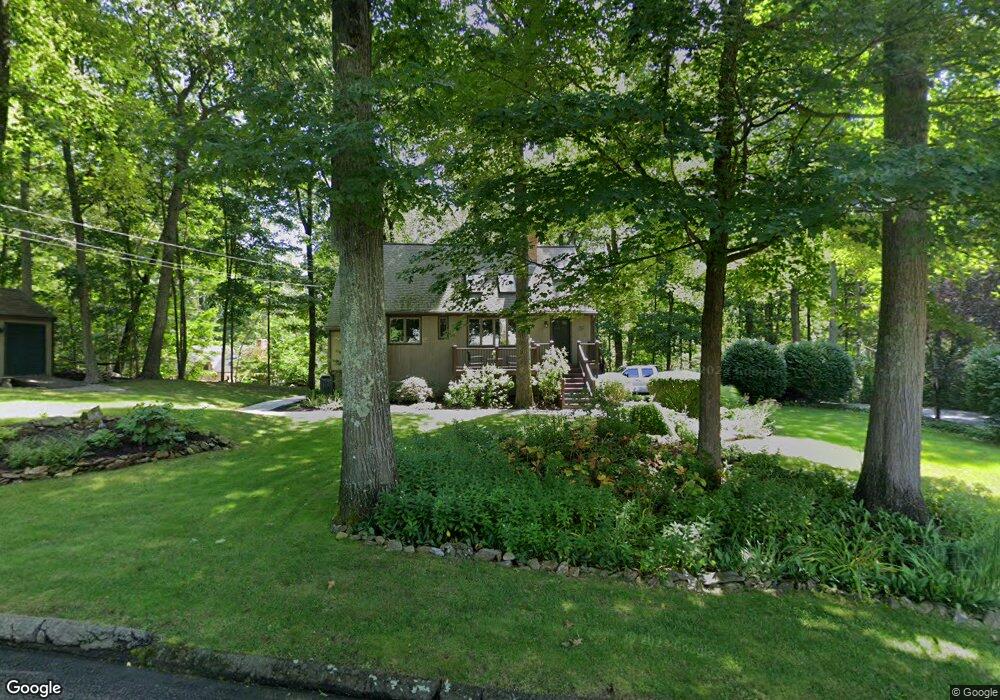
39 Spindrift Ln Guilford, CT 06437
Estimated Value: $504,798 - $600,000
2
Beds
2
Baths
1,365
Sq Ft
$404/Sq Ft
Est. Value
About This Home
This home is located at 39 Spindrift Ln, Guilford, CT 06437 and is currently estimated at $550,950, approximately $403 per square foot. 39 Spindrift Ln is a home located in New Haven County with nearby schools including A. Baldwin Middle School, E.C. Adams Middle School, and Guilford High School.
Ownership History
Date
Name
Owned For
Owner Type
Purchase Details
Closed on
Aug 19, 2003
Sold by
Nace Richard F and Nace Elizabeth S
Bought by
Olson Carl E
Current Estimated Value
Purchase Details
Closed on
Aug 2, 1995
Sold by
Devine Joann
Bought by
Nace Richard F and Nace Elizabeth S
Purchase Details
Closed on
May 16, 1991
Sold by
Guillet Adrian and Guillet Margaret
Bought by
Monarchio Joann D
Create a Home Valuation Report for This Property
The Home Valuation Report is an in-depth analysis detailing your home's value as well as a comparison with similar homes in the area
Home Values in the Area
Average Home Value in this Area
Purchase History
| Date | Buyer | Sale Price | Title Company |
|---|---|---|---|
| Olson Carl E | $289,000 | -- | |
| Nace Richard F | $170,000 | -- | |
| Monarchio Joann D | $178,000 | -- |
Source: Public Records
Mortgage History
| Date | Status | Borrower | Loan Amount |
|---|---|---|---|
| Open | Monarchio Joann D | $195,000 | |
| Closed | Monarchio Joann D | $217,500 | |
| Closed | Monarchio Joann D | $16,500 |
Source: Public Records
Tax History Compared to Growth
Tax History
| Year | Tax Paid | Tax Assessment Tax Assessment Total Assessment is a certain percentage of the fair market value that is determined by local assessors to be the total taxable value of land and additions on the property. | Land | Improvement |
|---|---|---|---|---|
| 2025 | $7,057 | $255,220 | $147,000 | $108,220 |
| 2024 | $6,784 | $255,220 | $147,000 | $108,220 |
| 2023 | $6,605 | $255,220 | $147,000 | $108,220 |
| 2022 | $7,112 | $213,890 | $133,000 | $80,890 |
| 2021 | $6,977 | $213,890 | $133,000 | $80,890 |
| 2020 | $6,911 | $213,890 | $133,000 | $80,890 |
| 2019 | $6,851 | $213,890 | $133,000 | $80,890 |
| 2018 | $6,690 | $213,890 | $133,000 | $80,890 |
| 2017 | $6,805 | $231,790 | $138,600 | $93,190 |
| 2016 | $6,645 | $231,790 | $138,600 | $93,190 |
| 2015 | $6,546 | $231,790 | $138,600 | $93,190 |
| 2014 | $6,356 | $231,790 | $138,600 | $93,190 |
Source: Public Records
Map
Nearby Homes
- 259 Weatherly Trail
- 95 Joseph Dr
- 747 Route 80
- 154 Wilburs Ln
- 75 Hart Rd
- 7 Hart Rd
- 448 Lake Dr
- 0 Tamarack Ln Unit Lot 23 24071362
- 0 Tamarack Ln Unit Lot 19 24071360
- 542 Lake Dr
- 2064 Long Hill Rd
- 817 Lake Dr
- 15 Pomps Ln
- 76 Wauwinet Trail Unit 76
- 21 Lasalette Way
- 148 Country Way
- 90 Cedar Hill Rd
- 79 Fall Rd
- 24 Echo Point Rd
- 50 Quidnet Ct
- 17 Spindrift Ln
- 59 Spindrift Ln
- 179 Weatherly Trail
- 65 Spindrift Ln
- 42 Spindrift Ln
- 149 Weatherly Trail
- 10 Spindrift Ln
- 34 Spindrift Ln
- 60 Spindrift Ln
- 238 Weatherly Trail
- 137 Weatherly Trail
- 62 Spindrift Ln
- 64 Spindrift Ln
- 284 Thornbuckle Ln
- 63 Spindrift Ln
- 184 Weatherly Trail
- 242 Weatherly Trail
- 158 Weatherly Trail
- 170 Weatherly Trail
- 131 Weatherly Trail