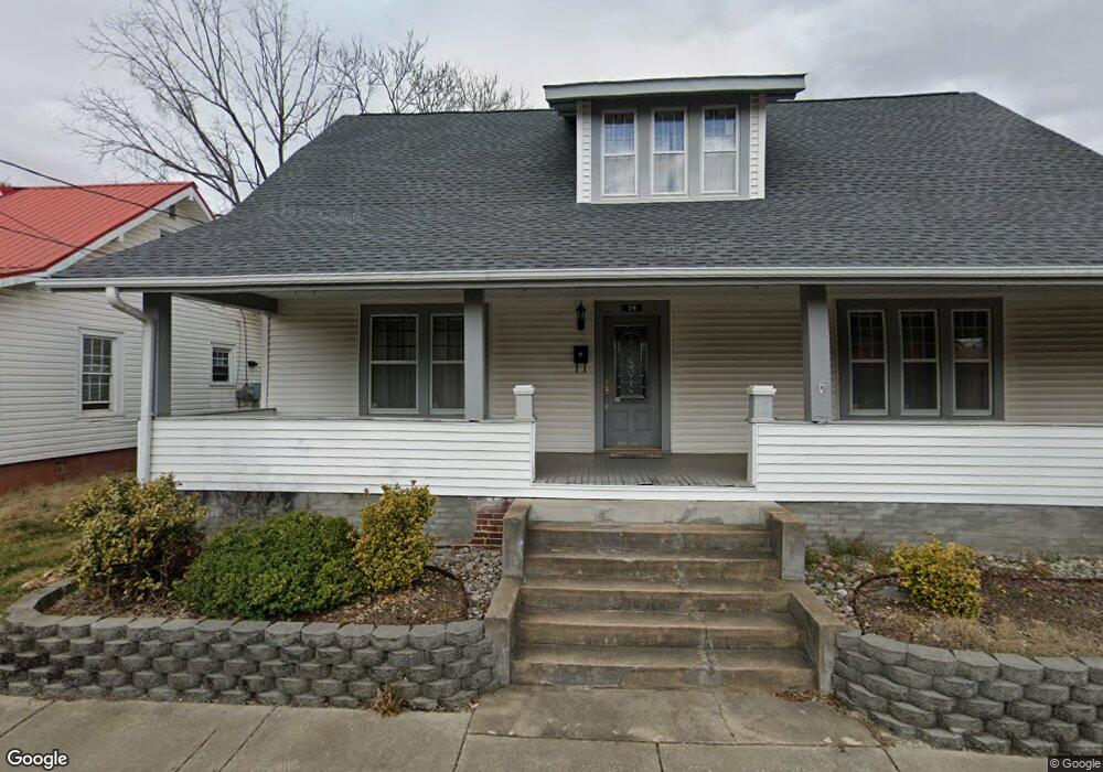
39 Spring St Marion, NC 28752
Estimated Value: $239,897 - $357,000
3
Beds
2
Baths
1,958
Sq Ft
$151/Sq Ft
Est. Value
About This Home
This home is located at 39 Spring St, Marion, NC 28752 and is currently estimated at $294,974, approximately $150 per square foot. 39 Spring St is a home with nearby schools including Marion Elementary School, East McDowell Junior High School, and McDowell High School.
Ownership History
Date
Name
Owned For
Owner Type
Purchase Details
Closed on
Jul 31, 2012
Sold by
Christopher Jordan
Bought by
Sullivan Patrick J and Sullivan Margaret H
Current Estimated Value
Home Financials for this Owner
Home Financials are based on the most recent Mortgage that was taken out on this home.
Original Mortgage
$86,625
Outstanding Balance
$59,739
Interest Rate
3.65%
Mortgage Type
New Conventional
Estimated Equity
$235,235
Purchase Details
Closed on
Mar 5, 2011
Sold by
Wood Joseph A
Bought by
Christopher Jordan
Create a Home Valuation Report for This Property
The Home Valuation Report is an in-depth analysis detailing your home's value as well as a comparison with similar homes in the area
Home Values in the Area
Average Home Value in this Area
Purchase History
| Date | Buyer | Sale Price | Title Company |
|---|---|---|---|
| Sullivan Patrick J | $116,000 | None Available | |
| Christopher Jordan | -- | None Available |
Source: Public Records
Mortgage History
| Date | Status | Borrower | Loan Amount |
|---|---|---|---|
| Open | Sullivan Patrick J | $86,625 |
Source: Public Records
Tax History
| Year | Tax Paid | Tax Assessment Tax Assessment Total Assessment is a certain percentage of the fair market value that is determined by local assessors to be the total taxable value of land and additions on the property. | Land | Improvement |
|---|---|---|---|---|
| 2025 | $721 | $120,570 | $25,000 | $95,570 |
| 2024 | $721 | $120,570 | $25,000 | $95,570 |
| 2023 | $721 | $120,570 | $25,000 | $95,570 |
| 2022 | $670 | $110,200 | $15,000 | $95,200 |
| 2021 | $670 | $110,200 | $15,000 | $95,200 |
| 2020 | $681 | $110,200 | $0 | $0 |
| 2019 | $681 | $94,890 | $0 | $0 |
| 2017 | $551 | $94,890 | $0 | $0 |
| 2016 | $551 | $94,890 | $12,100 | $82,790 |
| 2014 | $541 | $94,890 | $12,100 | $82,790 |
| 2013 | -- | $94,890 | $12,100 | $82,790 |
Source: Public Records
Map
Nearby Homes
- 300 Morgan St
- 584 Rutherford Rd
- 634 Rutherford Rd
- 40 Alabama Ave
- 24 Alabama Ave Unit 2
- 175 Blue Ridge St
- 390 Forest Heights Dr
- 204 Maple Ave
- 36 & 50 Catawba Ave
- TBD Kathleen Park St
- 200 Woodland Dr
- 329 Morehead Rd
- V/L U S 221 North Hwy
- 99999 U S 221 Hwy N
- 25 N Mcdowell Ave
- 99999 Thole St
- 150 Hoyle St Unit 7
- 19 Thole St
- 550 N Main St
- Ridley St
- 29 Spring St
- 51 Spring St
- 40 Spring St
- 296 S Garden St
- 261 S Main St
- 259 S Main St
- 161 Spring St
- 54 Spring St
- 239 S Main St
- 310 S Garden St
- 247 S Garden St
- 247 S Garden St Unit D
- 247 S Garden St Unit A
- 305 Garden St
- 235 B S Garden St
- 000 S Garden St
- 315 S Garden St
- 320 S Garden St
- 100 Carriage None Unit 1
- 100 Carriage Station Unit 1
Your Personal Tour Guide
Ask me questions while you tour the home.