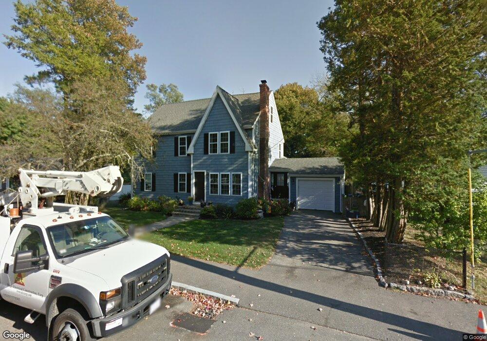
39 Strathmore Cir Braintree, MA 02184
East Braintree NeighborhoodEstimated Value: $746,000 - $963,000
3
Beds
3
Baths
2,584
Sq Ft
$323/Sq Ft
Est. Value
About This Home
This home is located at 39 Strathmore Cir, Braintree, MA 02184 and is currently estimated at $835,414, approximately $323 per square foot. 39 Strathmore Cir is a home located in Norfolk County with nearby schools including Braintree High School, Sacred Heart Elementary School, and South Shore SDA School.
Ownership History
Date
Name
Owned For
Owner Type
Purchase Details
Closed on
Mar 17, 2021
Sold by
Burgess Mark A and Burgess Rachel A
Bought by
Burgess Mark A and Burgess Rachel A
Current Estimated Value
Home Financials for this Owner
Home Financials are based on the most recent Mortgage that was taken out on this home.
Original Mortgage
$274,000
Outstanding Balance
$203,496
Interest Rate
2.8%
Mortgage Type
Stand Alone Refi Refinance Of Original Loan
Estimated Equity
$631,918
Purchase Details
Closed on
Apr 12, 2002
Sold by
Merrill Dorothy M
Bought by
Burgess Mark A
Home Financials for this Owner
Home Financials are based on the most recent Mortgage that was taken out on this home.
Original Mortgage
$215,900
Interest Rate
6.84%
Mortgage Type
Purchase Money Mortgage
Purchase Details
Closed on
Dec 31, 1996
Sold by
Merrill Richard E and Merrill Dorothy M
Bought by
Mf Rt
Create a Home Valuation Report for This Property
The Home Valuation Report is an in-depth analysis detailing your home's value as well as a comparison with similar homes in the area
Home Values in the Area
Average Home Value in this Area
Purchase History
| Date | Buyer | Sale Price | Title Company |
|---|---|---|---|
| Burgess Mark A | -- | Old Republic Title | |
| Burgess Mark A | $269,000 | -- | |
| Mf Rt | $145,000 | -- | |
| Mf Rt | $145,000 | -- |
Source: Public Records
Mortgage History
| Date | Status | Borrower | Loan Amount |
|---|---|---|---|
| Open | Burgess Mark A | $274,000 | |
| Previous Owner | Mf Rt | $352,000 | |
| Previous Owner | Burgess Mark A | $215,900 |
Source: Public Records
Tax History Compared to Growth
Tax History
| Year | Tax Paid | Tax Assessment Tax Assessment Total Assessment is a certain percentage of the fair market value that is determined by local assessors to be the total taxable value of land and additions on the property. | Land | Improvement |
|---|---|---|---|---|
| 2025 | $7,403 | $741,800 | $371,900 | $369,900 |
| 2024 | $6,641 | $700,500 | $348,700 | $351,800 |
| 2023 | $6,250 | $640,400 | $306,800 | $333,600 |
| 2022 | $6,094 | $612,500 | $278,900 | $333,600 |
| 2021 | $5,477 | $550,500 | $235,200 | $315,300 |
| 2020 | $5,428 | $550,500 | $235,200 | $315,300 |
| 2019 | $5,228 | $518,100 | $235,200 | $282,900 |
| 2018 | $4,994 | $473,800 | $204,600 | $269,200 |
| 2017 | $4,758 | $443,000 | $186,000 | $257,000 |
| 2016 | $4,499 | $409,700 | $167,400 | $242,300 |
| 2015 | $4,393 | $396,800 | $163,600 | $233,200 |
| 2014 | $4,196 | $367,400 | $150,600 | $216,800 |
Source: Public Records
Map
Nearby Homes
- 71 Robbie Rd
- 94 Kensington St
- 230 Lisle St
- 205 River St
- 605 Middle St Unit 38
- 685 Union St
- 391 Commercial St
- 51 Faxon St
- 31 Tingley Rd
- 21 Faxon St
- 8 Vinton Ave Unit 10
- 491 Washington St Unit 1
- 69 Dobson Rd
- 150 Elm St Unit 1
- 145 Commercial St Unit 3
- 37 Monatiquot Ave
- 141 Commercial St Unit 9
- 39 Lawnview Dr
- 23 Bower Rd
- 39 Dobson Rd
- 33 Strathmore Cir
- 43 Strathmore Cir
- 15 Strathmore Rd
- 47 Strathmore Cir
- 26 Strathmore Cir
- 11 Strathmore Rd
- 51 Strathmore Cir
- 440 Union St
- 434 Union St
- 446 Union St
- 41 Watson St
- 25 Strathmore Cir
- 37 Watson St
- 45 Watson St
- 12 Strathmore Rd
- 16 Strathmore Cir
- 35 Watson St
- 452 Union St
- 40 Strathmore Cir
- 33 Watson St